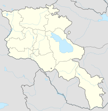
Vardenik
For the mountain in Serbia, see Vardenik (mountain).
| Vardenik Վարդենիկ | |
|---|---|
 Vardenik Վարդենիկ | |
| Coordinates: 40°07′59″N 45°26′12″E / 40.13306°N 45.43667°ECoordinates: 40°07′59″N 45°26′12″E / 40.13306°N 45.43667°E | |
| Country | Armenia |
| Marz (Province) | Gegharkunik |
| Founded | 1828-29 |
| Elevation | 1,994 m (6,542 ft) |
| Population (2011) | |
| • Total | 9,880 |
| Time zone | GMT+4 (UTC+4) |
| Postal code | 1418 |
Vardenik (Armenian: Վարդենիկ; until 1945, Gezeldara, Nerkin Gezaldara, Gyuzeldara, and Nizhnyaya Gezaldara), is a major village in the Gegharkunik Province of Armenia that sits along the Vardenis River. It was founded in 1828-29 by emigrants from Mush. There are the cyclopean fort ruins of Kaftarli 3 km south, with petroglyphs downhill along the bank of the river. Some churches and shrines can be found in the vicinity.[1]
The village is the largest rural community in Armenia by population.
References
- Vardenik at GEOnet Names Server
- World Gazeteer: Armenia – World-Gazetteer.com
- Report of the results of the 2001 Armenian Census, National Statistical Service of the Republic of Armenia
- Brady Kiesling, Rediscovering Armenia, p. 46; original archived at Archive.org, and current version online on Armeniapedia.org.
This article is issued from Wikipedia - version of the 11/15/2015. The text is available under the Creative Commons Attribution/Share Alike but additional terms may apply for the media files.
