Vacy, New South Wales
| Vacy New South Wales | |
|---|---|
 General Store, Vacy | |
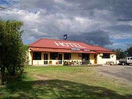 Farmers Hotel, Vacy | |
|
Vacy | |
| Coordinates | 32°31′53″S 151°34′8″E / 32.53139°S 151.56889°ECoordinates: 32°31′53″S 151°34′8″E / 32.53139°S 151.56889°E |
| Population | 547 (2011 census)[1] |
| • Density | 9.2/km2 (24/sq mi) |
| Established | c. 1828[2] |
| Postcode(s) | 2421 |
| Area | 59.5 km2 (23.0 sq mi)[3] |
| Time zone | AEST (UTC+10) |
| • Summer (DST) | AEDT (UTC+11) |
| Location | |
| LGA(s) | Dungog Shire[4] |
| Region | Hunter[4] |
| County | Durham[5] |
| Parish | Gresford[5] |
| State electorate(s) | Upper Hunter[6] |
| Federal Division(s) | Paterson[7] |
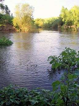
Vacy is a locality of the Dungog Shire local government area in the Hunter Region of New South Wales, Australia.[4][5][8] Situated between Gresford and Paterson, it includes the village of Vacy,[9] which was founded in the 1820s as a private town by John Cory, the owner of a large land grant.[2] Vacy began to prosper in the 1850s and was a busy town by the 1870s. It remained a private town until it was sold in 1927 by the Cory family.[10] The village is located at the junction of the Paterson and Allyn rivers. At the 2011 census, Vacy had a population of 547.[1]
Vacy includes a public school, general store, oval, school of arts hall, the Farmers Hotel, a motel, "Eaglereach" resort, a hairdressing salon, post office, cafe, and a church.
Gilbert Cory, the son of John Cory developed the Vacy estate after his first marriage to Jeanette Rens. He lived there for the remainder of his life.
The rural nature of Vacy is demonstrated in the work of farmers managing beef cattle, dairy cattle, sheep, poultry and equine establishments, as well as other residents, retirees and working families with hobby farms and small acreages.
References
- 1 2 Australian Bureau of Statistics (31 October 2012). "Vacy (State Suburb)". 2011 Census QuickStats. Retrieved 15 September 2012.
- 1 2 "Vacy". The Sydney Morning Herald. 8 February 2004. Retrieved 18 March 2010.
- ↑ Australian Bureau of Statistics (31 October 2012). "2011 Community Profiles: Vacy (State Suburb)". 2011 Census of Population and Housing. Retrieved 24 September 2012.
- 1 2 3 "Suburb Search - Local Council Boundaries - Hunter (HT) - Dungog Shire Council". New South Wales Department of Local Government. Retrieved 18 March 2010.
- 1 2 3 "Vacy (locality)". Geographical Names Register (GNR) of NSW. Geographical Names Board of New South Wales. Retrieved 28 September 2012.
- ↑ "Upper Hunter". New South Wales Electoral Commission. 14 October 2011. Retrieved 15 September 2012.
- ↑ "Paterson". Australian Electoral Commission. 22 February 2012. Retrieved 15 September 2012.
- ↑ "Vacy". Land and Property Management Authority - Spatial Information eXchange. New South Wales Land and Property Information. Retrieved 18 March 2010.
- ↑ "Vacy (village)". Geographical Names Register (GNR) of NSW. Geographical Names Board of New South Wales. Retrieved 28 September 2012.
- ↑ "Vacy". Australian Explorer. Retrieved 18 March 2010.