VERITAS (spacecraft)
 Veritas at Venus depiction (NASA) | |
| Mission type | Reconnaissance |
|---|---|
| Operator | NASA's JPL |
| Mission duration | 2 years (proposed) |
| Start of mission | |
| Launch date | 2021 (proposed) |
| Venus orbiter | |
VERITAS (Venus Emissivity, Radio Science, InSAR, Topography, and Spectroscopy) is a proposed mission concept by NASA's Jet Propulsion Laboratory (JPL) to map with high resolution the surface of planet Venus. The combination of surface topography and image data would provide knowledge of Venus' tectonic and impact history, the timing and mechanisms of volcanic resurfacing, and the mantle processes responsible for them.
Overview


VERITAS was selected on 30 September 2015 as a semifinalist for Mission #13 of the Discovery Program.[1] The winner will be chosen around December 2016 and must be ready to launch by the end of 2021.[2][3] Suzanne Smrekar of NASA's Jet Propulsion Laboratory (JPL) is the Principal Investigator, and JPL would manage the project.
Objectives
VERITAS would produce global, high resolution topography and imaging of Venus' surface and produce the first maps of deformation and global surface composition,[4] thermal emissivity, and gravity field.[5] It would also attempt to determine if Venus hosted ancient aqueous environments. Also, current data are highly suggestive of recent and active volcanism and this mission could determine if current volcanism is limited to mantle plume heads or is more widespread.[5]
High resolution imagery would be obtained by using an X band radar configured as a single pass interferometric synthetic aperture radar (InSAR)[6] coupled with a multispectral near-infrared (NIR) emissivity mapping capability. VERITAS would map surface topography with a spatial resolution of 250 m and 5 m vertical accuracy, and generate radar imagery with 30 m spatial resolution.[4]
- understand Venus' geologic evolution
- determine what geologic processes are currently operating
- find evidence for past or present water
Scientific payload
The primary mission goals, accomplished by seven objectives, require two instruments and a gravity science investigation over a 2-year orbital mission.[7]
- VEM (Venus Emissivity Mapper) maps surface emissivity using six spectral bands in five atmospheric windows that see through the clouds.[7] It would be provided by the German Aerospace Center (DLR)[8]
- VISAR (Venus Interferometric Synthetic Aperture Radar) generates a DEM (digital elevation model) with an accuracy of 250 m horizontal by 5 m height.[6]
Gravity science is carried out using the spacecraft's telecom system. The mission design also enables the opportunity to send a nanosat probe into the atmosphere of Venus, carrying a mass spectrometer to sample the noble gases and their isotopes.[7] For the NASA AO, this fulfills the option for a technology demonstration option.[9] Called Cupid's arrow it would pack a quadrupole ion trap mass spectrometer into nanosat atmospheric "skimmer".[10]
See also
- DAVINCI (spacecraft), a Venus atmospheric probe
- Psyche (spacecraft), an asteroid orbiter
- Near-Earth Object Camera
- Lucy (spacecraft), reconnaissance of Jupiter trojans
- Magellan (spacecraft), a previous Venus radar reconnaissance mission
References
- ↑ Brown, Dwayne C.; Cantillo, Laurie (30 September 2015). "NASA Selects Investigations for Future Key Planetary Mission". NASA News. Washington, D.C. Retrieved 2015-10-01.
- ↑ Clark, Stephen (24 February 2014). "NASA receives proposals for new planetary science mission". Space Flight Now. Retrieved 2015-02-25.
- ↑ Kane, Van (December 2, 2014). "Selecting the Next Creative Idea for Exploring the Solar System". Planetary Society. Retrieved 2015-02-10.
- 1 2 Hensley, S.; Smrekar, S. E (2012). "VERITAS: A Mission Concept for the High Resolution Topographic Mapping and Imaging of Venus". American Geophysical Union Fall Meeting 2012. NASA. Retrieved 2015-10-01.
- 1 2 Smrekar, S. E.; Elkins-Tanton, L. T; Hensley, S.; Campbell, B. A, B. A. (2014). VERITAS: A mission to study the highest priority Decadal Survey questions for Venus. American Geophysical Union - Fall Meeting 2014. NASA.
- 1 2 3 Paller, M.; Figueroa, H.; Freeman, A.; et. al. (2015). VISAR: A Next Generation Inteferometric Radar for Venus Exploration (PDF). Venus Lab and Technology Workshop (2015). Universities Space Research Association.
- 1 2 3 4 Freeman, A.; Smrekar, S. (9 June 2015). VERITAS – a Discovery-class Venus surface geology and geophysics mission (PDF). 11th Low Cost Planetary Missions Conference. Berlin, Germany.
- ↑ Helbert, J. (19 September 2013). Observing the surface of Venus after VIRTIS on VEX: new concepts and laboratory work (PDF). Infrared Remote Sensing and Instrumentation XXI. San Diego, USA.
- ↑
- ↑
External links
| Geography | 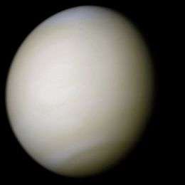 | ||||||||||||||||||||||
|---|---|---|---|---|---|---|---|---|---|---|---|---|---|---|---|---|---|---|---|---|---|---|---|
| Moons | |||||||||||||||||||||||
| Astronomy |
| ||||||||||||||||||||||
| Exploration |
| ||||||||||||||||||||||
| Related | |||||||||||||||||||||||
| |||||||||||||||||||||||
| Orbiters |    | ||||||
|---|---|---|---|---|---|---|---|
| Flybys | |||||||
| Descent probes | |||||||
| Landers | |||||||
| Balloon probes | |||||||
| Failed at launch | |||||||
| Planned flybys | |||||||
| Proposed |
| ||||||
| Cancelled | |||||||
| Program overviews | |||||||
| Related | |||||||
| |||||||
Discovery and New Frontiers program | ||||||||||||||||||||
|---|---|---|---|---|---|---|---|---|---|---|---|---|---|---|---|---|---|---|---|---|
| Discovery |
|  | ||||||||||||||||||
| New Frontiers |
| |||||||||||||||||||
italics indicates active current missions. · † indicates failure en route or before intended mission data returned · ° indicate missions yet to launch. | ||||||||||||||||||||