Utica, South Dakota
| Utica, South Dakota | |
|---|---|
| Town | |
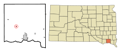 Location in Yankton County and the state of South Dakota | |
| Coordinates: 42°58′49″N 97°29′53″W / 42.98028°N 97.49806°WCoordinates: 42°58′49″N 97°29′53″W / 42.98028°N 97.49806°W | |
| Country | United States |
| State | South Dakota |
| County | Yankton |
| Area[1] | |
| • Total | 0.26 sq mi (0.67 km2) |
| • Land | 0.26 sq mi (0.67 km2) |
| • Water | 0 sq mi (0 km2) |
| Elevation | 1,368 ft (417 m) |
| Population (2010)[2] | |
| • Total | 65 |
| • Estimate (2012[3]) | 65 |
| • Density | 250.0/sq mi (96.5/km2) |
| Time zone | Central (CST) (UTC-6) |
| • Summer (DST) | CDT (UTC-5) |
| ZIP code | 57067 |
| Area code(s) | 605 |
| FIPS code | 46-65780[4] |
| GNIS feature ID | 1258718[5] |
Utica is a town in Yankton County, South Dakota, United States. The population was listed as 65 at the 2010 census.
Some say Utica is a name derived from the Sioux language meaning "dweller", while others believe the name is a transfer from Utica, New York.[6]
Geography
Utica is located at 42°58′49″N 97°29′53″W / 42.98028°N 97.49806°W (42.980242, -97.498020).[7]
According to the United States Census Bureau, the town has a total area of 0.26 square miles (0.67 km2), all of it land.[1]
Utica has been assigned the ZIP code 57067 and the FIPS place code 65780.
Demographics
| Historical population | |||
|---|---|---|---|
| Census | Pop. | %± | |
| 1910 | 103 | — | |
| 1920 | 141 | 36.9% | |
| 1930 | 98 | −30.5% | |
| 1940 | 95 | −3.1% | |
| 1950 | 84 | −11.6% | |
| 1960 | 70 | −16.7% | |
| 1970 | 89 | 27.1% | |
| 1980 | 100 | 12.4% | |
| 1990 | 115 | 15.0% | |
| 2000 | 86 | −25.2% | |
| 2010 | 65 | −24.4% | |
| Est. 2015 | 64 | [8] | −1.5% |
2010 census
As of the census[2] of 2010, there were 65 people, 31 households, and 16 families residing in the town. The population density was 250.0 inhabitants per square mile (96.5/km2). There were 44 housing units at an average density of 169.2 per square mile (65.3/km2). The racial makeup of the town was 86.2% White, 4.6% African American, 1.5% Native American, 4.6% from other races, and 3.1% from two or more races. Hispanic or Latino of any race were 4.6% of the population.
There were 31 households of which 25.8% had children under the age of 18 living with them, 48.4% were married couples living together, 3.2% had a female householder with no husband present, and 48.4% were non-families. 41.9% of all households were made up of individuals and 19.4% had someone living alone who was 65 years of age or older. The average household size was 2.10 and the average family size was 3.00.
The median age in the town was 41.5 years. 21.5% of residents were under the age of 18; 6.3% were between the ages of 18 and 24; 26.2% were from 25 to 44; 26.3% were from 45 to 64; and 20% were 65 years of age or older. The gender makeup of the town was 53.8% male and 46.2% female.
2000 census
As of the census[4] of 2000, there were 86 people, 39 households, and 18 families residing in the town. The population density was 325.2 people per square mile (127.7/km²). There were 43 housing units at an average density of 162.6 per square mile (63.9/km²). The racial makeup of the town was 87.21% White, 4.65% Native American, 4.65% from other races, and 3.49% from two or more races. Hispanic or Latino of any race were 1.16% of the population.
There were 39 households out of which 25.6% had children under the age of 18 living with them, 38.5% were married couples living together, 7.7% had a female householder with no husband present, and 51.3% were non-families. 43.6% of all households were made up of individuals and 12.8% had someone living alone who was 65 years of age or older. The average household size was 2.21 and the average family size was 3.32.
In the town the population was spread out with 25.6% under the age of 18, 10.5% from 18 to 24, 29.1% from 25 to 44, 20.9% from 45 to 64, and 14.0% who were 65 years of age or older. The median age was 34 years. For every 100 females there were 126.3 males. For every 100 females age 18 and over, there were 120.7 males.
The median income for a household in the town was $25,417, and the median income for a family was $47,500. Males had a median income of $23,750 versus $18,750 for females. The per capita income for the town was $20,057. There were no families and 4.8% of the population living below the poverty line, including no under eighteens and none of those over 64.
References
- 1 2 "US Gazetteer files 2010". United States Census Bureau. Retrieved 2012-06-21.
- 1 2 "American FactFinder". United States Census Bureau. Retrieved 2012-06-21.
- ↑ "Population Estimates". United States Census Bureau. Retrieved 2013-05-29.
- 1 2 "American FactFinder". United States Census Bureau. Retrieved 2008-01-31.
- ↑ "US Board on Geographic Names". United States Geological Survey. 2007-10-25. Retrieved 2008-01-31.
- ↑ Federal Writers' Project (1940). South Dakota place-names, v.1-3. University of South Dakota. p. 65.
- ↑ "US Gazetteer files: 2010, 2000, and 1990". United States Census Bureau. 2011-02-12. Retrieved 2011-04-23.
- ↑ "Annual Estimates of the Resident Population for Incorporated Places: April 1, 2010 to July 1, 2015". Retrieved July 2, 2016.
- ↑ "Census of Population and Housing". Census.gov. Retrieved June 4, 2015.
Municipalities and communities of Yankton County, South Dakota, United States | ||
|---|---|---|
| Cities | 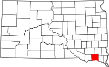 | |
| Towns | ||
| Footnotes | ‡This populated place also has portions in an adjacent county or counties | |