Gayville, South Dakota
| Gayville, South Dakota | |
|---|---|
| Town | |
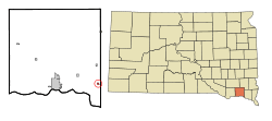 Location in Yankton County and the state of South Dakota | |
| Coordinates: 42°53′21″N 97°10′23″W / 42.88917°N 97.17306°WCoordinates: 42°53′21″N 97°10′23″W / 42.88917°N 97.17306°W | |
| Country | United States |
| State | South Dakota |
| County | Yankton |
| Incorporated | 1892[1] |
| Government | |
| • Mayor | Mike Pulomena |
| Area[2] | |
| • Total | 0.21 sq mi (0.54 km2) |
| • Land | 0.21 sq mi (0.54 km2) |
| • Water | 0 sq mi (0 km2) |
| Elevation | 1,161 ft (354 m) |
| Population (2010)[3] | |
| • Total | 407 |
| • Estimate (2012[4]) | 406 |
| • Density | 1,938.1/sq mi (748.3/km2) |
| Time zone | Central (CST) (UTC-6) |
| • Summer (DST) | CDT (UTC-5) |
| ZIP code | 57031 |
| Area code(s) | 605 |
| FIPS code | 46-23900[5] |
| GNIS feature ID | 1255217[6] |
Gayville is a town in Yankton County, South Dakota, United States. The population was 407 at the 2010 census.
History
Gayville was originally settled chiefly by Scandinavian farmers.[7] A post office was established as White Hall in 1870, renamed Boreman in 1872, and again renamed Gayville in 1873.[8][9] The present name honors Elkanah Gay, an early postmaster.[10] Gayville was a station on the Chicago, Milwaukee, St. Paul and Pacific Railroad.[11]
Geography
According to the United States Census Bureau, the town has a total area of 0.21 square miles (0.54 km2), all of it land.[2]
Demographics
| Historical population | |||
|---|---|---|---|
| Census | Pop. | %± | |
| 1910 | 257 | — | |
| 1920 | 305 | 18.7% | |
| 1930 | 261 | −14.4% | |
| 1940 | 278 | 6.5% | |
| 1950 | 271 | −2.5% | |
| 1960 | 261 | −3.7% | |
| 1970 | 269 | 3.1% | |
| 1980 | 407 | 51.3% | |
| 1990 | 401 | −1.5% | |
| 2000 | 418 | 4.2% | |
| 2010 | 407 | −2.6% | |
| Est. 2015 | 415 | [12] | 2.0% |
2010 census
As of the census[3] of 2010, there were 407 people, 163 households, and 109 families residing in the town. The population density was 1,938.1 inhabitants per square mile (748.3/km2). There were 179 housing units at an average density of 852.4 per square mile (329.1/km2). The racial makeup of the town was 96.8% White, 0.7% Native American, 0.7% Asian, 0.7% from other races, and 1.0% from two or more races. Hispanic or Latino of any race were 1.2% of the population.
There were 163 households of which 41.1% had children under the age of 18 living with them, 54.0% were married couples living together, 9.2% had a female householder with no husband present, 3.7% had a male householder with no wife present, and 33.1% were non-families. 28.2% of all households were made up of individuals and 12.9% had someone living alone who was 65 years of age or older. The average household size was 2.50 and the average family size was 3.09.
The median age in the town was 34.1 years. 31.2% of residents were under the age of 18; 7.1% were between the ages of 18 and 24; 26.8% were from 25 to 44; 21.3% were from 45 to 64; and 13.5% were 65 years of age or older. The gender makeup of the town was 49.6% male and 50.4% female.
2000 census
As of the census[5] of 2000, there were 418 people, 169 households, and 111 families residing in the town. The population density was 2,181.3 people per square mile (849.4/km²). There were 182 housing units at an average density of 949.7 per square mile (369.8/km²). The racial makeup of the town was 95.45% White, 2.63% Native American, 0.24% Asian, 0.48% from other races, and 1.20% from two or more races. Hispanic or Latino of any race were 0.48% of the population.
There were 169 households out of which 33.1% had children under the age of 18 living with them, 56.2% were married couples living together, 7.1% had a female householder with no husband present, and 34.3% were non-families. 30.2% of all households were made up of individuals and 16.0% had someone living alone who was 65 years of age or older. The average household size was 2.47 and the average family size was 3.11.
In the town the population was spread out with 29.2% under the age of 18, 5.7% from 18 to 24, 28.9% from 25 to 44, 20.3% from 45 to 64, and 15.8% who were 65 years of age or older. The median age was 36 years. For every 100 females there were 90.9 males. For every 100 females age 18 and over, there were 78.3 males.
As of 2000 the median income for a household in the town was $35,000, and the median income for a family was $45,682. Males had a median income of $27,344 versus $19,167 for females. The per capita income for the town was $13,535. About 6.7% of families and 9.4% of the population were below the poverty line, including 13.6% of those under age 18 and 10.5% of those age 65 or over.
Culture
Gayville is the self-proclaimed "Hay Capital of the World". Gayville is also constantly in competition with nearby Meckling, the self-proclaimed "Hay Capital of the Universe."
Gayville is home of the annual Gayville Hay Days celebration in July. It is also home of the old-time music hall, Gayville Hall, located in the historic Bagsted and Aaseth Building on the town's main street (Washington Street). Gayville Hall, known for its family atmosphere, was started in 2001 and presents two-hour music shows on Saturdays from March through early December each year, including the recurring "Hay Country Jamboree," a monthly "extravaganza" of old-time popular songs, country, bluegrass and humor. The venue is also noted for its tributes to country music legends like Hank Williams, Johnny Cash, Merle Haggard, and Waylon. Other genres of music performed include folk, jazz, dixieland, and gospel.
Notable people
- Marv Olson, professional baseball player.[14]
- Nels H. Smith, 18th Governor of Wyoming.[15]
References
- ↑ "SD Towns" (PDF). South Dakota State Historical Society. Retrieved 2010-02-12.
- 1 2 "US Gazetteer files 2010". United States Census Bureau. Archived from the original on January 24, 2012. Retrieved 2012-06-21.
- 1 2 "American FactFinder". United States Census Bureau. Retrieved 2012-06-21.
- ↑ "Population Estimates". United States Census Bureau. Archived from the original on June 17, 2013. Retrieved 2013-05-29.
- 1 2 "American FactFinder". United States Census Bureau. Archived from the original on September 11, 2013. Retrieved 2008-01-31.
- ↑ "US Board on Geographic Names". United States Geological Survey. 2007-10-25. Retrieved 2008-01-31.
- ↑ Federal Writers' Project (1938). A South Dakota Guide. WPA. p. 352. ISBN 978-0-403-02190-1.
- ↑ U.S. Geological Survey Geographic Names Information System: Gayville Post Office
- ↑ "Yankton County". Jim Forte Postal History. Retrieved 13 March 2015.
- ↑ Federal Writers' Project (1940). South Dakota place-names, v.1-3. University of South Dakota. p. 38.
- ↑ 1887: Resources of Dakota. Department of immigration and statistics. P.F. McClure, commissioner, Pierre. 1887. p. 490.
- ↑ "Annual Estimates of the Resident Population for Incorporated Places: April 1, 2010 to July 1, 2015". Retrieved July 2, 2016.
- ↑ "Census of Population and Housing". Census.gov. Archived from the original on May 11, 2015. Retrieved June 4, 2015.
- ↑ "Marv Olson". Baseball-reference.com. Retrieved October 2013. Check date values in:
|access-date=(help) - ↑ "Wyoming Governor Nels H. Smith". National Governors Association. Retrieved October 2013. Check date values in:
|access-date=(help)
External links
Municipalities and communities of Yankton County, South Dakota, United States | ||
|---|---|---|
| Cities | 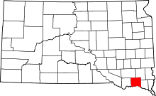 | |
| Towns | ||
| Footnotes | ‡This populated place also has portions in an adjacent county or counties | |