Usquepaug Road Historic District
|
Usquepaug Road Historic District | |
|
Queen's River Baptist Church | |
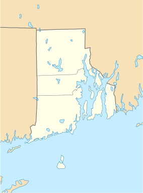  | |
| Location | Usquepaug Rd., South Kingstown, Rhode Island |
|---|---|
| Coordinates | 41°30′14″N 71°36′1″W / 41.50389°N 71.60028°WCoordinates: 41°30′14″N 71°36′1″W / 41.50389°N 71.60028°W |
| Architect | Alpin,Stephen A.; Et al. |
| Architectural style | Greek Revival |
| NRHP Reference # | 87001298[1] |
| Added to NRHP | October 30, 1987 |
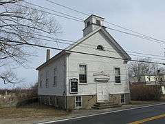
The Usquepaug Road Historic District is a historic district near the village of Usquepaug in South Kingstown, Rhode Island. It consists of a collection of properties, mostly on the south side of Usequepaug Road (Rhode Island Route 138) between the Usquepaug Cemetery and Dugway Bridge Road. Although the area began as a rural, agricultural area, it developed into a modest rural village, with a church, school, and cluster of vernacular rural houses. The schoolhouse was destroyed in the New England Hurricane of 1938.[2]
The district was listed on the National Register of Historic Places in 1987.[1]
See also
References
- 1 2 National Park Service (2009-03-13). "National Register Information System". National Register of Historic Places. National Park Service.
- ↑ "NRHP nomination for Usquepaug Road Historic District" (PDF). Rhode Island Preservation. Retrieved 2014-10-01.
| Topics | |
|---|---|
| Lists by states |
|
| Lists by insular areas | |
| Lists by associated states | |
| Other areas | |
| |
This article is issued from Wikipedia - version of the 11/26/2016. The text is available under the Creative Commons Attribution/Share Alike but additional terms may apply for the media files.