Uqi Salli Punta
| Uqi Salli Punta | |
|---|---|
 Uqi Salli Punta Location within Bolivia | |
| Highest point | |
| Elevation | 4,840 m (15,880 ft) [1] |
| Coordinates | 17°02′43″S 66°18′10″W / 17.04528°S 66.30278°WCoordinates: 17°02′43″S 66°18′10″W / 17.04528°S 66.30278°W |
| Geography | |
| Location |
Bolivia, Cochabamba Department, Chapare Province |
| Parent range | Andes |
Uqi Salli Punta (Quechua uqi lead, salli sulfur,[2][3] also spelled Okhe Salli Punta) is a 4,840-metre-high (15,880 ft) mountain in the Bolivian Andes. It is located in the Cochabamba Department, on the border of the Chapare Province, Villa Tunari Municipality, and the Quillacollo Province, Quillacollo Municipality.[1][4]
References
- 1 2 Bolivia 1:100,000 Quillacollo 3636
- ↑ Teofilo Laime Ajacopa, Diccionario Bilingüe Iskay simipi yuyayk'ancha, La Paz, 2007 (Quechua-Spanish dictionary)
- ↑ Diccionario Quechua - Español - Quechua, Academía Mayor de la Lengua Quechua, Gobierno Regional Cusco, Cusco 2005 (Quechua-Spanish dictionary)
- ↑ "Villa Tunari". INE, Bolivia. Retrieved March 31, 2016.
Capital: Cochabamba | ||
| Provinces | 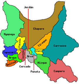 | |
| Municipalities (and seats) |
| |
This article is issued from Wikipedia - version of the 4/30/2016. The text is available under the Creative Commons Attribution/Share Alike but additional terms may apply for the media files.