Tubaran, Lanao del Sur
| Tubaran | |
|---|---|
| Municipality | |
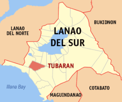 Map of Lanao del Sur with Tubaran highlighted | |
.svg.png) Tubaran Location within the Philippines | |
| Coordinates: 07°43′N 124°10′E / 7.717°N 124.167°ECoordinates: 07°43′N 124°10′E / 7.717°N 124.167°E | |
| Country | Philippines |
| Region | Autonomous Region in Muslim Mindanao (ARMM) |
| Province | Lanao del Sur |
| Barangays | 21 |
| Government[1] | |
| • Mayor | Mauyag Papandayan Jr. |
| Area | |
| • Total | 435.00 km2 (167.95 sq mi) |
| Population (2010)[2] | |
| • Total | 12,933 |
| • Density | 30/km2 (77/sq mi) |
| Time zone | PST (UTC+8) |
| ZIP code | 9304 |
| Dialing code | +63 (0)63 |
| Income class | 4th |
Tubaran is a fourth class municipality in the province of Lanao del Sur, Philippines. According to the 2010 census, it has a population of 12,933 people.[2]
Barangays
Tubaran is politically subdivided into 21 barangays.
- Alog
- Beta
- Poblacion (Buribid)
- Campo
- Datumanong
- Dinaigan
- Guiarong
- Mindamudag
- Paigoay-Pimbataan
- Polo
- Riantaran
- Tangcal
- Tubaran Proper
- Wago
- Bagiangun
- Gadongan
- Gaput
- Madaya
- Malaganding
- Metadicop
- Pagalamatan
History
Tubaran among to the Nine Princess of Unayan (e.g. in Meranau term Andong so Macadar, etc.)
Demographics
| Population census of Tubaran | ||
|---|---|---|
| Year | Pop. | ±% p.a. |
| 1990 | 8,491 | — |
| 1995 | 9,617 | +2.36% |
| 2000 | 11,021 | +2.96% |
| 2007 | 20,358 | +8.83% |
| 2010 | 12,933 | −15.22% |
| Source: National Statistics Office[2] | ||
References
- ↑ "Official City/Municipal 2013 Election Results". Intramuros, Manila, Philippines: Commission on Elections (COMELEC). 1 July 2013. Retrieved 5 September 2013.
- 1 2 3 "Total Population by Province, City, Municipality and Barangay: as of May 1, 2010" (PDF). 2010 Census of Population and Housing. National Statistics Office. Retrieved 20 June 2014.
External links
- Philippine Standard Geographic Code
- Philippine Census Information
- Local Governance Performance Management System
 |
Pagayawan | Binidayan | | |
| Calanogas | |
|||
| ||||
| | ||||
| Picong | Malabang | Marogong |
This article is issued from Wikipedia - version of the 11/1/2016. The text is available under the Creative Commons Attribution/Share Alike but additional terms may apply for the media files.