Trout Creek, Ontario
| Trout Creek | |
|---|---|
|
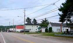
Hwy 522/Main Street West in Trout Creek | |
 Trout Creek Location of Trout Creek in Ontario | |
| Coordinates: 45°59′09″N 79°21′43″W / 45.98583°N 79.36194°WCoordinates: 45°59′09″N 79°21′43″W / 45.98583°N 79.36194°W[1] | |
| Country | Canada |
| Province | Ontario |
| District | Parry Sound District |
| Municipality | Powassan |
| Settled | 1868 |
| Town | 1913 |
| Elevation | 310 m (1,020 ft) |
| Time zone | Eastern Time Zone (UTC-5) |
| • Summer (DST) | Eastern Time Zone (UTC-4) |
| Canadian Postal Code | POH |
| Area code(s) | 705, 249 |
Trout Creek is a community and unincorporated area in the municipality of Powassan, Parry Sound District in Northern Ontario, Canada.[1] It is in geographic South Himsworth Township;[2] is located on Ontario Highway 11, 12 kilometres (7 mi) south of the town centre of Powassan; and is part of the Almaguin Highlands.
Etymology
Situated on a tributary of the South River, in Parry Sound District, 37 kilometres (23 mi) south of North Bay, this town (1913) was first known as Little Bend of the South River and Powassan as the Big Bend. It was called Melbourne after the pioneer settlers arrived in 1868, possibly for Melbourne, Australia, itself named in 1835 for Lord Melbourne (1779–1848), the British prime minister in 1834-41. However, its post office was called Barkerton in 1887. Three years later it was renamed Trout Creek.[3]
Transportation
The Canadian National Railway transcontinental main line was the first transportation link that was constructed in the area during the late 19th century. In the early 20th century, the Ferguson Road, later becoming Ontario Highway 11 was constructed on a roughly parallel course to the rail line. Ontario Highway 11 was rerouted around the community in 2002 following its expansion to a four-lane divided highway, with Ontario Highway 522 assuming its former alignment south out of the community reaching its terminus at McFadden Line and Interchange 301, and the former northern alignment became Ontario Highway 522B reaching its terminus at Hemlock Road and Interchange 306.
References
- 1 2 "Trout Creek". Geographical Names Data Base. Natural Resources Canada. Retrieved 2013-03-04.
- ↑ "Himsworth" (PDF). Geology Ontario - Historic Claim Maps. Ontario Ministry of Northern Development, Mines and Forestry. Retrieved 2013-03-05.
- ↑ Rayburn, Alan (1997). Place Names of Ontario. Toronto: University of Toronto Press. p. 349. ISBN 0-8020-7207-0. OCLC 36342881.
Other map sources:
- Map 8 (PDF) (Map). 1 : 700,000. Official road map of Ontario. Ministry of Transportation of Ontario. 2012-01-01. Retrieved 2013-03-05.
- Restructured municipalities - Ontario map #4 (Map). Restructuring Maps of Ontario. Ontario Ministry of Municipal Affairs and Housing. 2006. Retrieved 2013-03-05.