Transportation in Wayanad

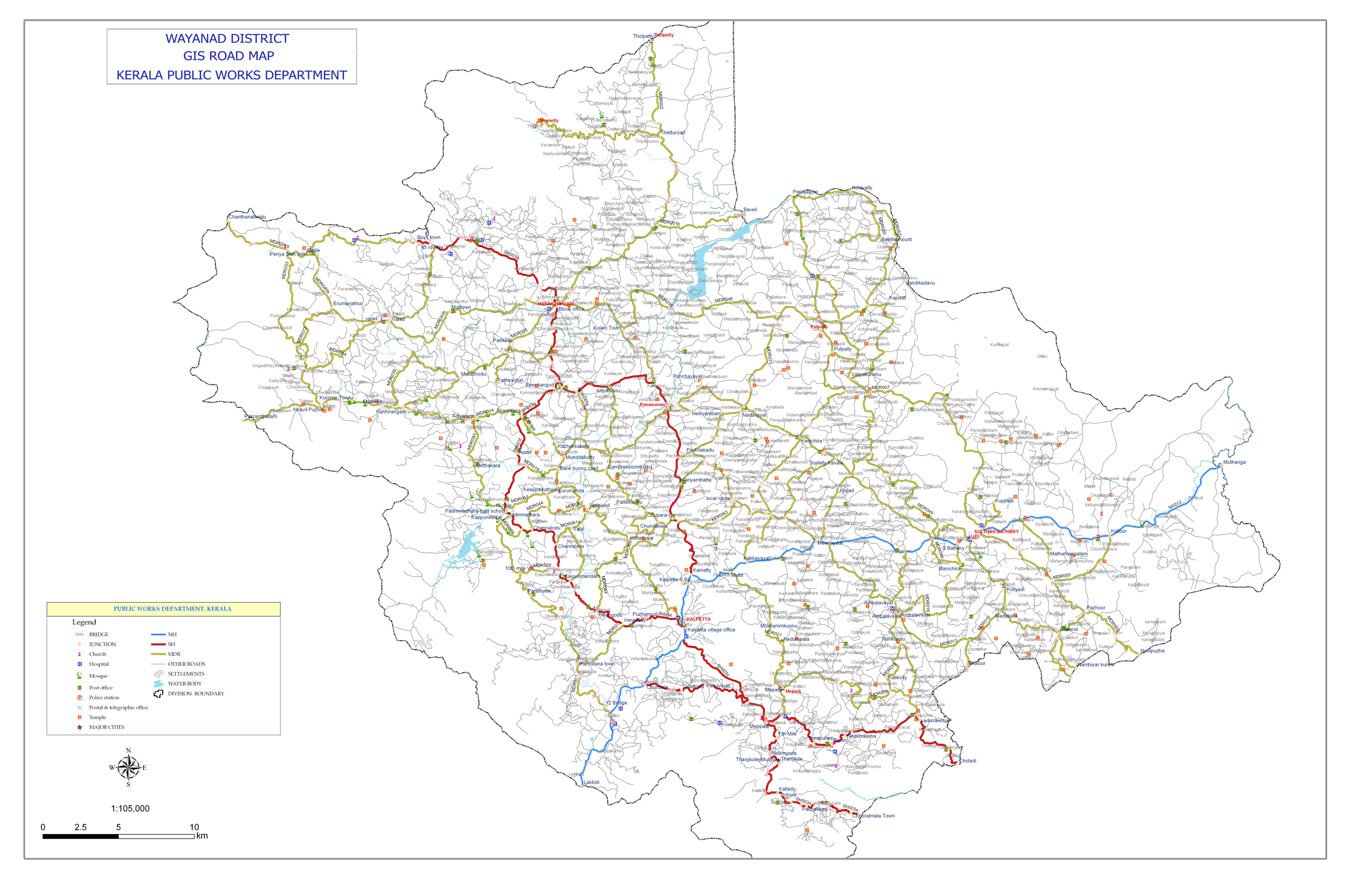
The district capital of Wayanad is Kalpetta town. Kalpetta has very good road connectivity with the rest of Kerala and neighboring South Indian cities. NH212 connects Kalpetta with Kozhikode and Mysore. State Highways connect Kalpetta with Ooty in Tamil Nadu and Madikeri in Karnataka.
Night Traffic Ban
En route to Mysore on NH 212, past Wayanad district boundary, which is also the Kerala state boundary, NH 212 passes through Bandipur National Park. There is a night traffic ban imposed on this stretch since 2009.[1] The alternate road to take is, leave NH 212 at Kalpetta and proceed to Mysore through Mananthavady, Kutta, Gonikoppal, and Hunsur.
Road routes
Kalpetta – Bangalore (280 km): Sulthan Bathery – Gundlupet - Mysore(NH212)(Night travel not allowed)
Kalpetta – Bangalore (312 km): Mananthavady - Kutta- Mysore (Night travel allowed)
Kalpetta - Mysore : 140 km via Sulthan Bathery (NH212 - No Night Travel), 172 km via Mananthavady, Kutta (Use for Night Travel).
Kalpetta – Ooty (127 km) : Meppadi – Gudalur
Kalpetta – Madikeri (135 km): Mananthavady - Kutta
Kalpetta - Kannur (123 km) : Mananthavady - Koothuparamba
Kalpetta - Malappuram (99 km) : Thamarassery - Areekkode - Manjeri
Kalpetta - Kozhikode (72 km) : Vythiri - Thamarassery
How to Reach Kalpetta
Kalpetta has very good road connectivity with the rest of Kerala and neighboring South Indian cities. NH212 connects Kalpetta with Kozhikode and Mysore. State Highways connect Kalpetta with Ooty in Tamil Nadu and Madikeri in Karnataka.
Highways

All national and state highways passing through Wayanad District intersect at Kalpetta,[2] making it a strategic location and the "Gateway of Wayanad":
- National Highway NH 212 connects Kalpetta with Kozhikode in Kerala and Mysore in Karnataka. This highway is the primary access to Wayanad from the major cities of Kerala (Kozhikode, Kochi and Thiruvananthapuram) as well as Karnataka (Bangalore and Mysore).
- State Highway SH 29 connects to the road to Gudalur and Ooty at the "Kerala - Tamil Nadu state border". This highway was originally Kozhikode - Vythiri - Kerala State border however the section Kozhikode - Chundale is now part of NH212. This highway now starts at Chundale, 6 km away from Kalpetta town-center.
- State Highway SH 54 is an alternate road connecting Kalpetta with Kozhikode. This highway starts at Kalpetta and proceeds to Kozhikode through Padinjarethara, Poozhithode, Peruvannamuzhi, Perambra and Pavangad, Kozhikode. Note that the section Padinjarethara to Poozhithode is not yet laid as the environmental clearance to build the road through the forest is pending.[3] This road is known as "Pinangode Road" at Kalpetta.
- State Highway SH 59 Hill Highway (Kerala) - This proposed highway connects both ends of Kerala state, passing through entire hilly regions of the state. This highway will pass through Kalpetta, connecting Mananthavady to the North and Meppadi and Nilambur to the South. (The section Meppadi to Nilambur is to be built).
Night Traffic Ban on NH 212 at Bandipur National Park
En route to Mysore on NH 212, past Wayanad district boundary, which is also the Kerala state boundary, NH 212 passes through Bandipur National Park. There is a night traffic ban imposed on this stretch since 2009.[4] The alternate road to take is, leave NH 212 at Kalpetta and proceed to Mysore through Mananthavady, Kutta, Gonikoppal, and Hunsur.
Road routes
Kalpetta – Bangalore (280 km): Sulthan Bathery – Gundlupet - Mysore(NH212)(Night travel not allowed)
Kalpetta – Bangalore (312 km): Mananthavady - Kutta- Mysore (Night travel allowed)
Kalpetta - Mysore : 140 km via Sulthan Bathery (NH212 - No Night Travel), 172 km via Mananthavady, Kutta (Use for Night Travel).
Kalpetta – Ooty (127 km) : Meppadi – Gudalur
Kalpetta – Madikeri (135 km): Mananthavady - Kutta
Kalpetta - Kannur (123 km) : Mananthavady - Koothuparamba
Kalpetta - Malappuram (99 km) : Thamarassery - Areekkode - Manjeri
Kalpetta - Kozhikode (72 km) : Vythiri - Thamarassery
How to reach Sultan Battery
Sultan Battery has a very good road connectivity with south Indian states. The major Road is NH 212 connected to Mysore, Bangalore and Kozhikode, two State highways connected to Ooty and Coimbatore and a state highway connected to Mangalore, Kannur, Thalassery and Kasaragod.
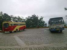
Sulthan Bathery is the biggest transport hub of Wayanad district. It is located near the border with the Karnataka state. There is a major Kerala Transport Depot in Sulthan Bathery. Most of the long distance buses to Kozhikode, Ooty and Bangalore start from this depot. The town also has two smaller bus stations for local travellers.
How to reach Mananthavady
Mainly five Ghat roads are used for reaching Mananthavady from coastal towns and lower hilly towns of Kerala:
- From Thalassery: Nedumpoil-Periya Ghat road, which connects Kasargod, Kannur, Thalassery and Kuthuparamba with Wayanad
- From Kozhikode: Thamarassery-Lakkidi Ghat road, part of NH 212, which connects Kozhikode and the rest of Kerala, south of Kozhikode with Wayanad
- From Vatakara: Kuttiady-Pakramthalam Ghat road, which connects Thalassery, Vatakara, Nadapuram, Kuttiady and Thottilpalam with Wayanad
- From Iritty: Kottiyoor-Ambayathode-Palchuram-Boys Town Ghat road, which connects lower hilly towns and villages of Kannur and Kasargod districts with Wayanad. The towns are Panathur, Malom, Udayagiri, Cherupuzha, Alakode, Sreekandapuram, Payyavoor, Iritty, Peravoor, Kelakam, Kottiyoor, etc.
- From Nilambur: Vazhikkadavu-Nadukani Ghat road, which connects Nilambur, Palakkad, Thrissur and Perinthalmanna, with Wayanad.
There is a high demand to start new bus route from Mananthavady to Ernakulam via Thamarassery, Perinthalmanna, Guruvayur which is the shortest way from here bypassing the cities Thrissur and Kozhikkode.
References
- ↑ "Bandipur-road-to-be-closed-at-night". DNA India. Retrieved 2014-05-11.
- ↑ "Road map of Wayanad district". Kerala PWD. Retrieved 2014-05-02.
- ↑ "Padinajrethara Poozhithode road". The Hindu. Retrieved 2014-05-02.
- ↑ "Bandipur-road-to-be-closed-at-night". DNA India. Retrieved 2014-05-11.
| Wikimedia Commons has media related to Mananthavady. |