Hill Highway (Kerala)
| |
|---|---|
| Hill Highway | |
| Route information | |
| Maintained by Kerala Public Works Department | |
| Length: | 1,332.16 km (827.77 mi) |
| Major junctions | |
| From: | Nandarapadvu, Kasaragod district |
| To: | Parassala, Thiruvananthapuram district |
| Location | |
| Primary destinations: | bandadka, Malom, chittarikkal, Alakode, Payyavoor, Kalpetta, Thiruvambady, Edakkara, Palakkad, Pattikkad, Neriamangalam, Kattappana, Erumely, Ranni, Punalur |
| Highway system | |
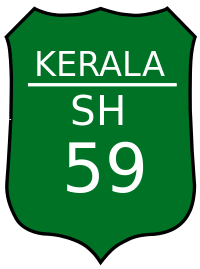
The Hill Highway or Malayora Highway or State Highway 59 (SH-59) is the longest state highway in Kerala. The proposed highway extends from Nandarapadvu in Kasaragod district to Parassala in Thiruvananthapuram district, will have a length of 1332.16 km. The expected outlay for the project is Rs.1,500 crore.The proposed highway would pass through areas including bandadka, Malom, chittarikkal, Alakode, Payyavoor, Mananthavady, Kalpetta, Thiruvambady, Edakkara, Palakkad, Pattikkad, Neriamangalam, Kattappana, Mundakayam, Erumely, Ranni, Konni, Pathanapuram, Punalur, Anchal, Palode and Vithura.[1]
This highway will pass through 13 out of the 14 districts of Kerala state. Alappuzha is not connected by this highway as that district is not part of the hilly ranges of Kerala. Between Kannur and Malappuram districts, this highway will have two parallel routes, one through Wayanad district and another through Kozhikode district.[2]
Development of hill highway in Kerala is proposed in two phases. First phase involved selection of most feasible route between Kasargode and Palakkad Districts. The National Transportation Planning and Research Centre (NATPAC) has already undertaken detailed investigation and finalised the alignment for Phase I of Hill Highway. Implementation of the same is in progress in the northern region of Kerala. In the second stage possible alternative routes for developing into Hill Highway between Palakkad and Thiruvananthapuram Districts are identified. Field studies and environmental screening of the project were completed and NATPAC submitted the report to Government on 21-05-2009. Government have approved the alignment on 6-7-2009 and issued Government order vide GO (MS) No.44/2009/PWD dated 6-7-2009.[3] It is also called as "Kerala's Spice route"[4]
Complete alignment

| Sl.No | District | Alignment | Length | Remarks |
| 1 | Kasargode | Nandarapadav, Puthiga, Perla, Badiyadukka, Mulariya, Pandi, Paduppu, Bandadka, Erinchilamkodu, Kolichal, Pathinettam Mile, Vallikadavu, Chittarikkal | 110Km | |
| 2 | Kannur | Cherupuzha. Manjakad, Alakode, Karuvanchal, Thavukunnu, Naduvil, Chemperi, Payyavoor, Ulikkal, Iritty, Peravoor, Nedumpoil, Vilangad
& Ulikkal, Vallithode, Anappanthy, Karikkottakary, Edoor, Aralam, Kappukadavu, Perumbunna, Madapurachal, Manathana, Kottiyoor, Ambayathode, Boy's Town |
109km | Dividing into 2 routes from Ulikkal |
| 3 | Kozhikode | Vilangad, Kiaveli, Kayakkody, Kuttiady, Maruthonkara, Peruvannamuzhi, Chakkittapara, Narinada, Koorachundu, Kallanod, Thalayad, Kattippara, Malapuram, Kodancheri, Thiruvambady, Koodaranji, Koombara, Kakkadampoyil | 110Km | |
| 4 | Wayanand | Boy's Town, Mananthavady, Naalam Mile , Anjukunnu , Panamaram, Kainatty, Kalpetta, Kappenkolly, Meppadi, Chooralmala , Aranappuzha | 96Km | |
| 5 | Malappuram | Kakkadampoyil , Akampadam, Nilambur, Pookkottumpadam, Kalikavu, Kizhekethala(Karuvarakundu), Pulvetta, Karingalthonni
& Munderi, Pothukal, Chungathara, Karulai, Pookottumpadam |
101Km | Dividing into 2 routes from Pookottumpadam |
| 6 | Palakkad | Ponpara, Edathinattukara,Kappuparambu,Thruvizhakunnu,Kottopadam,Kumaram,Puttur,Mannarkadu, Chandranagar(Palakkad Town), Kalligal,Puthunagaram, Kollenkode, Nenmara,Vadakkenchery | 130km | |
| 7 | Thrissur | Pattikkad, Vilangannoor, Mannamangalam, Pulikkanny, Palappilly, Nayattukundu, Vellikulangara, Vettilappara | 60Km | |
| 8 | Ernakulam | Vettilappara,Adivaram,Kadappara, Ellithodu,Chettinada, Pannamkuzhi, Payal, Kottapadi, Chelladu, Ughipara, Nadukani, Neriamangalam,Arrammile Elamblassery | 104Km | |
| 9 | Idukki | Kurathikudi, Perubankuth, Mankulam, Kallar, Eruttukanam,Kunjithanni, Rajakkad, Thinkalkadu, Myladumpara, Nedumkandam, Puliyanmala, Kattappana, Elappara, Kuttikkanam, Mundakayam | 166Km | |
| 10 | Kottayam | Mundakayam, Erumely, Palacheri | 24Km | |
| 11 | Pathanamthitta | Ranni, Kumbazha, Konni, Pathanapuram | 46Km | |
| 12 | Kollam | Pathanapuram, Punalur, Anchal, Kulathupuzha, Madathara, Kollayil | 64Km | |
| 13 | Thiruvananthapuram | Palode, Perungamala,Thennur, Vithura,Thudumukku, Malayadi, Paragondu, Aryanadu, Kuttichal,Kallikadu,Vazhichal,Kudapanamoodu,Annapara,Vellarda,Karakonam,Parassala | 75Km |
Budget Support
| No | Financial Year | Amount outlay (Rs) | Amount spend (Rs)[5] |
|---|---|---|---|
| 1 | 2012-13 | Nil | Nil |
| 2 | 2013-14 | 82.37 lakh | 6.23 cr |
| 3 | 2014-15 | 82.37 lakh | 8.98 cr |
| 4 | 2015-16 | 9.06 crore | 7.35 cr |
External links
References
- ↑ http://www.thehindu.com/2005/01/31/stories/2005013105930500.htm
- ↑ http://www.thehindubusinessline.com/todays-paper/tp-economy/hill-highway-to-boost-keralas-rural-economy/article2166637.ece
- ↑ http://www.newindianexpress.com/cities/kochi/DPR-of-hill-highway-likely-in-3-months/2013/09/23/article1798544.ece
- ↑ http://www.thehindu.com/todays-paper/tp-national/tp-kerala/alignment-for-hill-highway-finalised/article293539.ece
- ↑ http://niyamasabha.org/codes/13kla/session_15/ans/u01384-031215-843000000000-15-13.pdf
![]() Geographic data related to Hill Highway (Kerala) at OpenStreetMap
Geographic data related to Hill Highway (Kerala) at OpenStreetMap