Tony, Wisconsin
| Tony, Wisconsin | |
|---|---|
| Village | |
 Location of Tony, Wisconsin | |
| Coordinates: 45°28′52″N 90°59′41″W / 45.48111°N 90.99472°WCoordinates: 45°28′52″N 90°59′41″W / 45.48111°N 90.99472°W | |
| Country | United States |
| State | Wisconsin |
| County | Rusk |
| Area[1] | |
| • Total | 2.03 sq mi (5.26 km2) |
| • Land | 2.03 sq mi (5.26 km2) |
| • Water | 0 sq mi (0 km2) |
| Elevation[2] | 1,230 ft (375 m) |
| Population (2010)[3] | |
| • Total | 113 |
| • Estimate (2012[4]) | 109 |
| • Density | 55.7/sq mi (21.5/km2) |
| Time zone | Central (CST) (UTC-6) |
| • Summer (DST) | CDT (UTC-5) |
| Area code(s) | 715 & 534 |
| FIPS code | 55-80225[5] |
| GNIS feature ID | 1575507[2] |
Tony is a village in Rusk County, Wisconsin, United States. The population was 113 at the 2010 census.
Geography
Tony is located at 45°28′52″N 90°59′41″W / 45.48111°N 90.99472°W (45.481083, -90.994763).[6]
According to the United States Census Bureau, the village has a total area of 2.03 square miles (5.26 km2), all land.[1] When founded, it was named Deer Tail, as the village is located on Deer Tail Creek.
Demographics
| Historical population | |||
|---|---|---|---|
| Census | Pop. | %± | |
| 1920 | 216 | — | |
| 1930 | 160 | −25.9% | |
| 1940 | 186 | 16.3% | |
| 1950 | 182 | −2.2% | |
| 1960 | 162 | −11.0% | |
| 1970 | 144 | −11.1% | |
| 1980 | 146 | 1.4% | |
| 1990 | 114 | −21.9% | |
| 2000 | 105 | −7.9% | |
| 2010 | 113 | 7.6% | |
| Est. 2015 | 107 | [7] | −5.3% |
2010 census
As of the census[3] of 2010, there were 113 people, 47 households, and 29 families residing in the village. The population density was 55.7 inhabitants per square mile (21.5/km2). There were 52 housing units at an average density of 25.6 per square mile (9.9/km2). The racial makeup of the village was 92.0% White, 6.2% African American, 0.9% Native American, and 0.9% from other races. Hispanic or Latino of any race were 0.9% of the population.
There were 47 households of which 21.3% had children under the age of 18 living with them, 42.6% were married couples living together, 8.5% had a female householder with no husband present, 10.6% had a male householder with no wife present, and 38.3% were non-families. 23.4% of all households were made up of individuals and 10.7% had someone living alone who was 65 years of age or older. The average household size was 2.40 and the average family size was 2.83.
The median age in the village was 42.8 years. 24.8% of residents were under the age of 18; 6.2% were between the ages of 18 and 24; 19.4% were from 25 to 44; 25.6% were from 45 to 64; and 23.9% were 65 years of age or older. The gender makeup of the village was 49.6% male and 50.4% female.
2000 census
As of the census[5] of 2000, there were 105 people, 43 households, and 27 families residing in the village. The population density was 51.7 people per square mile (20.0/km²). There were 45 housing units at an average density of 22.2 per square mile (8.6/km²). The racial makeup of the village was 99.05% White, 0.95% from other races. Hispanic or Latino of any race were 0.95% of the population.
There were 43 households out of which 25.6% had children under the age of 18 living with them, 48.8% were married couples living together, 9.3% had a female householder with no husband present, and 34.9% were non-families. 32.6% of all households were made up of individuals and 23.3% had someone living alone who was 65 years of age or older. The average household size was 2.40 and the average family size was 3.00.
In the village the population was spread out with 23.8% under the age of 18, 8.6% from 18 to 24, 26.7% from 25 to 44, 23.8% from 45 to 64, and 17.1% who were 65 years of age or older. The median age was 36 years. For every 100 females there were 78.0 males. For every 100 females age 18 and over, there were 86.0 males.
The median income for a household in the village was $21,563, and the median income for a family was $31,250. Males had a median income of $26,875 versus $21,250 for females. The per capita income for the village was $16,328. There were 16.7% of families and 17.4% of the population living below the poverty line, including 50.0% of under eighteens and 11.8% of those over 64.
Notable people
- Jim Leonhard, current Wisconsin Badgers defensive backs coach, former NFL and Wisconsin Badgers defensive back, lived in Tony.
- John Q. Radcliffe, former Wisconsin State Assemblyman, attended high school in Tony.
References
- 1 2 "US Gazetteer files 2010". United States Census Bureau. Retrieved 2012-11-18.
- 1 2 "US Board on Geographic Names". United States Geological Survey. 2007-10-25. Retrieved 2008-01-31.
- 1 2 "American FactFinder". United States Census Bureau. Retrieved 2012-11-18.
- ↑ "Population Estimates". United States Census Bureau. Retrieved 2013-06-24.
- 1 2 "American FactFinder". United States Census Bureau. Retrieved 2008-01-31.
- ↑ "US Gazetteer files: 2010, 2000, and 1990". United States Census Bureau. 2011-02-12. Retrieved 2011-04-23.
- ↑ "Annual Estimates of the Resident Population for Incorporated Places: April 1, 2010 to July 1, 2015". Retrieved July 2, 2016.
- ↑ "Census of Population and Housing". Census.gov. Retrieved June 4, 2015.
Municipalities and communities of Rusk County, Wisconsin, United States | ||
|---|---|---|
| City | 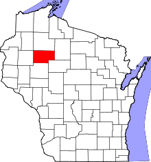 | |
| Villages | ||
| Towns | ||
| Unincorporated communities | ||