Tinguipaya Municipality
| Tinguipaya Municipality | |
|---|---|
| Municipality | |
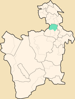 Location within Potosí Department | |
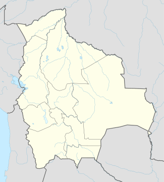 Tinguipaya Municipality Location within Bolivia | |
| Coordinates: 19°23′S 66°0′W / 19.383°S 66.000°WCoordinates: 19°23′S 66°0′W / 19.383°S 66.000°W | |
| Country |
|
| Department | Potosí Department |
| Province | Tomás Frías Province |
| Seat | Tinguipaya |
| Population (2001) | |
| • Total | 21,794 |
| • Ethnicities | Quechua |
| Time zone | -4 (UTC-4) |
Tinguipaya Municipality is the first municipal section of the Tomás Frías Province in the Potosí Department in Bolivia. Its seat is Tinguipaya.
Subdivision
The municipality consists of the following cantons:
- Anthura
- Tinguipaya
Geography
The municipality is located in the interadean zone with heights between 3,100 m and 4,882 m Malmisa being the highest elevation. Some of the highest mountains of the municipality are listed below:[1]
|
|
|
The people
The people are predominantly indigenous citizens of Quechua descent.[2]
| Ethnic group | % |
|---|---|
| Quechua | 94.7 |
| Aymara | 0.2 |
| Guaraní, Chiquitos, Moxos | 0.0 |
| Not indigenous | 5.1 |
| Other indigenous groups | 0.0 |
See also
References
- ↑ Plan de Desarrollo Municipal Tinguipaya 2008 – 2012 (Spanish)
- ↑ obd.descentralizacion.gov.bo/municipal/fichas/ (inactive)
External links
Capital: Potosí | ||
| Provinces |  | |
| Municipalities (and seats) |
| |
This article is issued from Wikipedia - version of the 1/31/2016. The text is available under the Creative Commons Attribution/Share Alike but additional terms may apply for the media files.