Tahua Municipality
| Tahua Municipality Tawa | |
|---|---|
| Municipality | |
|
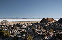
The village of Coquesa and Salar de Uyuni in Tahua Municipality | |
 Location within Potosí Department | |
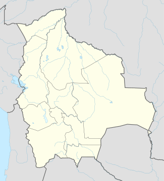 Tahua Municipality Location within Bolivia | |
| Coordinates: 20°18′S 67°24′W / 20.300°S 67.400°WCoordinates: 20°18′S 67°24′W / 20.300°S 67.400°W | |
| Country |
|
| Department | Potosí Department |
| Province | Daniel Campos Province |
| Seat | Tahua |
| Area | |
| • Total | 1,263 sq mi (3,272 km2) |
| Elevation | 12,100 ft (3,700 m) |
| Population (2001) | |
| • Total | 2,166 |
| • Ethnicities | Aymara |
| Time zone | -4 (UTC-4) |
Tahua Municipality is the second municipal section of the Daniel Campos Province in the Potosí Department in Bolivia. Its seat is Tahua.
Geography
Tahua Municipality lies in the Altiplano at the Uyuni salt flat.
Some of the highest mountains of the municipality are listed below:[1]
- Ch'iyar Qullu
- Jisk'a Wat'a
- Lluqu Lluqu
- Muruq'u Qullu
- Wila Qullu
- Wila Wilani
Subdivision
The municipality consists of the following cantons:
The people
The people are predominantly indigenous citizens of Aymara descent.[2]
| Ethnic group | % |
|---|---|
| Quechua | 6.0 |
| Aymara | 90.5 |
| Guaraní, Chiquitos, Moxos | 0.1 |
| Not indigenous | 3.3 |
| Other indigenous groups | 0.0 |
See also
References
- ↑ "Tahua". INE, Bolivia. Retrieved October 16, 2015.
- ↑ obd.descentralizacion.gov.bo/municipal/fichas/ (inactive)
External links
Capital: Potosí | ||
| Provinces |  | |
| Municipalities (and seats) |
| |
This article is issued from Wikipedia - version of the 9/16/2016. The text is available under the Creative Commons Attribution/Share Alike but additional terms may apply for the media files.