Timber Trail
| Timber Trail | |
|---|---|
|
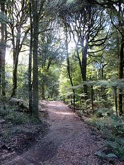
Above the Piropiro Valley; typical of the northern section of the Timber Trail | |
| Length | 83 km (52 mi) |
| Location | border of Waikato region and Manawatu-Wanganui region, New Zealand |
| Trailheads | Pureora and Ongarue |
| Use | Walking, cycling |
| Elevation | |
| Elevation change | 360 m (1,180 ft) |
| Highest point | 940 m (3,080 ft) |
| Lowest point | 200 m (660 ft) |
| Hiking details | |
| Trail difficulty | Intermediate to easy |
| Season | Year round |
| Sights | Suspension bridges, railway spiral, native bush |
| Hazards | mud, trees |
The Timber Trail, originally known as the Central North Island Rail Trail or Pureora Timber Trail, in the North Island of New Zealand is an 83 kilometres (52 mi) cycleway (also used by walkers and hunters) in Pureora Forest Park, fully opened in 2013, with 35 bridges (built by DoC staff, community max workers,[1] or contractors),[2] including 8 large suspension bridges (one of the longest on a NZ cycleway, much more stable than the swing bridges used on older tracks). It is one of several cycleways developed as part of the New Zealand Cycle Trail and passes through podocarp forests of rimu, totara, miro, matai and kahikatea, as well as some exotic forestry and regenerating bush. About half the trail is on the track-bed of an old bush tramway, including a spiral and tunnel.
It is easiest to ride downhill from Pureora (elevation 560 metres or 1,840 feet) to Ongarue (200 metres or 660 feet). Fit riders can cover the trail in a day. Accommodation and cycle transport can be arranged at Pureora Cabins, Pa Harakeke (campervans, camping and two chalets), Pureora Forest Park Lodge (up to 50 guests), or Blackfern Lodge, Waimiha (from the middle of the trail).[3] An alternative is the 4 bed Bog Inn Hut, built of totara slabs, at the foot of Mt Pureora, 2 kilometres (1.2 mi) off the trail. It originally housed scientists studying a nearby wetland.[4] Since 2013, several local farmers and B&Bs have been offering nearby accommodation, meals, and shuttle services for the trail.
There are three main access points:
- north - Pureora Forest, signposted from SH30 between Te Kuiti and Mangakino.
- centre - from Piropiro campsite at the end of Kokomiko Rd, Waimiha.
- south - Ongarue, signposted from SH4.[5]
Northern section
Pureora to Piropiro (39.5 km) Track category: Intermediate/Grade 3
0–8 km Easy/Grade 2 Pureroa DoC Centre to the first shelter.
The trail begins in Pikiariki Ecological Area, about 200 metres (660 ft) from the DOC Pureora Field Base on Barryville Rd, turning left a few metres into the bush, on a boardwalk, then winding some 4 kilometres (2.5 mi) through tall podocarps (frequented by kaka[6]), over Whareana Stream, through a Douglas fir plantation, across Whareana Rd and Cabbage Tree Rd before winding up through an area of regenerating toitoi, cabbage tree, five finger and kamahi. It crosses Tui Rd, to the shelter below Mt Pureora.[7]
8–23 km — Mt Pureora to Angel's Rest grade 3 (intermediate)
The trail winds to 940 metres (3,080 ft),[8] within a 40min walk of 1,165 metres (3,822 ft) Mt Pureora summit, through various stages of regenerating bush to the existing native bush edge to the top of the Ongarue River and an old logging road.[9]

Two large suspension bridges cross tributaries of the river at Bog Inn Creek (115 metres or 377 feet) and the similar sized Orauhora crossing.[10]
23–40 km — Angel’s Rest - Okauaka Ford - Maramataha River
Uses a logging road for some 6 kilometres (3.7 mi), then mainly Okauaka Road. 500 metres (1,600 ft) beyond the concrete ford and neighbouring trail bridge over Okauaka Stream, the track joins a tramway, crosses Okauaka Road again, and continues through the bush to Kokomiko Road and Piropiro campground. After the campground, the track rejoins the tramway to Maramataha Rodd, then follows Piropiro Stream on a new track to the Maramataha Bridge.[11]
Southern section
(Easy/Grade 2) 43 km Piropiro to Ongarue
40–52 km - Piropiro to Angels Rest Intermediate/Grade 3


A 30 minutes climb from the Piropiro campsite leads to the 141 metres (463 ft) Maramataha Bridge, some 60 metres (200 ft) above the Maramataha Gorge and the largest suspension bridge of its kind along any cycle trail in New Zealand. Construction required much rock drilling and anchor work. It is supported on 12.8 metres (42 ft) high glulam towers.[12]
52–64 km — Maramataha River - Deer Park junction - Waione Stream
South of the bridge the steepest climb on the trail zigzags to a plateau on a new track. From the plateau quad tracks lead to the north end of the Ellis and Burnand tramway, which the trail then mostly follows on easier gradients to Ongarue. These tramways were cleared in 2011.[13]
64–74 km — Waione Stream - Waikoura Stream - Goat Creek
A 40 metres (130 ft) suspension bridge crosses Waione Stream, then the tramway runs to Waikoura Stream, passing No. 11 and No. 10 camps, and the No. 9 tramway junction.[14] The information board says Waikoura Camp at No. 9 was the largest and last camp on this tramway, built in 1950 and closed in 1963, with 6 houses and 9 single men's huts. A 28 metres (92 ft) suspension bridge crosses Waikoura Stream and a tramway links to the 90 metres (300 ft) Mangatukutuku suspension bridge, then No. 7 tramway runs to Goat Creek.[15]
74–83 km — Goat Creek - Ongarue Spiral - Mangakahu Rd
A three span, curved, timber trestle bridge crosses Goat Creek, resembling many of the tramway bridges,[16] then 4 kilometres (2.5 mi) of tramway cleared in 2011 leads to the spiral.[17]
Ongarue Spiral took the tramway up 43 metres (141 ft) on a grade the bush lokeys could cope with (for 6 kilometres or 3.7 miles the gradient averaged 1 in 30).[18] Below the spiral the tramway was built by cutting a ledge in the ignimbrite cliffs. It continues to drop until reaching the bank of the Mangakahu Stream. The final 4 kilometres (2.5 mi) are undulating to the end of the trail in a car park beside Mangakahu Road, 2 kilometres (1.2 mi) from Ongarue.
History
The Timber Trail, originally known as the Central North Island Rail Trail,[19] cost about $5.5m to build.[20] It was one of the seven 'Quick Start' Projects announced in 2009, which were publicised as promoting economic growth[21] The Timber Trail took longer to complete than some later projects, so it was the tenth New Zealand Cycle Trail to be completed since Prime Minister John Key had launched the cycleways with the Green Party.[22]
By mid-2011 only 23 kilometres (14 mi) was open, with tenders still not let for interpretation panels and five bridges.[23] It was then that the contract with the Ministry of Economic Development for community max and taskforce green workers ended. 12 staff had been trained in 12 months in basic woodwork, track construction, quad bike and 4WD driving and health and safety. DoC employed five from the MED scheme for six months to build 6 to 10 metres (20 to 33 ft) bridges, shelters, other structures, and some track construction. Another went on 'community max' with the recreation team.[24]
Ongarue Spiral restoration work began in July 2011. The tunnel was strengthened and the stream re-diverted out of it (it had been diverted in when the tramway was replaced by logging trucks). The tunnel ceiling was reinforced with mesh, a lower bridge built to the right of the original bridge to preserve bits of the original and remnants of the upper bridge preserved in the new trail bridge.[25]
Negotiations were held to build a 30 metres (98 ft) suspension bridge over Mangakahu Stream to end the trail further east on Mangakahu Rd, but the trail as built has another 4 kilometres (2.5 mi) of undulating ride keeping north of the stream, roughly following the tramway (see map below) to within 2 kilometres (1.2 mi) of Ongarue.[26]
In July 2011 Maramataha, Waione, and Waikoura bridges were tested to their 10-person weight limit using water weights to get council consent and 1.6 kilometres (0.99 mi) of track was built (though not surfaced).[27] Maramataha Bridge was finished in early October 2012 and opened on 1 November 2012.[28] The northern end Bog Creek and Orauhora suspension bridges were ready by December 2012.[29]
On the 1 December 2012 southern section opening day 150 cyclists rode its four suspension bridges, the tramline and Ongarue Spiral.[30]
The Timber Trail was declared fully open when the Minister of Conservation cut the ribbon on Saturday, 30 March 2013.[31]
After the opening improvements and maintenance continued; in winter 2013 additional pumice was helicoptered to boggy patches on the Mt Pureora section.[32] Other changes are likely. For example, there were concession negotiations about lodgings at Piropiro Flats to supplement the existing campground, where stumps had been cleared.[33]

Most of the Timber Trail's southern section follows the Ellis & Burnand tramway. Their timber sawmill at Ongarue was fed with logs (especially rimu) by a gradually growing network of tramways from 1903 until floods damaged the lines in 1958. From then until closure in 1966 the tramway was converted for use by logging trucks. However, as one of the best preserved bush tramways, it is considered a nationally significant site.[34]
Accommodation
The Timber Trail has a number of accommodation options for cyclists. All accommodation is located near the start, finish or half way point of the track, this makes it easy for those completing any section to find accommodation.[35]
Accommodation near the track includes:
- Art Doc Gallery and Sleep-out
- Benneydale Lodge
- Lake Maraetai Lodge Mangakino
- Pa Harakeke
- That Dam Lodge Whakamaru
- Waione River Homestead Waimiha
- Waitomo Lodge Te Kuiti
- Timber Trail Kohia - Former DOC Huts at Pureora
See also
Further reading
- A national history overview on bush tramways: Mahoney, P, 1998, The Era of the Bush Tramway in New Zealand, IPL, Wellington.[36]
- Sparse Timber Sawmillers: Ken Anderson, 2007 ISBN 9780958298483 - a history of the logging, tramline and mill from 1903 until the mill closed in 1966.
References
- ↑ Ministry of Social Development explanation of 'Community Max' in 2010.
- ↑ Ediface constructors
- ↑ "DoC Timber Trail information". Department of Conservation. Retrieved 9 September 2013.
- ↑ DoC Bog Hut information
- ↑ DoC Timber Trail information
- ↑ DoC Timber Trail information
- ↑ DoC Timber Trail information
- ↑ DoC Timber Trail information
- ↑ Ediface constructors
- ↑ Malcolm Hutchinson website map and route description.
- ↑ Ediface constructors
- ↑ Ediface constructors
- ↑ Poutama update August 2011
- ↑ Poutama update August 2011
- ↑ Poutama update August 2011
- ↑ Ediface constructors
- ↑ Poutama update August 2011
- ↑ DoC December 2012 update
- ↑ DoC NZ Cycle Trail project: The Timber Trail
- ↑ Māori Affairs Ministry press release 3 Dec 2012.
- ↑ Tourism NZ announcement 11 February 2010.
- ↑ 'Chill' - photos and article on March 2013 opening.
- ↑ Cycleway update Aug 2011.
- ↑ Cycleway update Aug 2011.
- ↑ DoC December 2012 update
- ↑ Cycleway update Aug 2011.
- ↑ Cycleway update Aug 2011.
- ↑ DoC Timber Trail information
- ↑ DoC December 2012 update
- ↑ DoC December 2012 update
- ↑ 4 April 2013 media release
- ↑ Facebook Timber Trail page
- ↑ Cycleway update Aug 2011.
- ↑ DoC Ongarue Tramway information
- ↑ "Timber Trail Accommodation". Blue Tui Shuttles.
- ↑ DoC Ongarue Tramway information
External links
| Wikimedia Commons has media related to Timber trail. |
- 1:50,000 map of Timber Trail (35MB).
- The wams.org map also shows the route at 1:50,000, but doesn't distinguish it from other tracks
- map and gradient profile
- accommodation and services near the timber trail
- recent and historic photos on Ellis & Burnand Ongarue Tramline Facebook page
- Climax lokey on Mangatukutuku viaduct with a train of logs.
- History and photos of Climax lokey 1650.
- Recent photos of former tramway on Flickr
- Bush trams – Te Ara Encyclopedia of NZ
Biographies of Ellis & Burnand directors -
- Henry Valder – Te Ara Encyclopedia of NZ
- J W Ellis obituary - 1918 Auckland Star
- Ellis & Burnand was bought by Fletcher, now trading as PlaceMakers