Thornton, Arkansas
| Thornton, Arkansas | |
|---|---|
| City | |
 Location in Calhoun County and the state of Arkansas | |
| Coordinates: 33°46′36″N 92°29′23″W / 33.77667°N 92.48972°WCoordinates: 33°46′36″N 92°29′23″W / 33.77667°N 92.48972°W | |
| Country | United States |
| State | Arkansas |
| County | Calhoun |
| Area | |
| • Total | 1.93 sq mi (4.99 km2) |
| • Land | 1.91 sq mi (4.95 km2) |
| • Water | 0.02 sq mi (0.04 km2) |
| Elevation | 318 ft (97 m) |
| Population (2010) | |
| • Total | 407 |
| • Density | 213/sq mi (82.2/km2) |
| Time zone | Central (CST) (UTC−6) |
| • Summer (DST) | CDT (UTC−5) |
| ZIP code | 71766 |
| Area code | 870 |
| FIPS code | 05-69050 |
| GNIS feature ID | 0055554 |
Thornton is a city in Calhoun County, Arkansas, United States. The population was 407 as of the 2010 census,[1] down from 517 at the 2000 census. It is part of the Camden, Arkansas micropolitan area.
Geography
Thornton is located in northern Calhoun County at 33°46′36″N 92°29′23″W / 33.77667°N 92.48972°W (33.776794, -92.489711).[2] U.S. Route 79 passes through the city, leading northeast 6 miles (10 km) to Fordyce and southwest 26 miles (42 km) to Camden. U.S. Route 167 cuts across the southeast corner of the city limits, leading north to US 79 and Fordyce and south 16 miles (26 km) to Hampton, the Calhoun County seat.
According to the United States Census Bureau, Thornton has a total area of 1.9 square miles (5.0 km2), of which 0.02 square miles (0.04 km2), or 0.84%, is water.[1]
Demographics
| Historical population | |||
|---|---|---|---|
| Census | Pop. | %± | |
| 1880 | 150 | — | |
| 1890 | 132 | −12.0% | |
| 1910 | 611 | — | |
| 1920 | 1,312 | 114.7% | |
| 1930 | 550 | −58.1% | |
| 1960 | 658 | — | |
| 1970 | 746 | 13.4% | |
| 1980 | 711 | −4.7% | |
| 1990 | 502 | −29.4% | |
| 2000 | 517 | 3.0% | |
| 2010 | 407 | −21.3% | |
| Est. 2015 | 398 | [3] | −2.2% |
As of the census[5] of 2000, there were 517 people, 206 households, and 142 families residing in the city. The population density was 270.4 people per square mile (104.5/km²). There were 242 housing units at an average density of 126.6/sq mi (48.9/km²). The racial makeup of the city was 56.48% White, 41.78% Black or African American, 0.19% Native American, and 1.55% from two or more races. 0.97% of the population were Hispanic or Latino of any race.
There were 206 households out of which 32.5% had children under the age of 18 living with them, 51.9% were married couples living together, 13.1% had a female householder with no husband present, and 30.6% were non-families. 25.2% of all households were made up of individuals and 14.1% had someone living alone who was 65 years of age or older. The average household size was 2.51 and the average family size was 2.98.
In the city the age distribution of the population shows 25.5% under the age of 18, 7.2% from 18 to 24, 32.1% from 25 to 44, 22.1% from 45 to 64, and 13.2% who were 65 years of age or older. The median age was 37 years. For every 100 females there were 86.0 males. For every 100 females age 18 and over, there were 75.8 males.
The median income for a household in the city was $24,375, and the median income for a family was $31,125. Males had a median income of $33,472 versus $16,071 for females. The per capita income for the city was $14,323. About 26.6% of families and 33.9% of the population were below the poverty line, including 45.1% of those under age 18 and 32.8% of those age 65 or over.
Climate
The climate in this area is characterized by hot, humid summers and generally mild to cool winters. According to the Köppen climate classification system, Thornton has a humid subtropical climate, abbreviated "Cfa" on climate maps.[6]
References
- 1 2 "Geographic Identifiers: 2010 Demographic Profile Data (G001): Thornton city, Arkansas". U.S. Census Bureau, American Factfinder. Retrieved June 12, 2014.
- ↑ "US Gazetteer files: 2010, 2000, and 1990". United States Census Bureau. 2011-02-12. Retrieved 2011-04-23.
- ↑ "Annual Estimates of the Resident Population for Incorporated Places: April 1, 2010 to July 1, 2015". Retrieved July 2, 2016.
- ↑ "Census of Population and Housing". Census.gov. Retrieved June 4, 2015.
- ↑ "American FactFinder". United States Census Bureau. Retrieved 2008-01-31.
- ↑ Climate Summary for Thornton, Arkansas
Municipalities and communities of Calhoun County, Arkansas, United States | ||
|---|---|---|
| Cities | 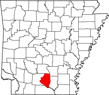 | |
| Towns | ||