Harrell, Arkansas
| Harrell, Arkansas | |
|---|---|
| Town | |
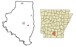 Location in Calhoun County and the state of Arkansas | |
| Coordinates: 33°30′38″N 92°24′0″W / 33.51056°N 92.40000°WCoordinates: 33°30′38″N 92°24′0″W / 33.51056°N 92.40000°W | |
| Country | United States |
| State | Arkansas |
| County | Calhoun |
| Named for | Jedediah Harrell |
| Area | |
| • Total | 0.6 sq mi (1.6 km2) |
| • Land | 0.6 sq mi (1.6 km2) |
| • Water | 0 sq mi (0 km2) |
| Elevation | 203 ft (62 m) |
| Population (2010) | |
| • Total | 254 |
| • Density | 423.3/sq mi (158.8/km2) |
| Time zone | Central (CST) (UTC-6) |
| • Summer (DST) | CDT (UTC-5) |
| ZIP code | 71745 |
| Area code(s) | 870 |
| FIPS code | 05-30310 |
| GNIS feature ID | 0049884 |
Harrell is a town[1] in Calhoun County, Arkansas, United States. The population was 254 at the 2010 census. It is part of the Camden Micropolitan Statistical Area.
Geography
Harrell is located at 33°30′38″N 92°24′00″W / 33.510471°N 92.400072°W.[2]
According to the United States Census Bureau, the city has a total area of 0.6 square miles (1.6 km2), all of it land.
Demographics
| Historical population | |||
|---|---|---|---|
| Census | Pop. | %± | |
| 1940 | 273 | — | |
| 1950 | 342 | 25.3% | |
| 1960 | 267 | −21.9% | |
| 1970 | 269 | 0.7% | |
| 1980 | 302 | 12.3% | |
| 1990 | 258 | −14.6% | |
| 2000 | 293 | 13.6% | |
| 2010 | 254 | −13.3% | |
| Est. 2015 | 248 | [3] | −2.4% |
As of the census[5] of 2000, there were 293 people, 120 households, and 81 families residing in the city. The population density was 472.0 people per square mile (182.5/km²). There were 139 housing units at an average density of 223.9/sq mi (86.6/km²). The racial makeup of the city was 43.00% White, 56.31% Black or African American, and 0.68% from two or more races.
There were 120 households out of which 32.5% had children under the age of 18 living with them, 43.3% were married couples living together, 20.8% had a female householder with no husband present, and 32.5% were non-families. 28.3% of all households were made up of individuals and 13.3% had someone living alone who was 65 years of age or older. The average household size was 2.44 and the average family size was 2.94.
In the city the population was spread out with 28.3% under the age of 18, 9.2% from 18 to 24, 27.3% from 25 to 44, 19.8% from 45 to 64, and 15.4% who were 65 years of age or older. The median age was 34 years. For every 100 females there were 83.1 males. For every 100 females age 18 and over, there were 75.0 males.
The median income for a household in the city was $21,875, and the median income for a family was $33,333. Males had a median income of $30,500 versus $14,500 for females. The per capita income for the city was $12,539. About 15.0% of families and 23.5% of the population were below the poverty line, including 25.3% of those under the age of eighteen and 20.0% of those sixty five or over.
Education
Public education is available via the Hampton School District based in Hampton, with students graduating from Hampton High School. The school district encompasses 479.67 square miles (1,242.3 km2) of land including all of Hampton and portions of several Calhoun County communities including Camden, Harrell, and Tinsman.
References
- ↑ Local.Arkansas.gov - Harrell, retrieved September 3, 2012
- ↑ "US Gazetteer files: 2010, 2000, and 1990". United States Census Bureau. 2011-02-12. Retrieved 2011-04-23.
- ↑ "Annual Estimates of the Resident Population for Incorporated Places: April 1, 2010 to July 1, 2015". Retrieved July 2, 2016.
- ↑ "Census of Population and Housing". Census.gov. Retrieved June 4, 2015.
- ↑ "American FactFinder". United States Census Bureau. Retrieved 2008-01-31.
Municipalities and communities of Calhoun County, Arkansas, United States | ||
|---|---|---|
| Cities | 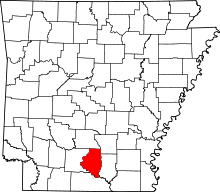 | |
| Towns | ||