Thorne Bay, Alaska
| Thorne Bay | ||
|---|---|---|
| City | ||
| ||
 Thorne Bay Location in Alaska | ||
| Coordinates: 55°40′38″N 132°33′22″W / 55.67722°N 132.55611°WCoordinates: 55°40′38″N 132°33′22″W / 55.67722°N 132.55611°W | ||
| Country | United States | |
| State | Alaska | |
| Incorporated | August 9, 1982[1] | |
| Government | ||
| • Mayor | Jim Gould[2] | |
| • State senator | Bert Stedman (R) | |
| • State rep. | Jonathan Kreiss-Tomkins (D) | |
| Area | ||
| • Total | 30.4 sq mi (78.6 km2) | |
| • Land | 25.5 sq mi (66.1 km2) | |
| • Water | 4.8 sq mi (12.5 km2) | |
| Elevation | 128 ft (39 m) | |
| Population (2010) | ||
| • Total | 451 | |
| • Density | 21.8/sq mi (8.4/km2) | |
| Time zone | Alaska (AKST) (UTC-9) | |
| • Summer (DST) | AKDT (UTC-8) | |
| ZIP code | 99919 | |
| Area code | 907 | |
| FIPS code | 02-77140 | |
| GNIS feature ID | 1669435 | |
Thorne Bay is a city in Prince of Wales-Hyder Census Area, Alaska, United States. At the 2000 census the population was 557.
Geography
Thorne Bay is located at 55°40′38″N 132°33′22″W / 55.677232°N 132.556246°W.[3]
According to the United States Census Bureau, the city has a total area of 30.4 square miles (79 km2), of which, 25.5 square miles (66 km2) of it is land and 4.8 square miles (12 km2) of it (15.85%) is water.
Demographics
| Historical population | |||
|---|---|---|---|
| Census | Pop. | %± | |
| 1970 | 443 | — | |
| 1980 | 320 | −27.8% | |
| 1990 | 569 | 77.8% | |
| 2000 | 557 | −2.1% | |
| 2010 | 471 | −15.4% | |
| Est. 2015 | 483 | [4] | 2.5% |
As of the census[6] of 2000, there were 557 people, 219 households, and 157 families residing in the city. The population density was 21.8 people per square mile (8.4/km²). There were 327 housing units at an average density of 12.8 per square mile (4.9/km²). The racial makeup of the city was 92.46% White, 2.87% Native American, 0.18% Pacific Islander, 0.54% from other races, and 3.95% from two or more races. 1.26% of the population were Hispanic or Latino of any race.
There were 219 households out of which 35.2% had children under the age of 18 living with them, 61.6% were married couples living together, 4.6% had a female householder with no husband present, and 28.3% were non-families. 23.7% of all households were made up of individuals and 2.7% had someone living alone who was 65 years of age or older. The average household size was 2.54 and the average family size was 3.03.
In the city the age distribution of the population shows 28.4% under the age of 18, 6.5% from 18 to 24, 30.5% from 25 to 44, 30.3% from 45 to 64, and 4.3% who were 65 years of age or older. The median age was 39 years. For every 100 females there were 115.9 males. For every 100 females age 18 and over, there were 122.9 males.
The median income for a household in the city was $45,625, and the median income for a family was $46,875. Males had a median income of $40,893 versus $34,375 for females. The per capita income for the city was $20,836. About 6.3% of families and 7.8% of the population were below the poverty line, including 5.4% of those under age 18 and 7.1% of those age 65 or over.
History and culture
Thorne Bay is named for Frank Manly Thorn, who served as Superintendent of the United States Coast and Geodetic Survey from 1885 to 1889. The name of the bay was misspelled when published in the original record, and the spelling was never corrected to match the spelling of Thorn's last name.[7]
Thorne Bay originally began as a large logging camp for the Ketchikan Pulp Company in 1960 that was originally located in Hollis. Being a floating camp at the time, most Hollis residents resided in float houses. In the 1960s and 1970s it was the largest logging camp in North America and was host to over 1500 residents at its peak. It became a second-class city in 1982 and in 2001 the logging company pulled out having been a victim of breach of contract from the U.S. Forest Service. The U.S. Forest Service signed a fifty-year contract in 1954 guaranteeing 150 mmbf per year for the pulp mill and sawmills in Ketchikan. By 1990 that figure was down to approximately 50 mmbf per year. Thanks to the U.S. Forest Service there are still some trees in that area. Currently Thorne Bay features many seasonal residents and an employment sector based primarily in Forest Service and public education.
World's largest logging camp
In the 1970s–1980s Thorne Bay was the world's largest logging camp, and it still holds the record. Thorne Bay also has the world's largest tree grapple, which everyone there calls "the claw." The grapple is placed in front of the small town, with a sign that says "Thorne Bay".
References
- ↑ 1996 Alaska Municipal Officials Directory. Juneau: Alaska Municipal League/Alaska Department of Community and Regional Affairs. January 1996. p. 150.
- ↑ 2015 Alaska Municipal Officials Directory. Juneau: Alaska Municipal League. 2015. p. 154.
- ↑ "US Gazetteer files: 2010, 2000, and 1990". United States Census Bureau. 2011-02-12. Retrieved 2011-04-23.
- ↑ "Annual Estimates of the Resident Population for Incorporated Places: April 1, 2010 to July 1, 2015". Retrieved July 2, 2016.
- ↑ "Census of Population and Housing". Census.gov. Retrieved June 4, 2015.
- ↑ "American FactFinder". United States Census Bureau. Retrieved 2008-01-31.
- ↑ Southeast Conference: Thorne Bay
External links
Municipalities and communities of Prince of Wales–Hyder Census Area, Alaska, United States | ||
|---|---|---|
| Cities | 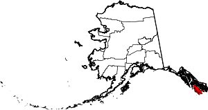 | |
| CDPs | ||
| Unincorporated community | ||