Thar Jath Airstrip
| Thar Jath Airstrip | |||||||||||
|---|---|---|---|---|---|---|---|---|---|---|---|
| IATA: n/a – ICAO: n/a | |||||||||||
| Summary | |||||||||||
| Airport type | Public, Civilian | ||||||||||
| Owner | n/a | ||||||||||
| Serves | Duar, South Sudan | ||||||||||
| Location |
Duar, | ||||||||||
| Elevation AMSL | unknown ft / unknown m | ||||||||||
| Coordinates | 08°46′55″N 30°07′52″E / 8.78194°N 30.13111°E | ||||||||||
| Map | |||||||||||
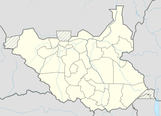 Thar Location of Thar Jath Airstrip in South Sudan | |||||||||||
| Runways | |||||||||||
| |||||||||||
Thar Jath Airstrip is an airport in South Sudan.
Location
Thar Jath Airstrip (IATA: n/a, ICAO: n/a) is located in Guit County, Fangak State, in north central South Sudan, near the town of Duar.
This location lies approximately 464 kilometres (288 mi), by air, north of Juba International Airport, the largest airport in South Sudan.[1] The geographic coordinates of this airport are: 8° 46' 55.24"N, 30° 7' 52.42"E (Latitude: 8.782013; Longitude: 30.131228). The elevation of Thar Jath Airstrip is unknown. The airport has a single unpaved runway, the dimensions of which are not publicly known at this time.
Overview
Thar Jath Airstrip is a small civilian airport that serves the town of Duar and surrounding communities. It also serves the Thar Jath oil field. There are no known scheduled airlines serving this airport at this time, but the United Nations Humanitarian Air Service served the field from Rumbek Airport.[2]
External links
See also
References
Coordinates: 8°46′55″N 30°07′52″E / 8.782013°N 30.131228°E