Texas State Highway 273
| ||||
|---|---|---|---|---|
 | ||||
| Route information | ||||
| Maintained by TxDOT | ||||
| Length: | 61.453 mi[1] (98.899 km) | |||
| Existed: | by 1938 – present | |||
| Major junctions | ||||
| South end: |
| |||
|
| ||||
| North end: |
| |||
| Highway system | ||||
| ||||

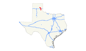
State Highway 273 or SH 273 is a state highway that runs from Pampa in northern Texas east and south to SH 203 near Hedley.
History
The route was originally designated in 1938 from Pampa to McLean. In 1990 the current route was completed by redesignating Farm to Market Road 2695 from McLean to SH 203 as part of SH 273.
Route description
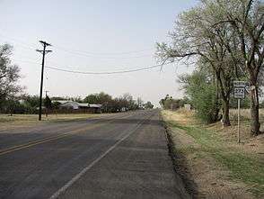
Beginning at a junction with US 60 at Pampa in Gray County, SH 273 runs south to a junction with Loop 171. In Pampa the highway is known as Cuyler Street and Barnes Street. After a brief co-routing with Loop 171, the highway runs southeast to Lefors and then south to a junction with Interstate 40 at McLean, where the route is known as Sitter Street. SH 273 then runs almost directly south to its final junction with SH 203 near Hedley in Donley County. Most of the terrain covered by the highway is lightly populated ranch and oil country.
Junction list
| County | Location | mi | km | Destinations | Notes |
|---|---|---|---|---|---|
| Donley | | ||||
| | |||||
| | |||||
| Gray | McLean | I-40 exit 142. | |||
| | |||||
| | |||||
| | |||||
| | |||||
| | |||||
| | |||||
| | |||||
| | South end of Loop 171 overlap | ||||
| | North end of Loop 171 overlap | ||||
| Pampa | |||||
1.000 mi = 1.609 km; 1.000 km = 0.621 mi
| |||||
References
- ↑ Transportation Planning and Programming Division (n.d.). "State Highway No. 273". Highway Designation Files. Texas Department of Transportation. Retrieved 2007-01-19.
External links
- Texas official travel map at the Texas Department of Transportation (Adobe Acrobat format, magnification required for legibility)
- Satellite image of junction of SH 273 with I-40 at Google Maps