McLean, Texas
| McLean, Texas | |
|---|---|
| Town | |
 Location of McLean, Texas | |
 | |
| Coordinates: 35°14′2″N 100°36′0″W / 35.23389°N 100.60000°WCoordinates: 35°14′2″N 100°36′0″W / 35.23389°N 100.60000°W | |
| Country | United States |
| State | Texas |
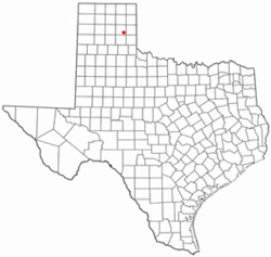
| County | Gray |
| Area | |
| • Total | 1.2 sq mi (3.0 km2) |
| • Land | 1.2 sq mi (3.0 km2) |
| • Water | 0.0 sq mi (0.0 km2) |
| Elevation | 2,861 ft (872 m) |
| Population (2000) | |
| • Total | 830 |
| • Density | 706.2/sq mi (272.7/km2) |
| Time zone | Central (CST) (UTC-6) |
| • Summer (DST) | CDT (UTC-5) |
| ZIP code | 79057 |
| Area code(s) | 806 |
| FIPS code | 48-45780[1] |
| GNIS feature ID | 1362506[2] |
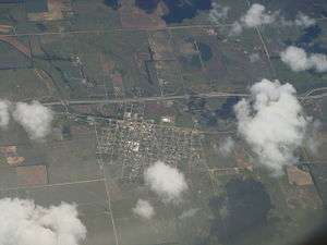
McLean is a town in Gray County, Texas, United States. It is part of the Pampa, Texas Micropolitan Statistical Area. The population was 778 according to the 2010 census.[3]
Geography
McLean is located at 35°14′2″N 100°36′0″W / 35.23389°N 100.60000°W (35.233836, -100.600055).[4]
According to the United States Census Bureau, the town has a total area of 1.2 square miles (3.1 km2), all of it land.
History
In 1901, Alfred Rowe, an English rancher who later perished in the sinking of the Titanic, donated land near a railroad cattle loading stop for the establishment of a town site.[5] The Choctaw, Oklahoma and Texas Railroad Company constructed a water well and a switch and section house there. The town was named for Judge William P. McLean (1836–1925) of the Texas Legislature and Railroad Commission.[6][7] The town grew rapidly. By 1904 McLean had three general stores, a bank, two wagonyards and livery stables, a lumberyard, and a newspaper, the McLean News. A windmill pumped water from a well drilled in the middle of Main Street, and citizens hauled the water in barrels and buckets. The town was incorporated in 1909 with C. S. Rice as mayor and became a center for agriculture.[8]
In 1927, the Mother Road, U.S. Route 66, was built through the town, and it became a stop for tourists as well as a center for oil, livestock, and agriculture processing and shipping. By 1940 the population had risen to 1,500 with 6 churches, 59 businesses, and a newspaper. In 1942, a prisoner of war camp was built east-northeast of the town and was operated until 1945, housing about 3000 German prisoners.
As the prominence of other Texas Panhandle cities, especially Amarillo and Pampa, surpassed McLean, the town began to decrease slowly in size. In 1984, the town was bypassed as part of the final phase of construction of Interstate 40, which replaced the old U.S. Route 66 through that area.[9]
Demographics
| Historical population | |||
|---|---|---|---|
| Census | Pop. | %± | |
| 1910 | 633 | — | |
| 1920 | 741 | 17.1% | |
| 1930 | 1,521 | 105.3% | |
| 1940 | 1,489 | −2.1% | |
| 1950 | 1,439 | −3.4% | |
| 1960 | 1,330 | −7.6% | |
| 1970 | 1,183 | −11.1% | |
| 1980 | 1,160 | −1.9% | |
| 1990 | 849 | −26.8% | |
| 2000 | 830 | −2.2% | |
| 2010 | 778 | −6.3% | |
| Est. 2015 | 797 | [10] | 2.4% |

As of the census[1] of 2000, there were 830 people, 343 households, and 186 families residing in the town. The population density was 706.2 people per square mile (271.6/km²). There were 459 housing units at an average density of 390.6 per square mile (150.2/km²). The racial makeup of the town was 96.87% White, 0.36% African American, 0.60% Native American, 0.24% Asian, 0.60% from other races, and 1.33% from two or more races. Hispanic or Latino of any race were 2.17% of the population.
There were 343 households out of which 23.3% had children under the age of 18 living with them, 45.5% were married couples living together, 6.7% had a female householder with no husband present, and 45.5% were non-families. 42.6% of all households were made up of individuals and 25.4% had someone living alone who was 65 years of age or older. The average household size was 2.12 and the average family size was 2.96.
In the town the population was spread out with 20.7% under the age of 18, 5.8% from 18 to 24, 17.7% from 25 to 44, 20.1% from 45 to 64, and 35.7% who were 65 years of age or older. The median age was 50 years. For every 100 females there were 80.4 males. For every 100 females age 18 and over, there were 70.0 males.
The median income for a household in the town was $22,847, and the median income for a family was $34,286. Males had a median income of $26,667 versus $20,000 for females. The per capita income for the town was $13,843. About 12.9% of families and 16.4% of the population were below the poverty line, including 17.9% of those under age 18 and 15.2% of those age 65 or over.
Education
The Town of McLean is served by the McLean Independent School District and is home to the McLean Tigers. The girls basketball team had the opportunity to go to the State Tournament in Austin, Texas and took second place.
Public Library
The Lovett Memorial Library was established August 9, 1940 in the City Hall of McLean, TX. The City Council voted to give $10.00 a month to help finance the new library. The City Council appointed a Library Board to be the governing body. Mrs. Lady Bryant was hired to open the library from 12:00 noon until 5:00 pm daily (closed on Sundays). Since 1940 the library has seen some changes. The current location of 302 N. Main Street in McLean now houses 5 public access computers, Wi-Fi access, fax, coping, printing, movies, audio books, and a selection of largeprint, fiction, mystery, western and nonfiction titles. The library is a member of the Texas Panhandle Library System and the Harrington Library Consortium.
National Register of Historical Places
The McLean Commercial District, consisting of most of the downtown area, was listed in the historical register on December 20, 2006.[12]
Citations
- 1 2 "American FactFinder". United States Census Bureau. Archived from the original on September 11, 2013. Retrieved 2008-01-31.
- ↑ "US Board on Geographic Names". United States Geological Survey. 2007-10-25. Retrieved 2008-01-31.
- ↑ http://factfinder.census.gov/faces/nav/jsf/pages/community_facts.xhtml
- ↑ "US Gazetteer files: 2010, 2000, and 1990". United States Census Bureau. 2011-02-12. Retrieved 2011-04-23.
- ↑ Alfred Rowe in the Handbook of Texas Online
- ↑ WP McLean in the Texas State Library & Archives
- ↑ McLean, Texas in Texas Escapes Online Magazine.
- ↑ McLean, Texas in the Handbook of Texas Online.
- ↑ McLean - Where Time Stands Still
- ↑ "Annual Estimates of the Resident Population for Incorporated Places: April 1, 2010 to July 1, 2015". Retrieved July 2, 2016.
- ↑ "Census of Population and Housing". Census.gov. Archived from the original on May 11, 2015. Retrieved June 4, 2015.
- ↑ National Park Service (2010-07-09). "National Register Information System". National Register of Historic Places. National Park Service.
External links
| Wikivoyage has a travel guide for McLean (Texas). |
Municipalities and communities of Gray County, Texas, United States | ||
|---|---|---|
| City | 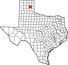 | |
| Towns | ||
| Unincorporated community | ||