Texas State Highway 176
| ||||
|---|---|---|---|---|
| Andrews Highway | ||||
 | ||||
| Route information | ||||
| Maintained by TxDOT | ||||
| Length: | 90.00 mi[1] (144.84 km) | |||
| Existed: | 1953 (1990) – present | |||
| Major junctions | ||||
| West end: |
| |||
|
| ||||
| East end: |
| |||
| Location | ||||
| Counties: | Andrews, Martin, Howard | |||
| Highway system | ||||
| ||||

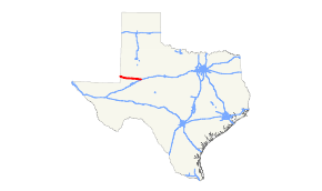
State Highway 176 (SH 176) is a Texas state highway running from the New Mexico state line east to Big Spring. It is most commonly known as the Andrews Highway.
History
SH 176 was originally designated by 1933 as a connector route between Tyler and Kilgore. By 1939, this route had been reassigned to SH 31 when its path was shifted south.
The current routing was first cosigned, but not designated, in 1959 concurrent with Ranch to Market Road 87. In 1990 this route was officially designated, canceling RM 87.
Major intersections
| County | Location | mi[2] | km | Destinations[2] | Notes |
|---|---|---|---|---|---|
| Andrews | | 0.00 | 0.00 | Continuation into New Mexico | |
| Andrews | 30.40 | 48.92 | Western terminus of concurrency with SH 115 | ||
| 31.50 | 50.69 | ||||
| | 33.90 | 54.56 | Eastern terminus of concurrency with SH 115 | ||
| Martin | Tarzan | 53.60 | 86.26 | Diamond interchange | |
| Lenorah | 74.60 | 120.06 | |||
| Howard | Big Spring | 93.00 | 149.67 | Exit 176 on I-20 | |
1.000 mi = 1.609 km; 1.000 km = 0.621 mi
| |||||
References
- ↑ Texas Department of Transportation,
- 1 2 Google (January 21, 2016). "Texas State Highway 176" (Map). Google Maps. Google. Retrieved January 21, 2016.
This article is issued from Wikipedia - version of the 1/22/2016. The text is available under the Creative Commons Attribution/Share Alike but additional terms may apply for the media files.