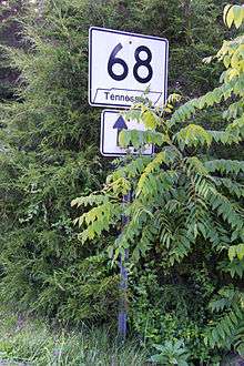
Tennessee State Route 68
| ||||
|---|---|---|---|---|
| Route information | ||||
| Maintained by TDOT | ||||
| Length: | 107.2 mi[1] (172.5 km) | |||
| Major junctions | ||||
| South end: |
| |||
|
| ||||
| North end: |
| |||
| Location | ||||
| Counties: | Polk, Monore, McMinn, Meigs, Rhea, Cumberland | |||
| Highway system | ||||
| ||||

State Route 68 (SR 68) is a 107.2-mile-long (172.5 km) state highway in the eastern part of the U.S. state of Tennessee.
Route description
SR-68 begins in southeastern Tennessee, at an intersection with Georgia State Route 5 and Georgia State Route 60 at the Tennessee–Georgia state line in Copperhill, Tennessee and McCaysville, Georgia. It then goes north to Ducktown, Tennessee where it junctions with U.S. Route 64 (US-64) and US-74. The route continues north and enters the Cherokee National Forest and goes through a mostly rural area, then in Turtletown it turns east and junctions with the shortest state route in Tennessee: SR-123. SR-68 then turns back north and continues through a sparsely populated area and crosses over the Hiwassee River, The route then becomes curvy and dangerous. It then enters Monroe County and goes through Coker Creek and then Tellico Plains and junctions with SR-165 the Cherohala Skyway. In Tellico Plains, SR-68 serves as the eastern terminus for SR-39 it then proceeds north to Madisonville where it has an interchange/junction with US-411 and SR-33. After this junction, the route then turns more northwesterly toward Sweetwater and passes The Lost Sea. In Sweetwater, it turns west and junctions with US-11 and Interstate 75. Just past the I-75 junction, the route enters McMinn County where there are no highway junctions. It then enters Meigs County and Ten Mile and junctions with SR-305, SR-58, and has a brief concurrency with SR-304. It then crosses Watts Bar Dam and the Tennessee River into Rhea County near the Watts Bar Nuclear Plant and continues west. The route then has a 1-mile-long (1.6 km) concurrency with SR-302 and a 2.7-mile-long (4.3 km) concurrency with US-27. US-27 and SR-68 go north to Spring City where SR-68 turns back west and US-27 goes north. Just after leaving Spring City, it turns back to north crosses over Waldens Ridge into Cumberland County where the route ends at US-127 in Crossville near Cumberland Mountain State Park and the Cumberland Homestead Towers.
Major intersections
| County | Location | mi | km | Destinations | Notes |
|---|---|---|---|---|---|
| Polk | Copperhill | Georgia state line | |||
| Ducktown | interchange | ||||
| | |||||
| Monroe | Tellico Plains | ||||
| Madisonville | interchange | ||||
| Christianburg | |||||
| Sweetwater | |||||
| I-75 exit 60 | |||||
| Meigs | | ||||
| | |||||
| Ten Mile | south end of SR 304 overlap | ||||
| | north end of SR 304 overlap | ||||
| Tennessee River | Watts Bar Dam | ||||
| Rhea | | south end of SR 302 overlap | |||
| | north end of SR 302 overlap | ||||
| | south end of US 27 / SR 29 overlap | ||||
| Spring City | north end of US 27 / SR 29 overlap | ||||
| Cumberland | Cumberland Homesteads | ||||
| 1.000 mi = 1.609 km; 1.000 km = 0.621 mi | |||||
See also
-
 Tennessee portal
 -
 U.S. Roads portal
References
- ↑ Google (July 11, 2014). "Tennessee State Route 68" (Map). Google Maps. Google. Retrieved July 11, 2014.
External links
-
 Media related to Tennessee State Route 68 at Wikimedia Commons