Syracuse, Missouri
| Syracuse, Missouri | |
|---|---|
| City | |
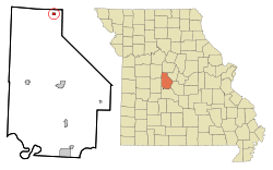 Location of Syracuse, Missouri | |
| Coordinates: 38°40′12″N 92°52′30″W / 38.67000°N 92.87500°WCoordinates: 38°40′12″N 92°52′30″W / 38.67000°N 92.87500°W | |
| Country | United States |
| State | Missouri |
| County | Morgan |
| Area[1] | |
| • Total | 0.38 sq mi (0.98 km2) |
| • Land | 0.38 sq mi (0.98 km2) |
| • Water | 0 sq mi (0 km2) |
| Elevation | 922 ft (281 m) |
| Population (2010)[2] | |
| • Total | 172 |
| • Estimate (2012[3]) | 169 |
| • Density | 452.6/sq mi (174.7/km2) |
| Time zone | Central (CST) (UTC-6) |
| • Summer (DST) | CDT (UTC-5) |
| ZIP code | 65354 |
| Area code(s) | 660 |
| FIPS code | 29-72106[4] |
| GNIS feature ID | 0729823[5] |
Syracuse is a city in Morgan County, Missouri, United States. The population was 172 at the 2010 census. In the middle of the 19th century, the city was the western terminus of the Pacific Railway that reached 108 miles from St. Louis.[6]
History
Syracuse was originally called Pacific City, and under the latter name was laid out in 1858.[7] The present name is after Syracuse, New York.[8]
Geography
Syracuse is located at 38°40′12″N 92°52′30″W / 38.67000°N 92.87500°W (38.669904, -92.874911).[9]
According to the United States Census Bureau, the city has a total area of 0.38 square miles (0.98 km2), all of it land.[1]
Demographics
| Historical population | |||
|---|---|---|---|
| Census | Pop. | %± | |
| 1880 | 202 | — | |
| 1890 | 187 | −7.4% | |
| 1900 | 175 | −6.4% | |
| 1910 | 193 | 10.3% | |
| 1920 | 288 | 49.2% | |
| 1930 | 288 | 0.0% | |
| 1940 | 262 | −9.0% | |
| 1950 | 221 | −15.6% | |
| 1960 | 180 | −18.6% | |
| 1970 | 214 | 18.9% | |
| 1980 | 222 | 3.7% | |
| 1990 | 185 | −16.7% | |
| 2000 | 172 | −7.0% | |
| 2010 | 172 | 0.0% | |
| Est. 2015 | 170 | [10] | −1.2% |
2010 census
As of the census[2] of 2010, there were 172 people, 68 households, and 45 families residing in the city. The population density was 452.6 inhabitants per square mile (174.7/km2). There were 79 housing units at an average density of 207.9 per square mile (80.3/km2). The racial makeup of the city was 98.8% White and 1.2% from two or more races. Hispanic or Latino of any race were 3.5% of the population.
There were 68 households of which 29.4% had children under the age of 18 living with them, 45.6% were married couples living together, 8.8% had a female householder with no husband present, 11.8% had a male householder with no wife present, and 33.8% were non-families. 22.1% of all households were made up of individuals and 14.7% had someone living alone who was 65 years of age or older. The average household size was 2.53 and the average family size was 3.04.
The median age in the city was 37.7 years. 25% of residents were under the age of 18; 11.6% were between the ages of 18 and 24; 24.3% were from 25 to 44; 23.3% were from 45 to 64; and 15.7% were 65 years of age or older. The gender makeup of the city was 48.3% male and 51.7% female.
2000 census
As of the census[4] of 2000, there were 172 people, 70 households, and 51 families residing in the city. The population density was 451.9 people per square mile (174.8/km²). There were 82 housing units at an average density of 215.4 per square mile (83.3/km²). The racial makeup of the city was 97.67% White, 0.58% Asian, and 1.74% from two or more races. Hispanic or Latino of any race were 2.33% of the population.
There were 70 households out of which 31.4% had children under the age of 18 living with them, 62.9% were married couples living together, 7.1% had a female householder with no husband present, and 27.1% were non-families. 20.0% of all households were made up of individuals and 2.9% had someone living alone who was 65 years of age or older. The average household size was 2.46 and the average family size was 2.78.
In the city the population was spread out with 22.7% under the age of 18, 9.3% from 18 to 24, 30.2% from 25 to 44, 32.6% from 45 to 64, and 5.2% who were 65 years of age or older. The median age was 37 years. For every 100 females there were 107.2 males. For every 100 females age 18 and over, there were 107.8 males.
The median income for a household in the city was $34,773, and the median income for a family was $38,214. Males had a median income of $24,750 versus $21,389 for females. The per capita income for the city was $18,463. None of the families and 4.5% of the population were living below the poverty line, including no under eighteens and 18.2% of those over 64.
KMOS-TV
Syracuse is home to the KMOS TV Tower, built in 2003, operated by the University of Central Missouri. At 2000 ft, it is the tallest structure in Missouri. See University of Central Missouri for details.
References
- 1 2 "US Gazetteer files 2010". United States Census Bureau. Retrieved 2012-07-08.
- 1 2 "American FactFinder". United States Census Bureau. Retrieved 2012-07-08.
- ↑ "Population Estimates". United States Census Bureau. Retrieved 2013-05-30.
- 1 2 "American FactFinder". United States Census Bureau. Retrieved 2008-01-31.
- ↑ "US Board on Geographic Names". United States Geological Survey. 2007-10-25. Retrieved 2008-01-31.
- ↑ Richards, Thomas Addison, Appletons’ Companion Hand-Book of Travel: Containing a full description of the principal cities, towns, and places of interest together with hotels and routes of travel through the United States and the Canadas (D.Appleton & Company, New York, 1865), pp 270-271.
- ↑ "Morgan County Place Names, 1928–1945". The State Historical Society of Missouri. Archived from the original on June 24, 2016. Retrieved November 19, 2016.
- ↑ Ramsay, Robert L. (1952). Our Storehouse of Missouri Place Names. University of Missouri Press. p. 25.
- ↑ "US Gazetteer files: 2010, 2000, and 1990". United States Census Bureau. 2011-02-12. Retrieved 2011-04-23.
- ↑ "Annual Estimates of the Resident Population for Incorporated Places: April 1, 2010 to July 1, 2015". Retrieved July 2, 2016.
- ↑ "Census of Population and Housing". Census.gov. Retrieved June 4, 2015.
Municipalities and communities of Morgan County, Missouri, United States | ||
|---|---|---|
| Cities | 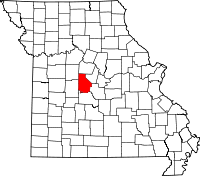 | |
| Villages | ||
| Townships | ||
| Unincorporated communities | ||
| Ghost town | ||
| Footnotes | ‡This populated place also has portions in an adjacent county or counties | |