Sweet Springs, Missouri
| Sweet Springs, Missouri | |
|---|---|
| City | |
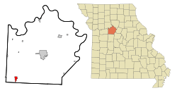 Location of Sweet Springs, Missouri | |
| Coordinates: 38°57′49″N 93°24′53″W / 38.96361°N 93.41472°WCoordinates: 38°57′49″N 93°24′53″W / 38.96361°N 93.41472°W | |
| Country | United States |
| State | Missouri |
| County | Saline |
| Area[1] | |
| • Total | 1.68 sq mi (4.35 km2) |
| • Land | 1.66 sq mi (4.30 km2) |
| • Water | 0.02 sq mi (0.05 km2) |
| Elevation | 712 ft (217 m) |
| Population (2010)[2] | |
| • Total | 1,484 |
| • Estimate (2012[3]) | 1,482 |
| • Density | 894.0/sq mi (345.2/km2) |
| Time zone | Central (CST) (UTC-6) |
| • Summer (DST) | CDT (UTC-5) |
| ZIP code | 65351 |
| Area code(s) | 660 |
| FIPS code | 29-71890[4] |
| GNIS feature ID | 0729400[5] |
Sweet Springs is a city in Saline County, Missouri, along the Blackwater River. The population was 1,484 at the 2010 census.
Geography
Sweet Springs is located at 38°57′49″N 93°24′53″W / 38.96361°N 93.41472°W (38.963661, -93.414774).[6] According to the United States Census Bureau, the city has a total area of 1.68 square miles (4.35 km2), of which, 1.66 square miles (4.30 km2) is land and 0.02 square miles (0.05 km2) is water.[1]
Demographics
| Historical population | |||
|---|---|---|---|
| Census | Pop. | %± | |
| 1880 | 1,182 | — | |
| 1890 | 1,137 | −3.8% | |
| 1900 | 1,080 | −5.0% | |
| 1910 | 1,122 | 3.9% | |
| 1920 | 1,177 | 4.9% | |
| 1930 | 1,641 | 39.4% | |
| 1940 | 1,413 | −13.9% | |
| 1950 | 1,439 | 1.8% | |
| 1960 | 1,452 | 0.9% | |
| 1970 | 1,716 | 18.2% | |
| 1980 | 1,694 | −1.3% | |
| 1990 | 1,595 | −5.8% | |
| 2000 | 1,628 | 2.1% | |
| 2010 | 1,484 | −8.8% | |
| Est. 2015 | 1,467 | [7] | −1.1% |
2010 census
As of the census[2] of 2010, there were 1,484 people, 575 households, and 368 families residing in the city. The population density was 894.0 inhabitants per square mile (345.2/km2). There were 688 housing units at an average density of 414.5 per square mile (160.0/km2). The racial makeup of the city was 94.3% White, 1.8% African American, 0.3% Native American, 0.4% Asian, 0.1% Pacific Islander, 0.9% from other races, and 2.3% from two or more races. Hispanic or Latino of any race were 1.7% of the population.
There were 575 households of which 32.0% had children under the age of 18 living with them, 44.2% were married couples living together, 13.0% had a female householder with no husband present, 6.8% had a male householder with no wife present, and 36.0% were non-families. 28.3% of all households were made up of individuals and 13.4% had someone living alone who was 65 years of age or older. The average household size was 2.48 and the average family size was 3.00.
The median age in the city was 42.4 years. 23.9% of residents were under the age of 18; 6.8% were between the ages of 18 and 24; 22.3% were from 25 to 44; 29.5% were from 45 to 64; and 17.4% were 65 years of age or older. The gender makeup of the city was 49.5% male and 50.5% female.
2000 census
As of the census[4] of 2000, there were 1,628 people, 612 households, and 417 families residing in the city. The population density was 1,004.3 people per square mile (388.0/km²). There were 717 housing units at an average density of 442.3 per square mile (170.9/km²). The racial makeup of the city was 95.76% White, 1.29% African American, 0.06% Native American, 0.31% Asian, 0.06% Pacific Islander, 0.43% from other races, and 2.09% from two or more races. Hispanic or Latino of any race were 1.29% of the population.
There were 612 households out of which 33.7% had children under the age of 18 living with them, 57.4% were married couples living together, 6.7% had a female householder with no husband present, and 31.7% were non-families. 28.8% of all households were made up of individuals and 16.0% had someone living alone who was 65 years of age or older. The average household size was 2.48 and the average family size was 3.06.
In the city the population was spread out with 25.7% under the age of 18, 6.8% from 18 to 24, 25.6% from 25 to 44, 22.2% from 45 to 64, and 19.7% who were 65 years of age or older. The median age was 39 years. For every 100 females there were 91.8 males. For every 100 females age 18 and over, there were 88.8 males.
The median income for a household in the city was $33,819, and the median income for a family was $41,563. Males had a median income of $28,942 versus $19,318 for females. The per capita income for the city was $14,126. About 6.2% of families and 9.6% of the population were below the poverty line, including 8.8% of those under age 18 and 10.9% of those age 65 or over
Climate
Sweet Springs has a typical temperate climate. As with most continental climates, the area has four seasons. Springs here are noted for their rainy days and variable temperatures. Thunderstorms are common and tornadoes occur during this time of year. Summers are usually hot and dry, with droughts occurring during several summers. Autumns are usually cool and rainy, although several days of warm weather are not uncommon. Winters are generally cold, with accumulating snow several days of the winter season. Although not as common, ice storms can and do occur as well.
History
Known early on as Claysville, Sweet Springs began as a stopping place for pioneers who were making their way across the Missouri River. The town's first settlers came from Kentucky in 1817; it was incorporated in 1832 and renamed to Brownsville in 1838 in honor of the man who owned the land on which the village stood.
Soon after, a minister passing through discovered his ailing wife's health was restored after drinking from a local spring. He bought the land the spring was located on and soon the water was famous, with visitors coming from far and wide. The name "Sweet Springs" became synonymous with the town, and the name was changed from Brownsville to Sweet Springs in 1887.
Notable people
- Pat Collins, catcher for 1927 New York Yankees
References
- 1 2 "US Gazetteer files 2010". United States Census Bureau. Retrieved 2012-07-08.
- 1 2 "American FactFinder". United States Census Bureau. Retrieved 2012-07-08.
- ↑ "Population Estimates". United States Census Bureau. Retrieved 2013-05-30.
- 1 2 "American FactFinder". United States Census Bureau. Retrieved 2008-01-31.
- ↑ "US Board on Geographic Names". United States Geological Survey. 2007-10-25. Retrieved 2008-01-31.
- ↑ "US Gazetteer files: 2010, 2000, and 1990". United States Census Bureau. 2011-02-12. Retrieved 2011-04-23.
- ↑ "Annual Estimates of the Resident Population for Incorporated Places: April 1, 2010 to July 1, 2015". Retrieved July 2, 2016.
- ↑ "Census of Population and Housing". Census.gov. Retrieved June 4, 2015.
External links
- City of Sweet Springs
- Sweet Springs R-VII School District
- Historic maps of Sweet Springs in the Sanborn Maps of Missouri Collection at the University of Missouri
Municipalities and communities of Saline County, Missouri, United States | ||
|---|---|---|
| Cities | 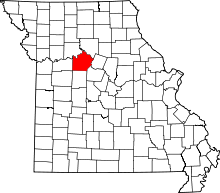 | |
| Villages | ||
| Townships |
| |
| Unincorporated communities | ||
| Footnotes | ‡This populated place also has portions in an adjacent county or counties | |