Superior, Wyoming
| Superior, Wyoming | |
|---|---|
| Town | |
 Location of Superior, Wyoming | |
 Superior, Wyoming Location in the United States | |
| Coordinates: 41°45′47″N 108°58′3″W / 41.76306°N 108.96750°WCoordinates: 41°45′47″N 108°58′3″W / 41.76306°N 108.96750°W | |
| Country | United States |
| State | Wyoming |
| County | Sweetwater |
| Area[1] | |
| • Total | 1.10 sq mi (2.85 km2) |
| • Land | 1.10 sq mi (2.85 km2) |
| • Water | 0 sq mi (0 km2) |
| Elevation | 7,070 ft (2,155 m) |
| Population (2010)[2] | |
| • Total | 336 |
| • Estimate (2012[3]) | 340 |
| • Density | 305.5/sq mi (118.0/km2) |
| Time zone | Mountain (MST) (UTC-7) |
| • Summer (DST) | MDT (UTC-6) |
| ZIP code | 82945 |
| Area code(s) | 307 |
| FIPS code | 56-74775[4] |
| GNIS feature ID | 1596949[5] |
Superior is a town in Sweetwater County, Wyoming, United States. The population was 336 at the 2010 census.
Notable people
- Former Wyoming Supreme Court Justice Richard V. Thomas was born in Superior in 1932.
- National Football Foundation and College Hall of Fame, Scholar Athlete for Wyoming 2002, Don Siler.
Geography
Superior is located at 41°45′47″N 108°58′3″W / 41.76306°N 108.96750°W (41.763159, -108.967616).[6]
According to the United States Census Bureau, the town has a total area of 1.10 square miles (2.85 km2), all of it land.[1]
Demographics
| Historical population | |||
|---|---|---|---|
| Census | Pop. | %± | |
| 1920 | 1,034 | — | |
| 1930 | 1,156 | 11.8% | |
| 1940 | 1,240 | 7.3% | |
| 1950 | 1,580 | 27.4% | |
| 1960 | 241 | −84.7% | |
| 1970 | 197 | −18.3% | |
| 1980 | 586 | 197.5% | |
| 1990 | 273 | −53.4% | |
| 2000 | 244 | −10.6% | |
| 2010 | 336 | 37.7% | |
| Est. 2015 | 323 | [7] | −3.9% |
2010 census
As of the census[2] of 2010, there were 336 people, 131 households, and 87 families residing in the town. The population density was 305.5 inhabitants per square mile (118.0/km2). There were 181 housing units at an average density of 164.5 per square mile (63.5/km2). The racial makeup of the town was 91.4% White, 0.6% African American, 1.8% Native American, 0.6% Asian, 2.7% from other races, and 3.0% from two or more races. Hispanic or Latino of any race were 12.8% of the population.
There were 131 households of which 37.4% had children under the age of 18 living with them, 50.4% were married couples living together, 10.7% had a female householder with no husband present, 5.3% had a male householder with no wife present, and 33.6% were non-families. 29.0% of all households were made up of individuals and 10.6% had someone living alone who was 65 years of age or older. The average household size was 2.56 and the average family size was 3.16.
The median age in the town was 41.3 years. 28% of residents were under the age of 18; 6.6% were between the ages of 18 and 24; 20.3% were from 25 to 44; 34.5% were from 45 to 64; and 10.7% were 65 years of age or older. The gender makeup of the town was 53.6% male and 46.4% female.
2000 census
As of the census[4] of 2000, there were 244 people, 92 households, and 67 families residing in the town. The population density was 222.1 people per square mile (85.6/km²). There were 153 housing units at an average density of 139.3 per square mile (53.7/km²). The racial makeup of the town was 83.20% White, 2.05% Native American, 0.41% Pacific Islander, 9.02% from other races, and 5.33% from two or more races. Hispanic or Latino of any race were 15.16% of the population.
There were 92 households out of which 34.8% had children under the age of 18 living with them, 62.0% were married couples living together, 4.3% had a female householder with no husband present, and 26.1% were non-families. 20.7% of all households were made up of individuals and 1.1% had someone living alone who was 65 years of age or older. The average household size was 2.65 and the average family size was 3.01.
In the town the population was spread out with 29.5% under the age of 18, 7.4% from 18 to 24, 29.9% from 25 to 44, 26.6% from 45 to 64, and 6.6% who were 65 years of age or older. The median age was 39 years. For every 100 females there were 110.3 males. For every 100 females age 18 and over, there were 123.4 males.
The median income for a household in the town was $46,250, and the median income for a family was $50,625. Males had a median income of $56,250 versus $30,833 for females. The per capita income for the town was $17,157. About 6.6% of families and 11.7% of the population were below the poverty line, including 8.9% of those under the age of 18 and none of those 65 or over.
Government
The mayor of Superior is Rochelle Johnson.
Education
Public education in the town of Superior is provided by Sweetwater County School District #1.
References
- 1 2 "US Gazetteer files 2010". United States Census Bureau. Retrieved 2012-12-14.
- 1 2 "American FactFinder". United States Census Bureau. Retrieved 2012-12-14.
- ↑ "Population Estimates". United States Census Bureau. Retrieved 2013-06-01.
- 1 2 "American FactFinder". United States Census Bureau. Retrieved 2008-01-31.
- ↑ "US Board on Geographic Names". United States Geological Survey. 2007-10-25. Retrieved 2008-01-31.
- ↑ "US Gazetteer files: 2010, 2000, and 1990". United States Census Bureau. 2011-02-12. Retrieved 2011-04-23.
- ↑ "Annual Estimates of the Resident Population for Incorporated Places: April 1, 2010 to July 1, 2015". Retrieved July 2, 2016.
- ↑ "Census of Population and Housing". Census.gov. Retrieved June 4, 2015.
External links
Municipalities and communities of Sweetwater County, Wyoming, United States | ||
|---|---|---|
| Cities | 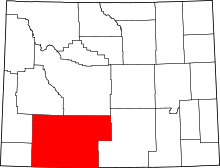 | |
| Towns | ||
| CDPs | ||
| Unincorporated communities | ||
| Ghost towns | ||