Sunburst, Montana
| Sunburst, Montana | |
|---|---|
| Town | |
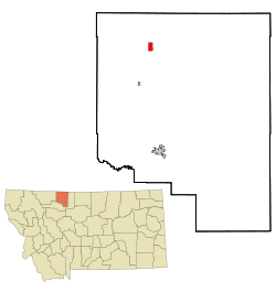 Location of Sunburst, Montana | |
| Coordinates: 48°53′0″N 111°54′32″W / 48.88333°N 111.90889°WCoordinates: 48°53′0″N 111°54′32″W / 48.88333°N 111.90889°W | |
| Country | United States |
| State | Montana |
| County | Toole |
| Area[1] | |
| • Total | 1.99 sq mi (5.15 km2) |
| • Land | 1.75 sq mi (4.53 km2) |
| • Water | 0.24 sq mi (0.62 km2) |
| Elevation | 3,369 ft (1,027 m) |
| Population (2010)[2] | |
| • Total | 375 |
| • Estimate (2012[3]) | 376 |
| • Density | 214.3/sq mi (82.7/km2) |
| Time zone | Mountain (MST) (UTC-7) |
| • Summer (DST) | MDT (UTC-6) |
| ZIP code | 59482 |
| Area code(s) | 406 |
| FIPS code | 30-72175 |
| GNIS feature ID | 0777316 |
Sunburst is a town in Toole County, Montana, United States. The population was 332 at the 2010 census.
Geography
Sunburst is located at 48°53′0″N 111°54′32″W / 48.88333°N 111.90889°W (48.883255, -111.908754).[4]
According to the United States Census Bureau, the town has a total area of 1.99 square miles (5.15 km2), of which, 1.75 square miles (4.53 km2) is land and 0.24 square miles (0.62 km2) is water.[1]
Climate
According to the Köppen Climate Classification system, Sunburst has a semi-arid climate, abbreviated "BSk" on climate maps.[5]
Demographics
| Historical population | |||
|---|---|---|---|
| Census | Pop. | %± | |
| 1930 | 486 | — | |
| 1940 | 709 | 45.9% | |
| 1950 | 845 | 19.2% | |
| 1960 | 882 | 4.4% | |
| 1970 | 604 | −31.5% | |
| 1980 | 476 | −21.2% | |
| 1990 | 437 | −8.2% | |
| 2000 | 415 | −5.0% | |
| 2010 | 375 | −9.6% | |
| Est. 2015 | 351 | [6] | −6.4% |
As of 2000 the median income for a household in the town was $58,250, and the median income for a family was $56,038. Males had a median income of $34,500 versus $11,333 for females. The per capita income for the town was $20,244. About 1.7% of families and 4.1% of the population were below the poverty line, including 4.4% of those under age 18 and 3.7% of those age 65 or over.
2010 census
As of the census[2] of 2010, there were 375 people, 150 households, and 107 families residing in the town. The population density was 214.3 inhabitants per square mile (82.7/km2). There were 176 housing units at an average density of 100.6 per square mile (38.8/km2). The racial makeup of the town was 94.9% White, 0.5% Native American, 0.5% from other races, and 4.0% from two or more races. Hispanic or Latino of any race were 2.7% of the population.
There were 150 households of which 34.0% had children under the age of 18 living with them, 60.7% were married couples living together, 6.7% had a female householder with no husband present, 4.0% had a male householder with no wife present, and 28.7% were non-families. 27.3% of all households were made up of individuals and 12% had someone living alone who was 65 years of age or older. The average household size was 2.50 and the average family size was 2.98.
The median age in the town was 39.4 years. 25.1% of residents were under the age of 18; 7.2% were between the ages of 18 and 24; 22.1% were from 25 to 44; 31.9% were from 45 to 64; and 13.6% were 65 years of age or older. The gender makeup of the town was 49.6% male and 50.4% female.
History
Sunburst has its origins as a farming community and later saw significant population growth after oil development occurred in the 1920s. Since oil development in the area ceased in the 1970s Sunburst has once again become a primarily agricultural town. The local high school still gives homage to its past, as its students are known as the Sunburst Refiners. It is roughly 30 miles north of Shelby and is near the Canada–US border. Its name comes from what is considered a dramatic sunrise that occurs when the sun comes over the Sweetgrass Hills and illuminates the local fields.
References
- 1 2 "US Gazetteer files 2010". United States Census Bureau. Retrieved December 18, 2012.
- 1 2 "American FactFinder". United States Census Bureau. Retrieved December 18, 2012.
- ↑ "Population Estimates". United States Census Bureau. Retrieved June 3, 2013.
- ↑ "US Gazetteer files: 2010, 2000, and 1990". United States Census Bureau. February 12, 2011. Retrieved April 23, 2011.
- ↑ Climate Summary for Sunburst, Montana
- ↑ "Annual Estimates of the Resident Population for Incorporated Places: April 1, 2010 to July 1, 2015". Retrieved July 2, 2016.
- ↑ "Census of Population and Housing". Census.gov. Retrieved June 4, 2015.
- ↑ "Census & Economic Information Center". Retrieved July 3, 2015.
 |
Twin River Heritage Rangeland Natural Area (Canada) | Coutts (Canada) | Writing-on-Stone Provincial Park (Canada) | |
| Glacier National Park | |
|||
| ||||
| | ||||
| Cut Bank | Kevin | Chester |
Municipalities and communities of Toole County, Montana, United States | ||
|---|---|---|
| City | 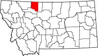 | |
| Towns | ||
| CDP | ||
| Unincorporated communities | ||