Sunburg, Minnesota
| Sunburg, Minnesota | |
|---|---|
| City | |
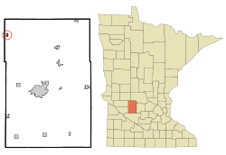 Location of Sunburg, Minnesota | |
| Coordinates: 45°20′52″N 95°14′23″W / 45.34778°N 95.23972°W | |
| Country | United States |
| State | Minnesota |
| County | Kandiyohi |
| Area[1] | |
| • Total | 0.50 sq mi (1.29 km2) |
| • Land | 0.47 sq mi (1.22 km2) |
| • Water | 0.03 sq mi (0.08 km2) |
| Elevation | 1,257 ft (383 m) |
| Population (2010)[2] | |
| • Total | 100 |
| • Estimate (2012[3]) | 100 |
| • Density | 212.8/sq mi (82.2/km2) |
| Time zone | Central (CST) (UTC-6) |
| • Summer (DST) | CDT (UTC-5) |
| ZIP code | 56289 |
| Area code(s) | 320 |
| FIPS code | 27-63454[4] |
| GNIS feature ID | 0652804[5] |
Sunburg is a city in Kandiyohi County, Minnesota, United States. The population was 100 at the 2010 census.[6] The community is famous for its celebration of its Norwegian-American heritage. The local Sunburg Creamery Cafe serves Norwegian dishes including Klub and Lutefisk. Hope Lutheran Church and Sunburg Community Bible Church are in the city, as well as several smaller Lutheran congregations within a few miles. Despite its small size, Sunburg has several businesses including Skindelien hardware, a gas station, N & J's grocery store, Lake Region bank, Jorgenson's auto dealership, and the aforementioned Sunburg Creamery cafe. Sunburg also has a baseball team.
Geography
According to the United States Census Bureau, the city has a total area of 0.50 square miles (1.29 km2), of which 0.47 square miles (1.22 km2) is land and 0.03 square miles (0.08 km2) is water.[1]
Minnesota State Highways 9 and 104 are two of the main routes in the community.
Monson Lake State Park is just west of the town.
History
Originally, Sunburg was established in hopes that a planned railroad line would travel through the community. However, the plans for the railroad never materialized. Nevertheless, Sunburg became an important part of the local farming economy. An elementary school existed from 1955 to 1989, as part of the Kerkhoven-Murdock-Sunburg School District. The school closed due to shrinking enrollment. The school building was later sold to the community of Sunburg for $1, which uses it as a community center and fire hall. The community center, fire hall was expanded, an assisted living center, called Marian's manor with proceeds from a $1.3 million estate bequest from Marian Peterson.
In 1996 Sunburg went under construction and put in their first citywide sanitary sewage system.
As of 2014, The city has still a U.S. Post Office, a gas station, a general store that carries milk, bread, auto parts and gifts. Sunburg also has a barber shop, a hardware store, bank, cafe and two churches.
Demographics
| Historical population | |||
|---|---|---|---|
| Census | Pop. | %± | |
| 1960 | 161 | — | |
| 1970 | 144 | −10.6% | |
| 1980 | 130 | −9.7% | |
| 1990 | 117 | −10.0% | |
| 2000 | 110 | −6.0% | |
| 2010 | 100 | −9.1% | |
| Est. 2015 | 102 | [7] | 2.0% |
2010 census
At the 2010 census,[2] there were 100 people, 47 households and 25 families residing in the city. The population density was 212.8 inhabitants per square mile (82.2/km2). There were 57 housing units at an average density of 121.3 per square mile (46.8/km2). The racial makeup of the city was 99.0% White and 1.0% from two or more races.
There were 47 households of which 25.5% had children under the age of 18 living with them, 42.6% were married couples living together, 2.1% had a female householder with no husband present, 8.5% had a male householder with no wife present, and 46.8% were non-families. 46.8% of all households were made up of individuals and 29.8% had someone living alone who was 65 years of age or older. The average household size was 2.13 and the average family size was 3.12.
The median age in the city was 43 years. 24% of residents were under the age of 18; 4% were between the ages of 18 and 24; 27% were from 25 to 44; 22% were from 45 to 64; and 23% were 65 years of age or older. The gender makeup of the city was 61.0% male and 39.0% female.
2000 census
At the 2000 census,[4] there were 110 people, 51 households and 32 families residing in the city. The population density was 227.9 per square mile (88.5/km²). There were 55 housing units at an average density of 114.0 per square mile (44.2/km²). The racial makeup of the city was 100.00% White.
There were 51 households of which 17.6% had children under the age of 18 living with them, 49.0% were married couples living together, 5.9% had a female householder with no husband present, and 35.3% were non-families. 31.4% of all households were made up of individuals and 11.8% had someone living alone who was 65 years of age or older. The average household size was 2.16 and the average family size was 2.73.
15.5% of the population were under the age of 18, 8.2% from 18 to 24, 28.2% from 25 to 44, 21.8% from 45 to 64, and 26.4% who were 65 years of age or older. The median age was 44 years. For every 100 females there were 139.1 males. For every 100 females age 18 and over, there were 144.7 males.
The median household income was $22,500 and the median family income was $28,750. Males had a median income of $26,875 compared with $18,333 for females. The per capita income for the city was $11,654. There were 13.3% of families and 17.8% of the population living below the poverty line, including no under eighteens and 17.6% of those over 64.
References
- 1 2 "US Gazetteer files 2010". United States Census Bureau. Retrieved 2012-11-13.
- 1 2 "American FactFinder". United States Census Bureau. Retrieved 2012-11-13.
- ↑ "Population Estimates". United States Census Bureau. Retrieved 2013-05-28.
- 1 2 "American FactFinder". United States Census Bureau. Retrieved 2008-01-31.
- ↑ "US Board on Geographic Names". United States Geological Survey. 2007-10-25. Retrieved 2008-01-31.
- ↑ "2010 Census Redistricting Data (Public Law 94-171) Summary File". American FactFinder. U.S. Census Bureau, 2010 Census. Retrieved 27 April 2011.
- ↑ "Annual Estimates of the Resident Population for Incorporated Places: April 1, 2010 to July 1, 2015". Retrieved July 2, 2016.
- ↑ "Census of Population and Housing". Census.gov. Retrieved June 4, 2015.
Municipalities and communities of Kandiyohi County, Minnesota, United States | ||
|---|---|---|
| Cities | 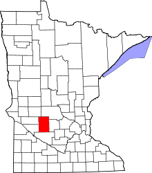 | |
| Townships | ||
| Unincorporated communities | ||
Coordinates: 45°20′52″N 95°14′18″W / 45.34778°N 95.23833°W