Summit Fire (2013)
This article is about the 2013 wildfire. For the underground incident in 1984, see Summit Tunnel fire. For the 2008 wildfire, see Summit Fire (2008).
| Summit Fire | |
|---|---|
|
The Summit fire being blown by strong Santa Ana winds on Wednesday, May 1. | |
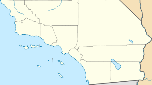
| Location | Banning, Riverside County, California |
| Coordinates | 34°17′20″N 116°56′29″W / 34.288877°N 116.941311°W |
| Statistics[1] | |
| Date(s) | May 1, 2013 – May 4, 2013 |
| Burned area | 3,161 acres (13 km2) |
| Buildings destroyed | 1 |
| Map | |
 | |
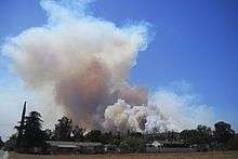
The Summit Fire was a wildfire that started in the Mias Canyon area north of Banning in Riverside County, California, on May 1, 2013.[1] By the time the fire was contained on May 4, 3,161 acres (12.79 km2) had burned and 1 residence had been destroyed.[2]
References
- 1 2 "Summit Fire". CAL FIRE. Retrieved 12 August 2015.
- ↑ Cocca, Christina; Tata, Samantha (1 May 2013). "Summit Fire Grows to 3K Acres; Destroys Home, Injures Firefighter". NBC Southern California. Retrieved 21 October 2016.
This article is issued from Wikipedia - version of the 12/3/2016. The text is available under the Creative Commons Attribution/Share Alike but additional terms may apply for the media files.