Summit, Utah
| Summit | |
|---|---|
| CDP | |
| Summit | |
 Location in Iron County and the state of Utah. | |
| Coordinates: 37°47′47″N 112°56′42″W / 37.79639°N 112.94500°WCoordinates: 37°47′47″N 112°56′42″W / 37.79639°N 112.94500°W | |
| Country | United States |
| State | Utah |
| County | Iron |
| Settled | 1858 |
| Elevation[1] | 5,955 ft (1,815 m) |
| Population (2010)[2] | |
| • Total | 160 |
| Time zone | Mountain (MST) (UTC-7) |
| • Summer (DST) | MDT (UTC-6) |
| ZIP code | 84772 |
| Area code(s) | 435 |
| GNIS feature ID | 2629954[1] |
Summit is a census-designated place in Iron County, Utah, United States. The population was 160 at the 2010 census.
History
Summit was named for the fact that it sits on the divide between the Parowan Valley and Cedar Valley. At first the area around Summit Creek was a grazing area for Parowan to the north. In the spring of 1858, Samuel T. Orton and others families to Summit Creek and began farming and tending bees, sheep and cattle. By July 1877 a LDS Ward was organized in Summit. Sylvanus C. Hulet was its first bishop. Originally educating their children in a one-room log schoolhouse, it was upgraded later to a concrete building, then from 1920 to 1936, to a two-room brick schoolhouse for students up to the seventh grade.[3]:184
Demographics
As of the census[2] of 2010, there were 160 people residing in the CDP. There were 79 housing units. The racial makeup of the town was 92.5% White, 3.1% American Indian and Alaska Native, 3.1% from some other race, and 1.3% from two or more races. Hispanic or Latino of any race were 8.1% of the population.
Climate
The climate in this area has mild differences between highs and lows, and there is adequate rainfall year round. According to the Köppen Climate Classification system, Summit has a marine west coast climate, abbreviated "Cfb" on climate maps.[4]
References
- 1 2 U.S. Geological Survey Geographic Names Information System: Summit, Utah. Retrieved May 23, 2011.
- 1 2 "American FactFinder". United States Census Bureau. Retrieved May 23, 2011.
- ↑ Janet Burton Seegmiller, A History of Iron County, Community Above Self; Utah Centennial County History Series: The Face and Faces of Iron County; Physical Characteristics; Ancient Peoples; Explorers, Traders, Trappers and Expeditions; Utah State Historical Society, Iron County Commission, 1998
- ↑ Climate Summary for Summit, Utah
Municipalities and communities of Iron County, Utah, United States | ||
|---|---|---|
| Cities | 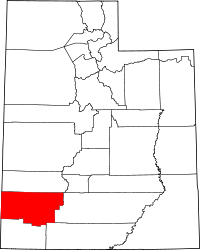 | |
| Towns | ||
| CDPs | ||
| Unincorporated communities | ||
| Ghost town | ||