Suffolk Coastal
| Suffolk Coastal District | |
|---|---|
| Non-metropolitan district | |
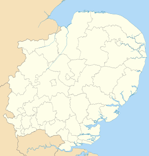
 Suffolk Coastal shown within Suffolk and England | |
| Sovereign state | United Kingdom |
| Constituent country | England |
| Region | East of England |
| Non-metropolitan county | Suffolk |
| Status | Non-metropolitan district |
| Admin HQ | Woodbridge |
| Incorporated | 1 April 1974 |
| Government | |
| • Type | Non-metropolitan district council |
| • Body | Suffolk Coastal District Council |
| • Leadership | Leader & Cabinet (Conservative) |
| • MPs |
Therese Coffey Daniel Poulter |
| Area | |
| • Total | 344.2 sq mi (891.5 km2) |
| Area rank | 38th (of 326) |
| Population (mid-2014 est.) | |
| • Total | 124,776 |
| • Rank | 174th (of 326) |
| • Density | 360/sq mi (140/km2) |
| • Ethnicity | 98.1% White |
| Time zone | GMT (UTC0) |
| • Summer (DST) | BST (UTC+1) |
| ONS code |
42UG (ONS) E07000205 (GSS) |
| OS grid reference | TM2756349450 |
| Website |
www |

Coastline at Aldeburgh.
Suffolk Coastal is a local government district in Suffolk, England. Its council is based in Woodbridge. Other towns include Felixstowe, Framlingham, Leiston, Aldeburgh, and Saxmundham.
The district was formed on 1 April 1974, under the Local Government Act 1972, as a merger of the municipal borough of Aldeburgh, along with Felixstowe, Leiston-cum-Sizewell, Saxmundham and Woodbridge urban districts, and Blyth Rural District and Deben Rural District. The population of the district was 124,298 at the 2011 Census.[1]
List of communities
There are 117 civil parishes and towns in Suffolk Coastal.
- Aldeburgh
- Alderton
- Aldringham cum Thorpe
- Badingham
- Bawdsey
- Benhall
- Blaxhall
- Blythburgh
- Boulge
- Boyton
- Bramfield
- Brandeston
- Bredfield
- Brightwell
- Bromeswell
- Bruisyard
- Bucklesham
- Burgh
- Butley
- Campsea Ashe
- Capel St Andrew
- Charsfield
- Chediston
- Chillesford
- Clopton
- Cookley
- Cransford
- Cratfield
- Cretingham
- Culpho
- Dallinghoo
- Darsham
- Debach
- Dennington
- Dunwich
- Earl Soham
- Easton
- Eyke
- Falkenham
- Farnham
- Felixstowe
- Foxhall
- Framlingham
- Friston
- Gedgrave
- Great Bealings
- Great Glemham
- Grundisburgh
- Hacheston
- Hasketon
- Hemley
- Heveningham
- Hollesley
- Hoo
- Huntingfield
- Iken
- Kelsale cum Carlton
- Kesgrave
- Kettleburgh
- Kirton
- Knodishall
- Leiston
- Letheringham
- Levington
- Linstead Magna
- Linstead Parva
- Little Bealings
- Little Glemham
- Marlesford
- Martlesham
- Melton
- Middleton
- Monewden
- Nacton
- Newbourne
- Orford
- Otley
- Parham
- Peasenhall
- Pettistree
- Playford
- Purdis Farm
- Ramsholt
- Rendham
- Rendlesham
- Rushmere St Andrew
- Saxmundham
- Saxtead
- Shottisham
- Sibton
- Snape
- Sternfield
- Stratford St Andrew
- Stratton Hall
- Sudbourne
- Sutton
- Swefling
- Swilland
- Theberton
- Thorington
- Trimley St Martin
- Trimley St Mary
- Tuddenham St Martin
- Tunstall
- Ubbeston
- Ufford
- Walberswick
- Waldringfield
- Walpole
- Wantisden
- Wenhaston with Mells Hamlet
- Westerfield
- Westleton
- Wickham Market
- Witnesham
- Woodbridge
- Yoxford
See also
Suffolk Coastal (Parliamentary Constituency)
References
- ↑ "District population 2011". Neighbourhood Statistics. Office for National Statistics. Retrieved 15 August 2016.
External links
| Boroughs or districts | |
|---|---|
| Major settlements | |
| Topics | |
Coordinates: 52°05′46″N 1°19′22″E / 52.0961°N 1.3227°E
This article is issued from Wikipedia - version of the 9/19/2016. The text is available under the Creative Commons Attribution/Share Alike but additional terms may apply for the media files.