Stung Treng Dam
| Stung Treng Dam | |
|---|---|
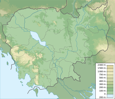 Location of Stung Treng Dam in Cambodia | |
| Country | Cambodia |
| Location | Stung Treng Province |
| Coordinates | 13°3′31.14″N 105°59′0.42″E / 13.0586500°N 105.9834500°ECoordinates: 13°3′31.14″N 105°59′0.42″E / 13.0586500°N 105.9834500°E |
| Status | Proposed |
| Opening date | 2016 (estimated) |
| Dam and spillways | |
| Type of dam | Earth core rockfill gravity dam |
| Impounds | Mekong River |
| Height | 22 m (72 ft) |
| Length | 10,844 m (35,577 ft) |
| Spillway capacity | 73,500 m3/s (2,600,000 cu ft/s) |
| Reservoir | |
| Total capacity | 70,000,000 m3 (57,000 acre·ft) |
| Surface area | 211 km2 (81 sq mi) |
| Power station | |
| Hydraulic head | 15.2 m (50 ft) |
| Turbines | 10 x 98 MW |
| Installed capacity | 980 MW (max. planned) |
The Stung Treng Dam is a proposed hydroelectric dam on the Mekong River in Stung Treng Province, Cambodia. It would be located on the mainstream of the Lower Mekong River. The project is controversial for several reasons, including its possible impact on the fisheries, as well as other ecological and environmental factors.
History
In 2007, the Russian company Bureyagesstroy got a license to conduct a feasibility study on a dam.[1] The feasibility study was carried out and the company asked permission to build the hydroelectric power station.[2] However, on December 9, 2009, a memorandum of understanding was signed between the Cambodian Government and the Vietnam Industrial and Urban Area Investment Development Corp (IDICO) to conduct a new feasibility study on the dam.[3] The results of this survey have not been released.
Description
The Stung Treng Dam would be an earth core rockfill gravity dam. If completed, the dam's crest would be 10,844 metres (35,577 ft) long and 22 metres (72 ft) high. Its rated head would be 15.2 metres (50 ft). It would have an installed capacity of 980 MW, and would, on average, generate 4,870 GWh per year. The dam's reservoir, which would extend well beyond the mainstream canal, would have an active storage of 70,000,000 cubic metres (57,000 acre·ft), and would inundate an area of 211 square kilometres (81 sq mi). The reservoir would be 50 kilometres (31 mi) long.[4]
Impact
Multiple independent agencies, including International Rivers, the Save the Mekong campaign and other have all raised concerns about the dam's construction.[5] In addition, Cambodia is a member of the Mekong River Commission, which requires prior notification of hydropower construction on the river's mainstream – i.e. plans for the Stung Treng will be subject to scrutiny by Laos, Thailand and Vietnam. A report authorized by the Mekong River Commission and released in January 2010 recommended that the Stung Treng along with the Sambor Dam be delayed for 10 years.[6]
The dam site lies within the Stung Treng Ramsar Site,[7] which effectively obliges the Royal Cambodian Government to ‘actively support' the three 'pillars' of the Ramsar Convention:
- ensuring the conservation and wise use of wetlands it has designated as Wetlands of International Importance,
- including as far as possible the wise use of all wetlands in national environmental planning,
- consulting with other Parties about implementation of the Convention, especially in regard to transboundary wetlands, shared water systems, and shared species.[8]
It is expected that fish migration routes (which support the world's largest inland fishery on the Tonlé Sap) will be essentially wholly impeded.[8] The two proposed dams of the Sambor and the Stung Treng would have the Mekong river basin's highest sediment trapping efficiencies of all the Lower Mekong Basin's proposed mainstream projects, destabilising downstream channels between Kratié and Phnom Penh and reducing overbank siltation in the Cambodian floodplain.[8]
If built, an estimated 21 villages with 2,059 households and 10,617 people will be displaced with the construction of the dam.[4]
Additional resources
- Halls, A.S. and Kshatriya, M. 2009. Modeling the Cumulative barrier and passage effects of mainstream hydropower dams on migratory fish populations in the Lower Mekong Basin.
- MRC Technical Paper No. 25. Vientiane, Mekong River Commission.
- King, P., Bird, J. and Haas, L. 2007. The current status of environmental criteria for hydropower development in the Mekong Region: a literature compilation. Vientiane, Lao PDR, WWF-Living Mekong Program.
References
- ↑ "Russian firm seeks dam deal". Khmer Property News. Retrieved 2011-01-22.
- ↑ "Russia is seeking permission to build a $2bn, 960 MW hydropower plant in Stung Treng Province". Power Engineering International. PennWell Corporation. 2009-12-09. Retrieved 2011-01-22.
- ↑ "Vietnamese investors to launch feasibility study of Stung Treng hydropower plant". Intellasia News Services. 2009-12-10. Retrieved 2011-01-22.
- 1 2 International Centre for Environmental Management (2009-10-23). Mainstream Project Profile Summaries (PDF). 2. Mekong River Commission. pp. 77–81. Retrieved 2011-02-06.
- ↑ "Mekong Mainstream Dams". International Rivers. Retrieved 22 January 2011.
- ↑ Baxter, Will (2010-11-03). "Cambodia 'most exposed' to dams threat". The Phnom Penh Post. (subscription required). Retrieved 2011-01-22.
- ↑ "The Annotated Ramsar List: Cambodia". The Convention on Wetlands. 10/01/2000. Retrieved 22 January 2011. Check date values in:
|date=(help) - 1 2 3 International Centre for Environmental Management (2009-10-23). Strategic Environmental Impact Assessment for Hydropower on the Mekong Mainstream. Final Report, prepared for the Mekong River Commission (PDF). 1. Mekong River Commission. p. 31. Retrieved 2011-02-06.
External links
| Wikimedia Commons has media related to Mekong. |