Strawberry Chapel and Childsbury Town Site
|
Strawberry Chapel and Childsbury Town Site | |
|
Strawberry Chapel | |
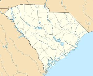  | |
| Location | Berkeley County, South Carolina |
|---|---|
| Nearest city | Goose Creek / Moncks Corner |
| Coordinates | 33°5′36″N 79°56′7″W / 33.09333°N 79.93528°WCoordinates: 33°5′36″N 79°56′7″W / 33.09333°N 79.93528°W |
| Built |
1707 (Childsbury) 1725 (Chapel) |
| NRHP Reference # | 72001194[1] |
| Added to NRHP | April 26, 1972 |
.jpg)
Strawberry Chapel is a parochial chapel of ease in the lower part of St. John's, Berkeley Parish in Berkeley County, South Carolina that was built in 1725. It is on Strawberry Chapel Road between South Carolina State Highway 8-44 and the West Branch of the Cooper River.[2] The Town of Childsbury was a planned community that was settled in 1707. The town no longer exists. They were named to the National Register of Historic Places on April 26, 1972.[1][3][4]
History
James Child, an English settler, was granted a tract of 1,200 acres (490 ha) on Strawberry Bluff overlooking the Cooper River. This location was the furthest upstream that ships could travel. He established a ferry across the river.[4]
The town of Childsbury was planned for the bluff.[4][5] At one time, the town had a tavern, school, chapel, race track, general store, and ferry. A tanner, butcher, shoemaker and carpenters lived in the town.[6] Due to the growth of nearby plantations, the town withered.[7] By 1750, the chapel and tavern continued to be used. Fairs were held until the mid-1750s.[6]
The chapel was a parochial chapel of ease of the Parish of St. John's, Berkeley. The parish church at the time was Biggin Church, which is about 10 mi (16 km) away.[8] The designation of "parochial" meant that it had the authority to baptize and bury the dead.[5]
By 1825, Strawberry Chapel replaced Biggins Church as the parish church.[4] The town is now a South Carolina Heritage Preserve.[6][9]
Town plan
The town was planned to have twenty-four blocks on Strawberry Bluff. At its center was a market square. Two other squares were named Child's Square and Dixe's Square. The streets were 66 ft (20 m) wide.[4]
Property was assigned for a college, a free school, a church, and a minister's house. Child designated 600 acres (240 ha) for farms and pastures and 100 acres (40 ha) on the bluff for a future citadel. A sketch of the plan for the town has been published.[4]
Chapel architecture
The chapel is a simple, rectangular brick building covered in stucco. It has a jerkin-head roof. The south-facing facade has a double three-paneled door with a flush fanlight. There are shuttered windows on either side of this door. The west end has a single door flanked by a pair of windows. There is decorative rosette window above. The east end has two windows with the rosette window above. Extending from the north wall behind the altar is a small anteroom for the vestry.[4][10]
A mural tablet in memory of an early rector of the parish was moved from Biggin Church to Strawberry Chapel.[8] The silver Communion service from Biggin Church, which had been hidden at the end of the Civil War, was found buried in a barn at the Comingtee Plantation in 1947.[11] It is now used at services at Strawberry Chapel.[8][10]
In 1882, a new chapel was built at nearby Cordesville. Strawberry Chapel underwent repairs in 1913.[8]
A graveyard is around the church. Additional pictures of the chapel are available.[10][12]
References
- 1 2 National Park Service (2009-03-13). "National Register Information System". National Register of Historic Places. National Park Service.
- ↑ "33° 5′ 36" N, 79° 56′ 7" W". Google Maps. google.com. Retrieved 10 May 2009.
- ↑ "Strawberry Chapel and Childsbury Town, Berkeley County (S.C. Sec. Rd. 44, Mount Holly vicinity)". National Register Properties in South Carolina. South Carolina Department of Archives and History. Retrieved 10 May 2009.
- 1 2 3 4 5 6 7 Bull, Elias B. (December 28, 1970). "Strawberry Chapel and Site of Town of Childsbury" (pdf). National Register of History Places Inventory - Nomination Form. National Park Service. Retrieved 9 May 2009.
- 1 2 Dalcho, Frederick (1820). An Historical Account of the Protestant Episcopal Church in South Carolina. Charleston, South Carolina: E. Thayer (Theological Book Store). pp. 266–269.
- 1 2 3 "Childsbury Towne Heritage Preserve". DNR Heritage Preserves. South Carolina Department of Natural Resources. Archived from the original on April 26, 2009. Retrieved 9 May 2009.
- ↑ Edgar, Walter; The Humanities CouncilSC (2006). South Carolina Encyclopedia. Columbia, South Carolina: University of South Carolina Press. p. 934. ISBN 1-57003-598-9. Cite uses deprecated parameter
|coauthors=(help) - 1 2 3 4 Thomas, Albert S. (1957). A Historical Account of the Protestant Episcopal Church in South Carolina. Columbia, South Carolina: R.L. Bryan Co. pp. 186–189.
- ↑ Clark, John F.; Pierce, Patricia A. (2003). Scenic Driving South Carolina. Guilford, Connecticut: Globe Pequot. p. 131. ISBN 0-7627-1139-6.
- 1 2 3 Stoney, Samuel Gaillard; Simons, A., and Lapham, Samuel, Jr. (1989). Plantations of the Carolina Low Country (7th ed.). Mineola, New York: Courier Dover Publications. pp. 66–67, 180. ISBN 0-486-26089-5. Cite uses deprecated parameter
|coauthors=(help) - ↑ Saturday Evening Post, June 21, 1947, "How the Comingtee Treasure Was Found," Herbert Ravenel Sass & Charlotte Ball
- ↑ Waterman, Thomas T.; Nichols, Frederick D. "Strawberry Chapel, Cooper River, West Branch, Cordesville vicinity, Berkeley County, SC (Photographs)". Historic American Building Survey. National Park Service. Retrieved 10 May 2009.
| Topics |   | |
|---|---|---|
| Lists by county |
| |
| Lists by city | ||
| Other lists | ||