Stotlers Crossroads, West Virginia
| Stotlers Crossroads | |
|---|---|
| Unincorporated community | |
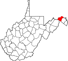
 Stotlers Crossroads  Stotlers Crossroads Location within the state of West Virginia | |
| Coordinates: 39°30′48″N 78°13′26″W / 39.51333°N 78.22389°WCoordinates: 39°30′48″N 78°13′26″W / 39.51333°N 78.22389°W | |
| Country | United States |
| State | West Virginia |
| County | Morgan |
| Elevation | 728 ft (222 m) |
| Time zone | Eastern (EST) (UTC-5) |
| • Summer (DST) | EDT (UTC-4) |
| GNIS feature ID | 1555723[1] |
Stotlers Crossroads is a small unincorporated community hamlet in southeastern Morgan County, West Virginia.[1] It is situated along Winchester Grade Road (CR 13) between the South and Middle Forks of Sleepy Creek on the eastern flanks of Highland Ridge (942 feet).
The community was named after W. R. Stotler, a merchant at the namesake crossroads.[2] Stotlers Crossroads is the location of several historic buildings, including the Mount Olivet United Methodist Church (1888) and Ambrose Chapel, listed on the National Register of Historic Places.[3]
Stotlers Crossroads is a junction of Winchester Grade Road (CR 13) with the Virginia Line and Highland Ridge Roads (CR 8).
References
- 1 2 "Stotlers Crossroads". Geographic Names Information System. United States Geological Survey.
- ↑ Kenny, Hamill (1945). West Virginia Place Names: Their Origin and Meaning, Including the Nomenclature of the Streams and Mountains. Piedmont, WV: The Place Name Press. p. 605.
- ↑ National Park Service (2009-03-13). "National Register Information System". National Register of Historic Places. National Park Service.
This article is issued from Wikipedia - version of the 7/28/2016. The text is available under the Creative Commons Attribution/Share Alike but additional terms may apply for the media files.