Rock Gap, West Virginia
| Rock Gap | |
|---|---|
| Unincorporated community | |
 Rock Gap  Rock Gap Location within the state of West Virginia | |
| Coordinates: 39°31′59″N 78°16′35″W / 39.53306°N 78.27639°WCoordinates: 39°31′59″N 78°16′35″W / 39.53306°N 78.27639°W | |
| Country | United States |
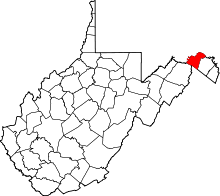
| State | West Virginia |
| County | Morgan |
| Time zone | Eastern (EST) (UTC-5) |
| • Summer (DST) | EDT (UTC-4) |
| GNIS feature ID | 1545910[1] |
Rock Gap is an unincorporated community along Valley Road (U.S. Highway 522) in Morgan County, West Virginia, United States. It is located between Omps to its south and Berkeley Springs to its north. Situated between Warm Springs Ridge (1,086 feet) to its west and Timber Ridge (1,355 feet) to its east, Rock Gap takes its name from the "Rock Gap" in Warm Spring Ridge, carved out by Rock Gap Run, a tributary stream of Sleepy Creek.
Rock Gap began as a small farming community along Valley Road. It had a post office in operation from 1884 to 1907 and again between 1921 and 1925. Residents of Rock Gap currently have a Berkeley Springs address.
Historic sites
- Mount Garfield School
- Mount Tabor Church
Mt. Tabor Church, formerly Mt. Tabor United Methodist Church, is now privately owned.