Storden, Minnesota
| Storden, Minnesota | |
|---|---|
| City | |
 Location of Storden, Minnesota | |
| Coordinates: 44°2′18″N 95°19′8″W / 44.03833°N 95.31889°W | |
| Country | United States |
| State | Minnesota |
| County | Cottonwood |
| platted | July 8, 1903 |
| Government | |
| • Type | Mayor - Council |
| • Mayor | Michael W. Timm |
| Area[1] | |
| • Total | 0.22 sq mi (0.57 km2) |
| • Land | 0.22 sq mi (0.57 km2) |
| • Water | 0 sq mi (0 km2) |
| Elevation | 1,411 ft (430 m) |
| Population (2010)[2] | |
| • Total | 219 |
| • Estimate (2015) | 217[3] |
| • Density | 995.5/sq mi (384.4/km2) |
| Time zone | Central (CST) (UTC-6) |
| • Summer (DST) | CDT (UTC-5) |
| ZIP code | 56174 |
| Area code(s) | 507 |
| FIPS code | 27-63022[4] |
| GNIS feature ID | 0652733[5] |
Storden is a city in Cottonwood County, Minnesota, United States. The population was 219 at the 2010 census.[6]
History
The town of Storden was platted July 8, 1903 and named in honor of the area's first settler, Nels Storden, an immigrant from Norway.[7][8]
Storden Baptist Church was established on July 12, 1879.[9] Amo Lutheran Church was founded in 1887.[10]
Geography
According to the United States Census Bureau, the city has a total area of 0.22 square miles (0.57 km2), all land.[1]
Minnesota State Highway 30 and County Highway 5 are two of the main routes in the community.
Demographics
| Historical population | |||
|---|---|---|---|
| Census | Pop. | %± | |
| 1930 | 285 | — | |
| 1940 | 331 | 16.1% | |
| 1950 | 398 | 20.2% | |
| 1960 | 390 | −2.0% | |
| 1970 | 364 | −6.7% | |
| 1980 | 341 | −6.3% | |
| 1990 | 283 | −17.0% | |
| 2000 | 274 | −3.2% | |
| 2010 | 219 | −20.1% | |
| Est. 2015 | 217 | [3] | −0.9% |
2010 census
As of the census[2] of 2010, there were 219 people, 104 households, and 57 families residing in the city. The population density was 995.5 inhabitants per square mile (384.4/km2). There were 124 housing units at an average density of 563.6 per square mile (217.6/km2). The racial makeup of the city was 96.8% White, 1.4% African American, and 1.8% from two or more races. Hispanic or Latino of any race were 0.9% of the population.
There were 104 households of which 24.0% had children under the age of 18 living with them, 49.0% were married couples living together, 4.8% had a female householder with no husband present, 1.0% had a male householder with no wife present, and 45.2% were non-families. 39.4% of all households were made up of individuals and 13.5% had someone living alone who was 65 years of age or older. The average household size was 2.11 and the average family size was 2.89.
The median age in the city was 44.8 years. 22.8% of residents were under the age of 18; 6% were between the ages of 18 and 24; 21.9% were from 25 to 44; 29.2% were from 45 to 64; and 20.1% were 65 years of age or older. The gender makeup of the city was 52.1% male and 47.9% female.
2000 census
As of the census[4] of 2000, there were 274 people, 120 households, and 81 families residing in the city. The population density was 1,279.5 people per square mile (503.8/km²). There were 132 housing units at an average density of 616.4 per square mile (242.7/km²). The racial makeup of the city was 95.99% White, 3.28% from other races, and 0.73% from two or more races. Hispanic or Latino of any race were 5.11% of the population.
There were 120 households out of which 20.0% had children under the age of 18 living with them, 60.8% were married couples living together, 3.3% had a female householder with no husband present, and 32.5% were non-families. 30.0% of all households were made up of individuals and 17.5% had someone living alone who was 65 years of age or older. The average household size was 2.28 and the average family size was 2.77.
In the city the population was spread out with 21.5% under the age of 18, 7.7% from 18 to 24, 20.4% from 25 to 44, 25.2% from 45 to 64, and 25.2% who were 65 years of age or older. The median age was 46 years. For every 100 females there were 95.7 males. For every 100 females age 18 and over, there were 93.7 males.
The median income for a household in the city was $30,694, and the median income for a family was $42,917. Males had a median income of $28,750 versus $22,000 for females. The per capita income for the city was $15,134. About 16.1% of families and 14.7% of the population were below the poverty line, including 16.7% of those under the age of eighteen and 12.1% of those sixty five or over.
Politics
Storden is located in Minnesota's 1st congressional district, represented by Tim Walz, a Democrat. At the state level, Storden is located in Senate District 22, represented by Republican Doug Magnus, and in House District 22B, represented by Republican Rod Hamilton.
Educational institutions
Storden is part of the consolidated Red Rock Central School District. The district comprises the southwestern Minnesota towns of Sanborn, Lamberton, Jeffers, and Storden with the Elementary School in Jeffers and Red Rock Central High School in Lamberton. The school mascot is the Falcon. From 1971 until consolidation with Sanborn and Lamberton in 1992, Storden was combined with Jeffers as the Storden-Jeffers Senior High School. The school's mascot was the Chiefs. Prior to 1971, the Storden High School "Tigers" played in the Red Rock Conference with other neighboring schools like Westbrook, Jeffers, Sanborn, Lamberton, and Walnut Grove. Other sports only pairings included Windom-Storden-Jeffers for cross-country from the late 80's to 1992. In 1990 Westbrook-Storden Jeffers (Chargers) were paired for football, and again from 91-92 as the Red Rock Chargers that added Walnut Grove to Westbrook Storden Jeffers. WWG & RRC are currently paired for wrestling.
References
- 1 2 "US Gazetteer files 2010". United States Census Bureau. Retrieved 2012-11-13.
- 1 2 "American FactFinder". United States Census Bureau. Retrieved 2012-11-13.
- 1 2 "Annual Estimates of the Resident Population for Incorporated Places: April 1, 2010 to July 1, 2015". Retrieved July 2, 2016.
- 1 2 "American FactFinder". United States Census Bureau. Retrieved 2008-01-31.
- ↑ "US Board on Geographic Names". United States Geological Survey. 2007-10-25. Retrieved 2008-01-31.
- ↑ "2010 Census Redistricting Data (Public Law 94-171) Summary File". American FactFinder. United States Census Bureau. Retrieved 27 April 2011.
- ↑ Upham, Warren (1920). Minnesota Geographic Names: Their Origin and Historic Significance. Minnesota Historical Society. p. 151.
- ↑ Chicago and North Western Railway Company (1908). A History of the Origin of the Place Names Connected with the Chicago & North Western and Chicago, St. Paul, Minneapolis & Omaha Railways. p. 193.
- ↑ "Our History - Storden Baptist Church". Storden Baptist Church. Retrieved July 23, 2016.
- ↑ "Home - Amo Lutheran Church". Amo Lutheran Church. Retrieved July 23, 2016.
- ↑ "Census of Population and Housing". Census.gov. Retrieved June 4, 2015.
External links
Municipalities and communities of Cottonwood County, Minnesota, United States | ||
|---|---|---|
| Cities | 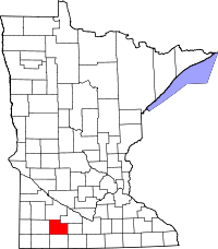 | |
| Townships | ||
| Unincorporated community | ||
| Footnotes | ‡This populated place also has portions in an adjacent county or counties | |
Coordinates: 44°02′16″N 95°19′06″W / 44.03778°N 95.31833°W