Sterling, Kansas
| Sterling, Kansas | |
|---|---|
| City | |
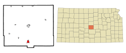 Location within Rice County and Kansas | |
 KDOT map of Rice County (legend) | |
| Coordinates: 38°12′38″N 98°12′16″W / 38.21056°N 98.20444°WCoordinates: 38°12′38″N 98°12′16″W / 38.21056°N 98.20444°W | |
| Country | United States |
| State | Kansas |
| County | Rice |
| Township | Sterling |
| Area[1] | |
| • Total | 1.71 sq mi (4.43 km2) |
| • Land | 1.67 sq mi (4.33 km2) |
| • Water | 0.04 sq mi (0.10 km2) |
| Elevation | 1,640 ft (500 m) |
| Population (2010)[2] | |
| • Total | 2,328 |
| • Estimate (2015)[3] | 2,293 |
| • Density | 1,400/sq mi (530/km2) |
| Time zone | Central (CST) (UTC-6) |
| • Summer (DST) | CDT (UTC-5) |
| ZIP code | 67579 |
| Area code | 620 |
| FIPS code | 20-68200 [4] |
| GNIS feature ID | 0475908 [5] |
| Website | City Website |
Sterling is a city in Rice County, Kansas, United States. As of the 2010 census, the city population was 2,328.[6] Sterling is home to Sterling College.
History
For millennia, the land now known as Kansas was inhabited by Native Americans. In 1803, most of modern Kansas was secured by the United States as part of the Louisiana Purchase. In 1854, the Kansas Territory was organized, then in 1861 Kansas became the 34th U.S. state. In 1867, Rice County was founded.
Sterling was originally called Peace, and under the latter name was founded in 1872.[7] In 1876, the name was changed to Sterling, by two brothers after their father Sterling Rosan.[8]
In the 1890s, Jonathan S. Dillon sold groceries at his general store in Sterling. Later in 1913, he opened his first J.S. Dillon Cash Food Market in Hutchinson. Later he expanded into the Dillons grocery supermarket chain.
Historic places
- Charles K. Beckett House (NRHP), 210 West Main Street.
- Cooper Hall (NRHP), North Broadway Avenue.
- Shay Building (NRHP), 202 South Broadway Avenue.
- Sterling Carnegie Library (NRHP), 132 North Broadway Avenue.
Films
- Picnic, 1955, the sequence by the lake was filmed in Sterling.
Geography
Sterling is located at 38°12′38″N 98°12′16″W / 38.21056°N 98.20444°W (38.210658, -98.204549).[9] According to the United States Census Bureau, the city has a total area of 1.71 square miles (4.43 km2), of which, 1.67 square miles (4.33 km2) is land and 0.04 square miles (0.10 km2) is water.[1]
Climate
| Climate data for Sterling, Kansas | |||||||||||||
|---|---|---|---|---|---|---|---|---|---|---|---|---|---|
| Month | Jan | Feb | Mar | Apr | May | Jun | Jul | Aug | Sep | Oct | Nov | Dec | Year |
| Average high °F (°C) | 40.4 (4.7) |
47.2 (8.4) |
56.9 (13.8) |
67.1 (19.5) |
76.4 (24.7) |
87.4 (30.8) |
92.7 (33.7) |
90.9 (32.7) |
82.0 (27.8) |
70.2 (21.2) |
54.4 (12.4) |
43.4 (6.3) |
67.4 (19.7) |
| Daily mean °F (°C) | 29.3 (−1.5) |
35.0 (1.7) |
44.3 (6.8) |
54.2 (12.3) |
64.5 (18.1) |
75.1 (23.9) |
80.4 (26.9) |
78.6 (25.9) |
69.4 (20.8) |
57.2 (14) |
42.6 (5.9) |
32.5 (0.3) |
55.3 (12.9) |
| Average low °F (°C) | 18.1 (−7.7) |
22.7 (−5.2) |
31.6 (−0.2) |
41.2 (5.1) |
52.5 (11.4) |
62.7 (17.1) |
68.0 (20) |
66.3 (19.1) |
56.8 (13.8) |
44.2 (6.8) |
30.8 (−0.7) |
21.5 (−5.8) |
43.0 (6.1) |
| Source: [10] | |||||||||||||
Demographics
| Historical population | |||
|---|---|---|---|
| Census | Pop. | %± | |
| 1880 | 1,014 | — | |
| 1890 | 1,641 | 61.8% | |
| 1900 | 2,002 | 22.0% | |
| 1910 | 2,133 | 6.5% | |
| 1920 | 2,060 | −3.4% | |
| 1930 | 1,868 | −9.3% | |
| 1940 | 2,215 | 18.6% | |
| 1950 | 2,243 | 1.3% | |
| 1960 | 2,303 | 2.7% | |
| 1970 | 2,312 | 0.4% | |
| 1980 | 2,312 | 0.0% | |
| 1990 | 2,536 | 9.7% | |
| 2000 | 2,642 | 4.2% | |
| 2010 | 2,328 | −11.9% | |
| Est. 2015 | 2,293 | [3] | −1.5% |
| U.S. Decennial Census | |||
2010 census
As of the census[2] of 2010, there were 2,328 people, 786 households, and 510 families residing in the city. The population density was 1,394.0 inhabitants per square mile (538.2/km2). There were 933 housing units at an average density of 558.7 per square mile (215.7/km2). The racial makeup of the city was 93.1% White, 2.4% African American, 0.7% Native American, 0.6% Asian, 0.9% from other races, and 2.3% from two or more races. Hispanic or Latino of any race were 4.3% of the population.
There were 786 households of which 27.9% had children under the age of 18 living with them, 52.7% were married couples living together, 8.9% had a female householder with no husband present, 3.3% had a male householder with no wife present, and 35.1% were non-families. 30.2% of all households were made up of individuals and 14.8% had someone living alone who was 65 years of age or older. The average household size was 2.31 and the average family size was 2.89.
The median age in the city was 29.5 years. 18.9% of residents were under the age of 18; 26.9% were between the ages of 18 and 24; 16% were from 25 to 44; 22% were from 45 to 64; and 16.3% were 65 years of age or older. The gender makeup of the city was 50.2% male and 49.8% female.
2000 census
As of the census[4] of 2000, there were 2,642 people, 819 households, and 538 families residing in the city. The population density was 1,861.3 people per square mile (718.4/km²). There were 963 housing units at an average density of 678.4 per square mile (261.8/km²). The racial makeup of the city was 95.42% White, 1.51% African American, 0.76% Native American, 0.68% Asian, 0.72% from other races, and 0.91% from two or more races. Hispanic or Latino of any race were 1.74% of the population.
There were 819 households out of which 29.9% had children under the age of 18 living with them, 55.3% were married couples living together, 8.1% had a female householder with no husband present, and 34.2% were non-families. 32.0% of all households were made up of individuals and 17.2% had someone living alone who was 65 years of age or older. The average household size was 2.34 and the average family size was 2.94.
In the city the population was spread out with 19.4% under the age of 18, 32.9% from 18 to 24, 17.3% from 25 to 44, 16.8% from 45 to 64, and 13.5% who were 65 years of age or older. The median age was 23 years. For every 100 females there were 84.9 males. For every 100 females age 18 and over, there were 77.3 males.
The median income for a household in the city was $35,282, and the median income for a family was $40,739. Males had a median income of $32,381 versus $17,423 for females. The per capita income for the city was $13,229. About 8.7% of families and 11.9% of the population were below the poverty line, including 14.1% of those under age 18 and 8.1% of those age 65 or over.
Economy
Jacam, a chemical manufacturer serving the oil and gas industry,[11] is the largest employer in Sterling.[12]
Education
Primary and secondary education
Sterling is part of Unified School District 376.[13][14] The district has two schools in Sterling:
- Sterling High School, 308 East Washington Avenue, Grades 9 to 12.
- Sterling Junior High School, 412 North 5th Street, Grades 7 to 8.
- Sterling Grade School, 218 South 5th Street, Grades K to 6.
College
Sterling College is a four-year institution affiliated with the Presbyterian Church USA. The college is one of the largest employers in the city of Sterling. The Sterling Warriors play home games at the Smisor Stadium.
Infrastructure
Transportation
Highway
K-96 / K-14 state highway passes through Sterling. KDOT has proposed converting K-96 into a 4-lane highway and bypass the cities of Nickerson and Sterling. Numerous routes have been studied.[15][16]
Rail
The Kansas and Oklahoma Railroad passes through the city.
Notable people
- Doris Fleeson, syndicated journalist, born in Sterling
- Lorene Harrison, musician, educator, born in Sterling
- Martin Pence, United States District Court judge, born in Sterling
See also
- National Register of Historic Places listings in Rice County, Kansas
- Main Street Programs in the United States
References
- 1 2 "US Gazetteer files 2010". United States Census Bureau. Retrieved 2012-07-06.
- 1 2 "American FactFinder". United States Census Bureau. Retrieved 2012-07-06.
- 1 2 "Annual Estimates of the Resident Population for Incorporated Places: April 1, 2010 to July 1, 2015". Retrieved July 2, 2016.
- 1 2 "American FactFinder". United States Census Bureau. Retrieved 2008-01-31.
- ↑ "US Board on Geographic Names". United States Geological Survey. 2007-10-25. Retrieved 2008-01-31.
- ↑ "2010 City Population and Housing Occupancy Status". U.S. Census Bureau. Retrieved September 26, 2011.
- ↑ Kansas State Historical Society (1916). Biennial Report of the Board of Directors of the Kansas State Historical Society. Kansas State Printing Plant. p. 273.
- ↑ Kansas Place-Names, John Rydjord, University of Oklahoma Press, 1972, ISBN 0-8061-0994-7
- ↑ "US Gazetteer files: 2010, 2000, and 1990". United States Census Bureau. 2011-02-12. Retrieved 2011-04-23.
- ↑ "Monthly Normals for Sterling". National Weather Service. Retrieved June 27, 2010.
- ↑ http://www.jacam.com/
- ↑ http://sterling-kansas.com/DocumentCenter/View/115
- ↑ USD 376
- ↑ Kansas School District Boundary Map
- ↑ K-96 Location - Final Study; KDOT; December 2010.
- ↑ K-96 Location - Information; KDOT.
Further reading
- History of the State of Kansas; William G. Cutler; A.T. Andreas Publisher; 1883. (Online HTML eBook)
- Kansas : A Cyclopedia of State History, Embracing Events, Institutions, Industries, Counties, Cities, Towns, Prominent Persons, Etc; 3 Volumes; Frank W. Blackmar; Standard Publishing Co; 944 / 955 / 824 pages; 1912. (Volume1 - Download 54MB PDF eBook),(Volume2 - Download 53MB PDF eBook), (Volume3 - Download 33MB PDF eBook)
External links
| Wikimedia Commons has media related to Sterling, Kansas. |
- Official website
- Sterling - Directory of Public Officials
- Harold Tilton - a personal military museum on YouTube, from Hatteberg's People on KAKE TV news
- KWCH 'One of a Kind' Kansas road trip in 2011: Photos, Video 1, Video 2, Video 3. Towns included were Coldwater, Sterling, Atwood, Lucas, Marion.
- Sterling City Map, KDOT
Municipalities and communities of Rice County, Kansas, United States | ||
|---|---|---|
| Cities | 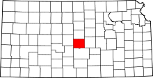 | |
| Unincorporated communities | ||
| Townships | ||