Texas State Highway 56
| ||||
|---|---|---|---|---|
 | ||||
| Route information | ||||
| Maintained by TxDOT | ||||
| Length: | 64.468 mi[1] (103.751 km) | |||
| Existed: | April 7, 1974[1] – present | |||
| Major junctions | ||||
| West end: |
| |||
|
| ||||
| East end: |
| |||
| Highway system | ||||
| ||||

State Highway 56 is a state highway in the U.S. state of Texas that runs through Grayson and Fannin Counties in North Central Texas. This highway was designated in 1974 to replace U.S. Highway 82 when it was rerouted north of Whitesboro and Sherman.[2] SH 56 has been extended further since then as the US 82 bypass continued to be extended north of Bonham and Honey Grove.
Through Sherman, SH 56 operates on a pair of one-way streets, Lamar (eastbound) and Houston (westbound).
Previous routes
SH 56 was originally designated by 1926 through the northwestern Panhandle, coinciding with the future route of U.S. Highway 54. Construction was completed by 1938, when the SH 56 designation was dropped in favor of US 54.[3]
Route description
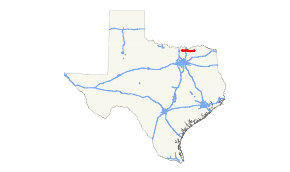
SH 56 begins at an intersection with U.S. Route 82 just outside of Whitesboro. The highway then enters Whitesboro with indirect access to U.S. Route 377. SH 56 next travels through Southmayd, where it meets State Highway 289, before entering Sherman. Just east of Farm to Market Road 1417, the highway splits into a pair of one–way streets, with eastbound traffic traveling on Lamar Street and westbound on Houston Street. SH 56 meets U.S. Route 75 before entering downtown Sherman. The highway merges back into one street, just before State Highway 11 before leaving Sherman. SH 56 runs through a generally undeveloped area of Grayson County before entering Bells, where the highway meets U.S. Route 69. Between Bells and Savoy, SH 56 enters Fannin County. The highway runs through Ector, before entering Bonham where it meets State Highway 121 and State Highway 78. SH 56 runs through Dodd City, Windom and Honey Grove before ending at an intersection with US 82.
Junction list
| County | Location | mi | km | Destinations | Notes |
|---|---|---|---|---|---|
| Grayson | | ||||
| Whitesboro | |||||
| | West end of FM 901 overlap | ||||
| | East end of FM 901 overlap | ||||
| Southmayd | Interchange | ||||
| Sherman | Interchange | ||||
| US 75 exit 58 | |||||
| | |||||
| Bells | |||||
| Fannin | Savoy | ||||
| Ector | |||||
| Bonham | West end of SH 121 overlap | ||||
| East end of SH 121 overlap | |||||
| Dodd City | |||||
| | |||||
| Windom | |||||
| | |||||
| Honey Grove | West end of SH 34 overlap | ||||
| East end of SH 34 overlap | |||||
| | |||||
1.000 mi = 1.609 km; 1.000 km = 0.621 mi
| |||||
References
- 1 2 Transportation Planning and Programming Division (n.d.). "State Highway No. 56". Highway Designation Files. Texas Department of Transportation. Retrieved August 4, 2016.
- ↑ Transportation Planning and Programming Division (n.d.). "U.S. Highway No. 82". Highway Designation Files. Texas Department of Transportation. Retrieved August 3, 2016.
- ↑ Transportation Planning and Programming Division (n.d.). "U.S. Highway No. 54". Highway Designation Files. Texas Department of Transportation. Retrieved August 3, 2016.