Stanley, Wisconsin
| Stanley, Wisconsin | |
|---|---|
| City | |
 Location of Stanley, Wisconsin | |
| Coordinates: 44°58′N 90°56′W / 44.967°N 90.933°WCoordinates: 44°58′N 90°56′W / 44.967°N 90.933°W | |
| Country | United States |
| State | Wisconsin |
| Counties | Chippewa, Clark |
| Area[1] | |
| • Total | 4.25 sq mi (11.01 km2) |
| • Land | 4.18 sq mi (10.83 km2) |
| • Water | 0.07 sq mi (0.18 km2) |
| Elevation[2] | 1,083 ft (330 m) |
| Population (2010)[3] | |
| • Total | 3,608 |
| • Estimate (2012[4]) | 3,633 |
| • Density | 863.2/sq mi (333.3/km2) |
| Time zone | Central (CST) (UTC−6) |
| • Summer (DST) | CDT (UTC−5) |
| Area code(s) | 715 & 534 |
| FIPS code | 55-76625[5] |
| GNIS feature ID | 1574790[2] |
| Website |
stanleywisconsin |
Stanley is a city in Chippewa and Clark counties in the U.S. state of Wisconsin. The population was 3,608 at the 2010 census. Of this, 3,602 were in Chippewa County, and 6 in Clark County.
History
Stanley was settled and platted in 1881 when the Wisconsin Central Railway built its line through the area. The town is named for L.C. Stanley, a merchant and railroad man from Chippewa Falls who was involved in that first plat.[6] The main early businesses were a small steam sawmill and some charcoal kilns built by the York Iron Company in 1887.[7]
In 1891 the Northwestern Lumber Company from Eau Claire started a big lumber mill at Stanley and spawned the Stanley, Merrill and Phillips Railway to haul logs out of the country to the north and south where it held timber lands. (The railway never reached Merrill or Phillips; its furthest reach was Walrath, to the north of Jump River.) The mill in Stanley sawed wood until 1920, when Northwestern's timber holdings in the area were largely exhausted. Over that period, the mill is estimated to have sawed 850 million board feet of lumber.[8]
Stanley became a village in 1895 and a city in 1898.
On May 18, 1906 a fire started in one of the Northwest Lumber Company buildings east of the current Chapman Lake in what is now Fandry Park. The fire quickly spread to other businesses and into the residential area to the east. It ended up destroying a number of business buildings, two churches, and about seventy homes. But neighbors helped neighbors, businesses rebuilt (some with fireproof brick), and the city moved on.[9]
The Northwestern Lumber Company had started a brickyard around 1900, digging its clay north of Chapman Park's location. After the fire in 1906, production increased greatly to rebuild Stanley and buildings as far off as Eau Claire and Auburndale.[10]
After the decline of logging, agriculture became important – particularly dairy farming.
On May 20, 2002, the city annexed a portion of land in the Town of Thorp in Clark County.
Geography
Stanley is located at 44°58′N 90°56′W / 44.967°N 90.933°W (44.9613, -90.9385).[11]
According to the United States Census Bureau, the city has a total area of 4.25 square miles (11.01 km2), of which 4.18 square miles (10.83 km2) is land and 0.07 square miles (0.18 km2) is water.[1]
Stanley is located primarily on the north side of Wisconsin State Highway 29. It is mostly in Chippewa County, but parts of the east side are in Clark County.
Demographics

| Historical population | |||
|---|---|---|---|
| Census | Pop. | %± | |
| 1900 | 2,387 | — | |
| 1910 | 2,675 | 12.1% | |
| 1920 | 2,577 | −3.7% | |
| 1930 | 1,988 | −22.9% | |
| 1940 | 2,021 | 1.7% | |
| 1950 | 2,014 | −0.3% | |
| 1960 | 2,014 | 0.0% | |
| 1970 | 2,049 | 1.7% | |
| 1980 | 2,095 | 2.2% | |
| 1990 | 2,011 | −4.0% | |
| 2000 | 1,898 | −5.6% | |
| 2010 | 3,608 | 90.1% | |
| Est. 2015 | 3,569 | [12] | −1.1% |
As of 2000 the median income for a household in the city was $27,644, and the median income for a family was $41,964. Males had a median income of $27,900 versus $21,607 for females. The per capita income for the city was $19,421. About 4.0% of families and 8.0% of the population were below the poverty line, including 10.8% of those under age 18 and 11.2% of those age 65 or over.
2010 census
As of the census[3] of 2010, there were 3,608 people, 930 households, and 532 families residing in the city. The population density was 863.2 inhabitants per square mile (333.3/km2). There were 1,006 housing units at an average density of 240.7 per square mile (92.9/km2). The racial makeup of the city was 80.4% White, 16.6% African American, 1.7% Native American, 0.6% Asian, 0.2% Pacific Islander, 0.2% from other races, and 0.3% from two or more races. Hispanic or Latino of any race were 3.1% of the population.
There were 930 households of which 30.0% had children under the age of 18 living with them, 40.9% were married couples living together, 11.3% had a female householder with no husband present, 5.1% had a male householder with no wife present, and 42.8% were non-families. 37.8% of all households were made up of individuals and 21.3% had someone living alone who was 65 years of age or older. The average household size was 2.26 and the average family size was 2.96.
The median age in the city was 37.6 years. 15.1% of residents were under the age of 18; 9% were between the ages of 18 and 24; 39.1% were from 25 to 44; 24.9% were from 45 to 64; and 12% were 65 years of age or older. The gender makeup of the city was 68.8% male and 31.2% female.
Education
Students residing in Stanley and the neighboring village of Boyd are served by Stanley-Boyd Elementary School, Stanley-Boyd Middle School, and Stanley-Boyd High School. The high school has an enrollment of 326 students. For interscholastic sports, Stanley-Boyd High School is a member of the Cloverbelt Conference of the WIAA.
Stanley Correctional Institution
The city is the site of the Stanley Correctional Institution.
Notable people
- Robert Whitney Burns, U.S. Air Force Lieutenant General
- Dave Cahill, Philadelphia Eagles, Los Angeles Rams, and Atlanta Falcons
- Clarence B. Culbertson, Wisconsin State Assemblyman
- George H. Hipke, Wisconsin State Senator
- Larry Krause, Green Bay Packers
- Vincent Mroz, Secret Service agent
- David Plombon, Wisconsin State Assemblyman
- Terry A. Willkom, Wisconsin State Assemblyman
References
- 1 2 "US Gazetteer files 2010". United States Census Bureau. Retrieved 2012-11-18.
- 1 2 "US Board on Geographic Names". United States Geological Survey. 2007-10-25. Retrieved 2008-01-31.
- 1 2 "American FactFinder". United States Census Bureau. Retrieved 2012-11-18.
- ↑ "Population Estimates". United States Census Bureau. Retrieved 2013-06-24.
- ↑ "American FactFinder". United States Census Bureau. Retrieved 2008-01-31.
- ↑ Taylor, Mary E. (August 1985). "D.R. Moon Memorial Library" (PDF). NRHP Inventory-Nomination Form. National Park Service. Retrieved 2016-04-10.
- ↑ Forrester, George (1891). Historical and Biographical Album of the Chippewa Valley Wisconsin. Chicago, Ill: A. Warner. p. 61.
- ↑ Nagel, Paul (1979). S.M.&P. Ry. – The Stanley, Merrill and Phillips Railway. Chippewa Falls, Wisc.: Print-it Press Company. pp. 6–10, 44.
- ↑ Hoffman, Arnie; Jean Anderson (1976). "Stanley fire among most damaging". Our Story 1776–1976 – insert in Eau Claire Leader Telegram. Retrieved 2011-11-11.
- ↑ "Brickmaking once Booming Business". Our Story 1776–1976 – insert in Eau Claire Leader Telegram. 1976. Retrieved 2011-11-11.
- ↑ "US Gazetteer files: 2010, 2000, and 1990". United States Census Bureau. 2011-02-12. Retrieved 2011-04-23.
- ↑ "Annual Estimates of the Resident Population for Incorporated Places: April 1, 2010 to July 1, 2015". Retrieved July 2, 2016.
- ↑ "Census of Population and Housing". Census.gov. Retrieved June 4, 2015.
External links
Municipalities and communities of Chippewa County, Wisconsin, United States | ||
|---|---|---|
| Cities | 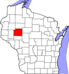 | |
| Villages | ||
| Towns | ||
| CDPs | ||
| Unincorporated communities | ||
| Footnotes | ‡This populated place also has portions in an adjacent county or counties | |
Municipalities and communities of Clark County, Wisconsin, United States | ||
|---|---|---|
| Cities |  | |
| Villages | ||
| Towns | ||
| CDPs | ||
| Unincorporated communities | ||
| Ghost towns | ||
| Footnotes | ‡This populated place also has portions in an adjacent county or counties | |