Cornell, Wisconsin
| Cornell, Wisconsin | |
|---|---|
| City | |
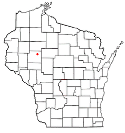 Location of Cornell, Wisconsin | |
| Coordinates: 45°10′0″N 91°8′59″W / 45.16667°N 91.14972°WCoordinates: 45°10′0″N 91°8′59″W / 45.16667°N 91.14972°W | |
| Country | United States |
| State | Wisconsin |
| County | Chippewa |
| Area[1] | |
| • Total | 4.37 sq mi (11.32 km2) |
| • Land | 3.84 sq mi (9.95 km2) |
| • Water | 0.53 sq mi (1.37 km2) |
| Elevation[2] | 1,083 ft (330 m) |
| Population (2010)[3] | |
| • Total | 1,467 |
| • Estimate (2012[4]) | 1,472 |
| • Density | 382.0/sq mi (147.5/km2) |
| Time zone | Central (CST) (UTC-6) |
| • Summer (DST) | CDT (UTC-5) |
| Area code(s) | 715 & 534 |
| FIPS code | 55-17100[5] |
| GNIS feature ID | 1563404[2] |
| Website |
cityofcornell |
Cornell is a city in Chippewa County in the U.S. state of Wisconsin. The population was 1,467 at the 2010 census. It is located on the Chippewa River, upstream from Lake Wissota and Chippewa Falls.
History
The city was named for Ezra Cornell, founder of Cornell University.[6]
Geography
Cornell is located at 45°09′55″N 91°08′57″W / 45.165328°N 91.149044°W (45.165328, -91.149044).[7]
According to the United States Census Bureau, the city has a total area of 4.37 square miles (11.32 km2), of which 3.84 square miles (9.95 km2) is land and 0.53 square miles (1.37 km2) is water.[1]
Demographics

| Historical population | |||
|---|---|---|---|
| Census | Pop. | %± | |
| 1920 | 1,337 | — | |
| 1930 | 1,510 | 12.9% | |
| 1940 | 1,759 | 16.5% | |
| 1950 | 1,944 | 10.5% | |
| 1960 | 1,685 | −13.3% | |
| 1970 | 1,616 | −4.1% | |
| 1980 | 1,578 | −2.4% | |
| 1990 | 1,541 | −2.3% | |
| 2000 | 1,466 | −4.9% | |
| 2010 | 1,467 | 0.1% | |
| Est. 2015 | 1,440 | [8] | −1.8% |
| WI Counties 1900-1990 | |||
As of 2000 the median income for a household in the city was $30,690, and the median income for a family was $38,313. Males had a median income of $30,776 versus $19,808 for females. The per capita income for the city was $15,494. About 6.8% of families and 8.9% of the population were below the poverty line, including 10.1% of those under age 18 and 5.8% of those age 65 or over.
2010 census
As of the census[3] of 2010, there were 1,467 people, 607 households, and 400 families residing in the city. The population density was 382.0 inhabitants per square mile (147.5/km2). There were 670 housing units at an average density of 174.5 per square mile (67.4/km2). The racial makeup of the city was 97.6% White, 0.3% African American, 0.3% Native American, 0.2% Asian, 0.1% Pacific Islander, and 1.5% from two or more races. Hispanic or Latino of any race were 0.2% of the population.
There were 607 households of which 27.7% had children under the age of 18 living with them, 48.9% were married couples living together, 11.7% had a female householder with no husband present, 5.3% had a male householder with no wife present, and 34.1% were non-families. 30.1% of all households were made up of individuals and 16.9% had someone living alone who was 65 years of age or older. The average household size was 2.34 and the average family size was 2.84.
The median age in the city was 44 years. 22.4% of residents were under the age of 18; 7.4% were between the ages of 18 and 24; 21.7% were from 25 to 44; 26.3% were from 45 to 64; and 22.3% were 65 years of age or older. The gender makeup of the city was 48.6% male and 51.4% female.
Transportation
Cornell Municipal Airport (4WI9, formerly 2H3) serves the city and surrounding communities.
Attractions
Brunet Island State Park is adjacent to the city. The northern trailhead for the Old Abe State Trail, a paved rail-trail, is located downtown.
Cornell has the world's only surviving pulpwood stacker.[9] The stacker helped to launch the huge timber industry in the Northwoods of Wisconsin in the late 19th century and early 20th century. It was used to move large quantities of pulpwood logs, making the process of stacking wood faster, safer, and easier. The stacker has been unused since 1972, but is considered a historical treasure. An annual town fair, known as the Stacker Festival, continues today.
References
- 1 2 "US Gazetteer files 2010". United States Census Bureau. Archived from the original on 2012-07-14. Retrieved 2012-11-18.
- 1 2 "US Board on Geographic Names". United States Geological Survey. 2007-10-25. Retrieved 2008-01-31.
- 1 2 "American FactFinder". United States Census Bureau. Retrieved 2012-11-18.
- ↑ "Population Estimates". United States Census Bureau. Archived from the original on 2013-06-17. Retrieved 2013-06-24.
- ↑ "American FactFinder". United States Census Bureau. Archived from the original on 2013-09-11. Retrieved 2008-01-31.
- ↑ Chicago and North Western Railway Company (1908). A History of the Origin of the Place Names Connected with the Chicago & North Western and Chicago, St. Paul, Minneapolis & Omaha Railways. p. 171.
- ↑ "US Gazetteer files: 2010, 2000, and 1990". United States Census Bureau. 2011-02-12. Retrieved 2011-04-23.
- ↑ "Annual Estimates of the Resident Population for Incorporated Places: April 1, 2010 to July 1, 2015". Retrieved July 2, 2016.
- ↑ http://www.cityofcornell.com/
External links
Municipalities and communities of Chippewa County, Wisconsin, United States | ||
|---|---|---|
| Cities | 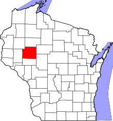 | |
| Villages | ||
| Towns | ||
| CDPs | ||
| Unincorporated communities | ||
| Footnotes | ‡This populated place also has portions in an adjacent county or counties | |