Stanaford, West Virginia
| Stanaford, West Virginia | |
|---|---|
| Census-designated place (CDP) | |
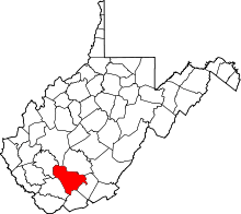
 Location of Stanaford, West Virginia | |
| Coordinates: 37°49′17″N 81°9′5″W / 37.82139°N 81.15139°WCoordinates: 37°49′17″N 81°9′5″W / 37.82139°N 81.15139°W | |
| Country | United States |
| State | West Virginia |
| County | Raleigh |
| Area[1] | |
| • Total | 1.9 sq mi (5.0 km2) |
| • Land | 1.9 sq mi (4.9 km2) |
| • Water | 0.0 sq mi (0.0 km2) |
| Elevation | 2,405 ft (733 m) |
| Population (2010)[2] | |
| • Total | 1,350 |
| • Density | 710/sq mi (270/km2) |
| Time zone | Eastern (EST) (UTC-5) |
| • Summer (DST) | EDT (UTC-4) |
| ZIP code | 25927 |
| Area code(s) | 304 |
| FIPS code | 54-76444[3] |
| GNIS feature ID | 1555700[4] |
Stanaford is a census-designated place (CDP) and coal town in Raleigh County, West Virginia, United States. The population was 1,350 at the 2010 census.[2]
The community was named after nearby Stanaford Branch.[5]
Geography
Stanaford is located at 37°49′17″N 81°9′5″W / 37.82139°N 81.15139°W (37.821262, -81.151458).[1]
According to the United States Census Bureau, the CDP has a total area of 1.9 square miles (5.0 km²); 1.9 square miles (4.9 km²) of this is land, and 0.02 square miles (0.04 km²) is water.
Climate
The climate in this area has mild differences between highs and lows, and there is adequate rainfall year round. According to the Köppen Climate Classification system, Stanaford has a marine west coast climate, abbreviated "Cfb" on climate maps.[6]
Demographics
As of the census[3] of 2000, there were 1,443 people, 595 households, and 449 families residing in the CDP. The population density was 768.2 people per square mile (296.4/km²). There were 638 housing units at an average density of 339.6/sq mi (131.0/km²). The racial makeup of the CDP was 87.18% White, 9.42% African American, 0.21% Native American, 0.90% Asian, 0.76% from other races, and 1.52% from two or more races. Hispanic or Latino of any race were 0.90% of the population.
There were 595 households out of which 24.2% had children under the age of 18 living with them, 60.7% were married couples living together, 12.1% had a female householder with no husband present, and 24.4% were non-families. 21.5% of all households were made up of individuals and 10.3% had someone living alone who was 65 years of age or older. The average household size was 2.43 and the average family size was 2.79.
In the CDP the population was spread out with 19.4% under the age of 18, 8.3% from 18 to 24, 21.1% from 25 to 44, 32.6% from 45 to 64, and 18.5% who were 65 years of age or older. The median age was 46 years. For every 100 females there were 87.4 males. For every 100 females age 18 and over, there were 87.9 males.
The median income for a household in the CDP was $30,640, and the median income for a family was $33,750. Males had a median income of $35,313 versus $32,188 for females. The per capita income for the CDP was $16,775. About 11.1% of families and 16.7% of the population were below the poverty line, including 25.7% of those under age 18 and 8.0% of those age 65 or over.
References
- 1 2 "US Gazetteer files: 2010, 2000, and 1990". United States Census Bureau. 2011-02-12. Retrieved 2011-04-23.
- 1 2 "American FactFinder". United States Census Bureau. Retrieved 2011-05-14.
- 1 2 "American FactFinder". United States Census Bureau. Retrieved 2008-01-31.
- ↑ "US Board on Geographic Names". United States Geological Survey. 2007-10-25. Retrieved 2008-01-31.
- ↑ Kenny, Hamill (1945). West Virginia Place Names: Their Origin and Meaning, Including the Nomenclature of the Streams and Mountains. Piedmont, WV: The Place Name Press. p. 599.
- ↑ Climate Summary for Stanaford, West Virginia