Bradley, West Virginia
| Bradley, West Virginia | |
|---|---|
| Census-designated place (CDP) (CDP) | |
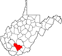
 Location of Bradley, West Virginia | |
| Coordinates: 37°52′35″N 81°12′12″W / 37.87639°N 81.20333°WCoordinates: 37°52′35″N 81°12′12″W / 37.87639°N 81.20333°W | |
| Country | United States |
| State | West Virginia |
| County | Raleigh |
| Area | |
| • Total | 4.2 sq mi (11.0 km2) |
| • Land | 4.2 sq mi (11.0 km2) |
| • Water | 0.0 sq mi (0.0 km2) |
| Elevation | 2,218 ft (676 m) |
| Population (2010) | |
| • Total | 2,040 |
| • Density | 490/sq mi (190/km2) |
| Time zone | Eastern (EST) (UTC-5) |
| • Summer (DST) | EDT (UTC-4) |
| ZIP code | 25818 |
| Area code(s) | 304 |
| FIPS code | 54-09676[1] |
| GNIS feature ID | 1553959[2] |
Bradley is a census-designated place (CDP) in Raleigh County, West Virginia, United States. The population was 2,040 at the 2010 census.[3]
Geography
Bradley is located at 37°52′35″N 81°12′12″W / 37.87639°N 81.20333°W (37.876409, -81.203450).[4]
According to the United States Census Bureau, the CDP has a total area of 5.6 square miles (14.6 km²), all of it land.
Demographics
As of the census[1] of 2000, there were 2,371 people, 873 households, and 613 families residing in the CDP. The population density was 422.0 people per square mile (162.9/km²). There were 934 housing units at an average density of 166.2/sq mi (64.2/km²). The racial makeup of the CDP was 96.46% White, 0.97% African American, 0.42% Native American, 1.10% Asian, 0.04% Pacific Islander, 0.17% from other races, and 0.84% from two or more races. Hispanic or Latino of any race were 0.34% of the population.
There were 873 households out of which 31.6% had children under the age of 18 living with them, 57.5% were married couples living together, 9.6% had a female householder with no husband present, and 29.7% were non-families. 25.8% of all households were made up of individuals and 10.9% had someone living alone who was 65 years of age or older. The average household size was 2.42 and the average family size was 2.90.
In the CDP the population was spread out with 21.4% under the age of 18, 16.1% from 18 to 24, 29.8% from 25 to 44, 22.2% from 45 to 64, and 10.5% who were 65 years of age or older. The median age was 33 years. For every 100 females there were 93.7 males. For every 100 females age 18 and over, there were 93.5 males.
The median income for a household in the CDP was $28,844, and the median income for a family was $32,330. Males had a median income of $30,427 versus $16,176 for females. The per capita income for the CDP was $13,910. About 16.9% of families and 18.3% of the population were below the poverty line, including 33.2% of those under age 18 and 5.3% of those age 65 or over.
References
- 1 2 "American FactFinder". United States Census Bureau. Archived from the original on 2013-09-11. Retrieved 2008-01-31.
- ↑ "US Board on Geographic Names". United States Geological Survey. 2007-10-25. Retrieved 2008-01-31.
- ↑ "American FactFinder". United States Census Bureau. Archived from the original on 2013-09-11. Retrieved 2011-05-14.
- ↑ "US Gazetteer files: 2010, 2000, and 1990". United States Census Bureau. 2011-02-12. Retrieved 2011-04-23.