Springfield, Victoria (Macedon Ranges)
| Springfield Victoria | |||||||||||||
|---|---|---|---|---|---|---|---|---|---|---|---|---|---|
 | |||||||||||||
 Springfield | |||||||||||||
| Coordinates | 37°21′S 144°45′E / 37.350°S 144.750°ECoordinates: 37°21′S 144°45′E / 37.350°S 144.750°E | ||||||||||||
| Established | 1860s | ||||||||||||
| Postcode(s) | 3434 | ||||||||||||
| Elevation | 490 m (1,608 ft) | ||||||||||||
| LGA(s) | Shire of Macedon Ranges | ||||||||||||
| State electorate(s) | Macedon | ||||||||||||
| Federal Division(s) | McEwen | ||||||||||||
| |||||||||||||
Springfield is a locality in the Shire of Macedon Ranges local government area in central Victoria, Australia approximately 84 kilometres north of the state capital, Melbourne. It is within the catchment area of Deep Creek, a tributary of the Maribyrnong River.
History
In 1838, the Springfield pastoral run was taken up by James Fulton. This property actually lay to the west of Deep Creek, whereas present day Springfield is located on the eastern side of the creek.[1]
Along with the Shire of Lancefield, the historic Shire of Springfield was merged into the existing Shire of Romsey on 31 May 1916. More recently, in 1995, further amalgamations merged Romsey Shire and others to form the present Macedon Ranges Shire.[2] While it was once the centre of its own local government area, Springfield now lies on the extreme eastern edge of the shire, with Kyneton, the administrative centre, almost 40 km away by road.
Springfield was a stopping point on the ill-fated Lancefield-Kilmore railway, which operated briefly during the 1890s.[3]
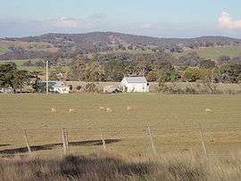
Although at one point the small settlement had its own Post Office and State School, today the Springfield area consists mostly of scattered farmhouses and cattle and sheep grazing properties.[4] There is also a CFA firestation in Springfield.
See also
References
- ↑ Mitchell, Peter; Alan Jackson; Carol Moore; Gavin Smith (2004). Romsey: A Veritable Garden of Eden. Romsey: West Bourke Books Inc. p. 6. ISBN 0-646-43570-1.
- ↑ Mitchell, Peter; Alan Jackson; Carol Moore; Gavin Smith (2004). Romsey: A Veritable Garden of Eden. Romsey: West Bourke Books Inc. pp. 57–62. ISBN 0-646-43570-1.
- ↑ Victorian Railways Resources (1900 map). "Victorian Railway Maps 1860-2000". 1900 map. Retrieved 2009-03-18.
- ↑ Victorian Municipal Directory. Brunswick: Arnall & Jackson. 1956. p. 792.
External links
![]() Media related to Springfield, Victoria (Macedon Ranges) at Wikimedia Commons
Media related to Springfield, Victoria (Macedon Ranges) at Wikimedia Commons