Malmsbury, Victoria
| Malmsbury Victoria | |||||||||||||
|---|---|---|---|---|---|---|---|---|---|---|---|---|---|
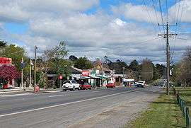 The Calder Highway at Malmsbury | |||||||||||||
 Malmsbury | |||||||||||||
| Coordinates | 37°11′20″S 144°23′6″E / 37.18889°S 144.38500°ECoordinates: 37°11′20″S 144°23′6″E / 37.18889°S 144.38500°E | ||||||||||||
| Population | 612 (2011 census)[1] | ||||||||||||
| Postcode(s) | 3446 | ||||||||||||
| Elevation | 462 m (1,516 ft) | ||||||||||||
| Location | |||||||||||||
| LGA(s) | Shire of Macedon Ranges | ||||||||||||
| State electorate(s) | Macedon | ||||||||||||
| Federal Division(s) | Bendigo | ||||||||||||
| |||||||||||||

Malmsbury is a town in central Victoria, Australia on the Old Calder Highway (C794), 96 km north-west of the state capital, Melbourne and 11 km north-west of Kyneton. Situated close by the Coliban River, Malmsbury has a population of 612.[1] Malmsbury is in the north western area of the Shire of Macedon Ranges local government area.
The original inhabitants of the local area were the Dja Dja Wurrung people. European settlement began with squatters raising sheep and cattle. Gold was discovered in 1858 and the town became a service centre for diggers travelling to Bendigo and Castlemaine. Malmesbury [sic] Post Office opened on 9 November 1854, closed within two months, reopened in 1856, and was renamed Malmsbury around 1896,[2] although the name Malmesbury remains in occasional use.[3]
The Malmsbury area is known for its deposits of bluestone, used in the construction of notable buildings both locally and throughout the state. The town also houses the Malmsbury Youth Justice Centre, a custodial centre for young adult males aged 18–21 deemed too vulnerable for adult prison.
Malmsbury has a railway station on the Melbourne to Bendigo railway line. The Malmsbury Viaduct River is a large masonry arch rail bridge constructed over the Coliban River in 1859 and is classified "A" by the National Trust. The town's school uses the viaduct as its emblem. A stretch of the Calder Freeway (M79) bypassing Malmsbury was officially opened on 12 April 2008, and the removal of heavy through traffic was celebrated eight days later by the holding of a "Monster Street Party" in the town.
Since the Calder Freeway bypass construction Malmsbury has gained a reputation as a getaway destination for tourists across the country. During this period several restaurants have opened up in the town such as Small Holdings, The Moto Bean Cafe and the resurgent Mill once again under new ownership. Each of these new destinations complements the older establishments such as the Malmsbury Bakery.[4]
References
- 1 2 Australian Bureau of Statistics (31 October 2012). "Malmsbury, Vic(SSC)". 2011 Census QuickStats. Retrieved 2012-10-24.
- ↑ Premier Postal History. "Post Office List". Retrieved 2008-04-11.
- ↑ Priestly, Susan (1984). The Victorians: vol. III, Making Their Mark. McMahons Point, NSW: Fairfax, Syme & Weldon Associates. pp. 55, 75, 102. ISBN 0-949288-03-9.
- ↑ http://www.yelp.com.au/biz/moto-bean-cafe-malmsbury
External links
![]() Media related to Malmsbury, Victoria at Wikimedia Commons
Media related to Malmsbury, Victoria at Wikimedia Commons
- Macedon Ranges Shire Council - Official site
- Visit Victoria: Malmsbury - Official Government tourism site.
- Geoscience Australia place names search: Malmsbury