Spring Lake, Utah
| Spring Lake, Utah | |
|---|---|
| CDP | |
 Location in Utah County and the state of Utah | |
| Coordinates: 40°0′1″N 111°44′55″W / 40.00028°N 111.74861°WCoordinates: 40°0′1″N 111°44′55″W / 40.00028°N 111.74861°W | |
| Country | United States |
| State | Utah |
| County | Utah |
| Settled | 1850 |
| Area | |
| • Total | 1.2 sq mi (3.1 km2) |
| • Land | 1.2 sq mi (3.1 km2) |
| • Water | 0.0 sq mi (0.0 km2) |
| Elevation | 4,731 ft (1,442 m) |
| Population (2010) | |
| • Total | 458 |
| • Density | 380/sq mi (150/km2) |
| Time zone | Mountain (MST) (UTC-7) |
| • Summer (DST) | MDT (UTC-6) |
| ZIP code | 84651 |
| Area code(s) | 801 |
| FIPS code | 49-72170[1] |
| GNIS feature ID | 1446051[2] |
Spring Lake is a census-designated place (CDP) in Utah County, Utah, United States. It is part of the Provo–Orem Metropolitan Statistical Area. The population was 458 at the 2010 census.[3] It is an unincorporated part of Utah County, located just south of Payson and north of Santaquin.
Geography
According to the United States Census Bureau, the CDP has a total area of 1.2 square miles (3.1 km2), of which 1.2 square miles (3.1 km2) is land and 0.012 square miles (0.03 km2), or 0.91%, is water.[4]
Spring Lake is at approximately 4,700 feet (1,400 m) above sea level. The small lake of the same name is only a few feet deep under normal conditions, but in the spring of 2006 the lake was drained in order to dredge it and make it deeper. It was then refilled in the fall of 2006 and now contains trout.
Demographics
| Historical population | |||
|---|---|---|---|
| Census | Pop. | %± | |
| 1880 | 157 | — | |
| 1890 | 93 | −40.8% | |
| 1900 | 232 | 149.5% | |
| 1910 | 188 | −19.0% | |
| 1920 | 252 | 34.0% | |
| 1930 | 300 | 19.0% | |
| 1940 | 453 | 51.0% | |
| 1950 | 495 | 9.3% | |
| 2000 | 469 | — | |
| 2010 | 458 | −2.3% | |
| Source: U.S. Census Bureau[5] | |||
As of the census[1] of 2000, there were 469 people, 129 households, and 110 families residing in the CDP. The population density was 236.8 people per square mile (91.5/km²). There were 134 housing units at an average density of 67.7/sq mi (26.1/km²). The racial makeup of the CDP was 85.50% White, 0.21% Native American, 0.43% Asian, 0.21% Pacific Islander, 11.73% from other races, and 1.92% from two or more races. Hispanic or Latino of any race were 13.86% of the population.
There were 129 households out of which 45.7% had children under the age of 18 living with them, 78.3% were married couples living together, 5.4% had a female householder with no husband present, and 14.7% were non-families. 13.2% of all households were made up of individuals and 7.0% had someone living alone who was 65 years of age or older. The average household size was 3.64 and the average family size was 4.01.
In the CDP the population was spread out with 33.9% under the age of 18, 11.3% from 18 to 24, 24.7% from 25 to 44, 22.0% from 45 to 64, and 8.1% who were 65 years of age or older. The median age was 29 years. For every 100 females there were 100.4 males. For every 100 females age 18 and over, there were 103.9 males.
The median income for a household in the CDP was $38,646, and the median income for a family was $38,958. Males had a median income of $28,929 versus $37,692 for females. The per capita income for the CDP was $15,314. About 6.0% of families and 10.8% of the population were below the poverty line, including 20.8% of those under age 18 and none of those age 65 or over.
Community
Much of Spring Lake consists of farms and ranches, with many people owning horses, cattle, and raising alfalfa and hay for their animals. Being located between Payson and Santaquin, the rural area may give way to more homes in the coming years, but as there is no city water for many, wells are needed which place a limit of one house per 5.25 acres (21,200 m2) of land. Only when city water is provided will greater housing density be possible.
There are no businesses or stoplights in Spring Lake as of 2010.
Spring Lake was the birthplace of Antonga Black Hawk, the famous Ute leader. Antonga led many raids on settlements during Utah's Black Hawk War. After his death in 1870 he was buried in Spring Lake. In 1911 his body was discovered by miners, and moved to an LDS Church museum in Salt Lake City, but was later returned to Spring Lake.[6]
References
- 1 2 "American FactFinder". United States Census Bureau. Retrieved 2008-01-31.
- ↑ "US Board on Geographic Names". United States Geological Survey. 2007-10-25. Retrieved 2008-01-31.
- ↑ "Profile of General Population and Housing Characteristics: 2010 Demographic Profile Data (DP-1): Spring Lake CDP, Utah". U.S. Census Bureau, American Factfinder. Retrieved March 9, 2012.
- ↑ "Geographic Identifiers: 2010 Demographic Profile Data (G001): Spring Lake CDP, Utah". U.S. Census Bureau, American Factfinder. Retrieved March 9, 2012.
- ↑ "Census of Population and Housing". U.S. Census Bureau. Retrieved October 20, 2011.
- ↑ Peterson, John Alton. Utah’s Black Hawk War, University of Utah Press, 1998.
Municipalities and communities of Utah County, Utah, United States | ||
|---|---|---|
| Cities | 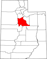 | |
| Towns | ||
| CDPs | ||
| Unincorporated communities | ||
| Indian reservation | ||
| Ghost towns | ||
| Footnotes | ‡This populated place also has portions in an adjacent county or counties | |