Palmyra, Utah
| Palmyra, Utah | |
|---|---|
| CDP | |
 Location in Utah County and the state of Utah | |
| Coordinates: 40°7′36″N 111°41′7″W / 40.12667°N 111.68528°WCoordinates: 40°7′36″N 111°41′7″W / 40.12667°N 111.68528°W | |
| Country | United States |
| State | Utah |
| County | Utah |
| Named for | Palmyra, New York |
| Area | |
| • Total | 11.7 sq mi (30.4 km2) |
| • Land | 11.5 sq mi (29.8 km2) |
| • Water | 0.2 sq mi (0.6 km2) |
| Elevation | 4,524 ft (1,379 m) |
| Population (2010) | |
| • Total | 491 |
| • Density | 42/sq mi (16/km2) |
| Time zone | Mountain (MST) (UTC-7) |
| • Summer (DST) | MDT (UTC-6) |
| ZIP code | 84660 |
| Area code(s) | 801 |
| FIPS code | 49-57630[1] |
| GNIS feature ID | 1444167[2] |
Palmyra is a census-designated place (CDP) in Utah County, Utah, United States. It is part of the Provo–Orem Metropolitan Statistical Area. The population was 491 at the 2010 census.[3] Palmyra is located directly west of Springville and northwest of Spanish Fork.
Palmyra was first settled in 1852.
Geography
According to the United States Census Bureau, the CDP has a total area of 11.7 square miles (30.4 km2), of which 11.5 square miles (29.8 km2) is land and 0.23 square miles (0.6 km2), or 2.05%, is water.
Demographics
| Historical population | |||
|---|---|---|---|
| Census | Pop. | %± | |
| 1940 | 262 | — | |
| 1950 | 236 | −9.9% | |
| 2000 | 485 | — | |
| 2010 | 491 | 1.2% | |
| Source: U.S. Census Bureau[4] | |||
As of the census[1] of 2000, there were 485 people, 142 households, and 123 families residing in the CDP. The population density was 42.2 people per square mile (16.3/km²). There were 148 housing units at an average density of 12.9/sq mi (5.0/km²). The racial makeup of the CDP was 97.53% White, 0.21% Native American, 2.06% Asian, 0.21% from other races. Hispanic or Latino of any race were 3.71% of the population.
There were 142 households out of which 40.8% had children under the age of 18 living with them, 80.3% were married couples living together, 4.2% had a female householder with no husband present, and 12.7% were non-families. 12.0% of all households were made up of individuals and 4.2% had someone living alone who was 65 years of age or older. The average household size was 3.42 and the average family size was 3.72.
In the CDP the population was spread out with 34.0% under the age of 18, 10.1% from 18 to 24, 23.5% from 25 to 44, 21.6% from 45 to 64, and 10.7% who were 65 years of age or older. The median age was 31 years. For every 100 females there were 119.5 males. For every 100 females age 18 and over, there were 114.8 males.
The median income for a household in the CDP was $58,750, and the median income for a family was $90,122. Males had a median income of $42,917 versus $24,531 for females. The per capita income for the CDP was $18,967. About 5.8% of families and 8.5% of the population were below the poverty line, including 17.0% of those under age 18 and none of those age 65 or over.
References
- 1 2 "American FactFinder". United States Census Bureau. Retrieved 2008-01-31.
- ↑ "US Board on Geographic Names". United States Geological Survey. 2007-10-25. Retrieved 2008-01-31.
- ↑ "Profile of General Population and Housing Characteristics: 2010 Demographic Profile Data (DP-1): Palmyra CDP, Utah". U.S. Census Bureau, American Factfinder. Retrieved March 9, 2012.
- ↑ "Census of Population and Housing". U.S. Census Bureau. Retrieved November 18, 2011.
Municipalities and communities of Utah County, Utah, United States | ||
|---|---|---|
| Cities | 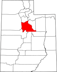 | |
| Towns | ||
| CDPs | ||
| Unincorporated communities | ||
| Indian reservation | ||
| Ghost towns | ||
| Footnotes | ‡This populated place also has portions in an adjacent county or counties | |