Spodnja Bukova Gora
| Spodnja Bukova Gora | |
|---|---|
 Spodnja Bukova Gora Location in Slovenia | |
| Coordinates: 45°33′48.69″N 15°3′51.16″E / 45.5635250°N 15.0642111°ECoordinates: 45°33′48.69″N 15°3′51.16″E / 45.5635250°N 15.0642111°E | |
| Country |
|
| Traditional region | Lower Carniola |
| Statistical region | Southeast Slovenia |
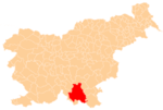
| Municipality | Kočevje |
| Elevation | 603 m (1,978 ft) |
| Population (2002) | |
| • Total | 0 |
Spodnja Bukova Gora (pronounced [ˈspoːdnja ˈbuːkɔʋa ˈɡɔːɾa]; in older sources also Dolenja Bukova Gora,[1] German: Unterbuchberg[1][2]) is a remote abandoned settlement in the Municipality of Kočevje in southern Slovenia. The area is part of the traditional region of Lower Carniola and is now included in the Southeast Slovenia Statistical Region.[3] Its territory is now part of the village of Bukova Gora.[4]
History
Spodnja Bukova Gora was a Gottschee German village. All of the houses in the settlement were burned by Italian troops in August 1942 during the Rog Offensive.[4] Together with Gorenja Bukova Gora and Srednja Bukova Gora, it was merged into the settlement of Bukova Gora in 1955.[5]
References
- 1 2 Leksikon občin kraljestev in dežel zastopanih v državnem zboru, vol. 6: Kranjsko. 1906. Vienna: C. Kr. Dvorna in Državna Tiskarna, p. 38.
- ↑ Ferenc, Mitja. 2007. Nekdanji nemški jezikovni otok na kočevskem. Kočevje: Pokrajinski muzej, p. 4.
- ↑ Kočevje municipal site
- 1 2 Savnik, Roman, ed. 1971. Krajevni leksikon Slovenije, vol. 2. Ljubljana: Državna založba Slovenije, p. 218.
- ↑ "Preimovanje, dopolnitve in popravki nekaterih krajevnih imen." 1955. Dolenjski list 8(25) (1 July): 4. (Slovene)
External links
- Spodnja Bukova Gora on Geopedia
- Pre–World War II map of Spodnja Bukova Gora with oeconyms and family names
This article is issued from Wikipedia - version of the 1/2/2016. The text is available under the Creative Commons Attribution/Share Alike but additional terms may apply for the media files.