Mokri Potok
| Mokri Potok | |
|---|---|
 Mokri Potok Location in Slovenia | |
| Coordinates: 45°33′28.70″N 14°49′36.94″E / 45.5579722°N 14.8269278°ECoordinates: 45°33′28.70″N 14°49′36.94″E / 45.5579722°N 14.8269278°E | |
| Country |
|
| Traditional region | Lower Carniola |
| Statistical region | Southeast Slovenia |
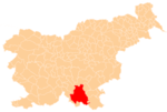
| Municipality | Kočevje |
| Area | |
| • Total | 2.03 km2 (0.78 sq mi) |
| Population (2012) | |
| • Total | 0 |
| [1] | |
Mokri Potok (pronounced [ˈmɔːkɾi ˈpɔːtɔk]; earlier Spodnji Vecenbah[2] or Spodnji Vencenbah,[3] German: Unterwetzenbach[4][2]) is a village in the Municipality of Kočevje in southern Slovenia. The area is part of the traditional region of Lower Carniola and is now included in the Southeast Slovenia Statistical Region.[5] It no longer has any permanent residents.[1]
History
Mokri Potok was a Gottschee German village. In the land registry of 1498 it had three full farms divided into six half-farms. In the land registry of 1574 there were four half-farms as well as a full farm owned by the mayor. Before the Second World War the village had 19 houses. The village was not destroyed during the war, when its original inhabitants were expelled. The last residents abandoned the village in 1965.[3]
References
- 1 2 Statistical Office of the Republic of Slovenia
- 1 2 Ferenc, Mitja. 2007. Nekdanji nemški jezikovni otok na kočevskem. Kočevje: Pokrajinski muzej, p. 4.
- 1 2 Savnik, Roman, ed. 1971. Krajevni leksikon Slovenije, vol. 2. Ljubljana: Državna založba Slovenije, p. 242.
- ↑ Leksikon občin kraljestev in dežel zastopanih v državnem zboru, vol. 6: Kranjsko. 1906. Vienna: C. Kr. Dvorna in Državna Tiskarna, p. 36.
- ↑ Kočevje municipal site