South Ubian, Tawi-Tawi
| South Ubian | |
|---|---|
| Municipality | |
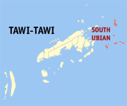 Map of Tawi-Tawi with South Ubian highlighted | |
.svg.png) South Ubian Location within the Philippines | |
| Coordinates: 05°11′N 120°29′E / 5.183°N 120.483°ECoordinates: 05°11′N 120°29′E / 5.183°N 120.483°E | |
| Country | Philippines |
| Region | Autonomous Region in Muslim Mindanao (ARMM) |
| Province | Tawi-Tawi |
| District | Lone district of Tawi-Tawi |
| Barangays | 31 |
| Government[1] | |
| • Mayor | Salma Omar |
| Population (2010)[2] | |
| • Total | 25,935 |
| Time zone | PST (UTC+8) |
| ZIP code | 7504 |
| Dialing code | +63 (0)68 |
| Income class | 3rd |
South Ubian is a third class municipality in the province of Tawi-Tawi, Philippines. According to the 2010 census, it has a population of 25,935 people.[2]
Barangays
South Ubian is politically subdivided into 31 barangays.[2]
- Babagan
- Bengkol
- Bintawlan
- Boheh
- Bubuan
- Bunay Bunay Tong
- Bunay Bunay Lookan
- Bunay Bunay Center
- Lahad Dampong
- East Talisay
- Laitan
- Lambi-lambian
- Laud
- Likud Dampong
- Likud Egang
- Nunuk
- Nusa-nusa
- Nusa
- Pampang
- Putat
- Sollogan
- Tampakan Dampong
- Tangngah
- Tinda-tindahan
- Tong Tampakan
- Tubig Dayang Center
- Tubig Dayang Riverside
- Tubig Dayang
- Tukkai
- West Talisay
- Unas-unas
Demographics
| Population census of South Ubian | ||
|---|---|---|
| Year | Pop. | ±% p.a. |
| 1990 | 19,191 | — |
| 1995 | 20,180 | +0.95% |
| 2000 | 27,301 | +6.69% |
| 2007 | 32,986 | +2.64% |
| 2010 | 27,741 | −6.11% |
| Source: National Statistics Office[2] | ||
References
- ↑ "Official City/Municipal 2013 Election Results". Intramuros, Manila, Philippines: Commission on Elections (COMELEC). 1 July 2013. Retrieved 5 September 2013.
- 1 2 3 4 "Total Population by Province, City, Municipality and Barangay: as of May 1, 2010" (PDF). 2010 Census of Population and Housing. National Statistics Office. Retrieved 1 September 2014.
External links
 |
Pangutaran, Sulu Sulu Sea |
Pandami, Sulu | | |
| Languyan Tandubas |
|
Celebes Sea | ||
| ||||
| | ||||
| Sapa-Sapa | Celebes Sea |
Bongao (capital) | |
| Municipalities | |
This article is issued from Wikipedia - version of the 11/1/2016. The text is available under the Creative Commons Attribution/Share Alike but additional terms may apply for the media files.