South Dakota Highway 43
| ||||
|---|---|---|---|---|
|
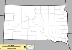
Location of SD 43 (in red) | ||||
| Route information | ||||
| Defined by SDCL §31-4-163 | ||||
| Maintained by SDDOT | ||||
| Length: | 1 mi (2 km) | |||
| Existed: | 1976 – present | |||
| Major junctions | ||||
| South end: |
| |||
| North end: |
| |||
| Location | ||||
| Counties: | Gregory | |||
| Highway system | ||||
| ||||

South Dakota Highway 43 (SD 43) is a short state route that runs from U.S. Highway 18, 1 mile (1.6 km) south of Fairfax, southeasterly to the Nebraska border, where it becomes Nebraska Highway 11. The route is 1 mile (1.6 km) in length.
Route description
South Dakota Highway 43 begins at the Nebraska–South Dakota border as a continuation of Nebraska Highway 11. It runs northwest for approximately one mile before meeting its northern terminus at US 18. The highway does not run through any populated areas, but rather serves as a connector route between Nebraska Highway 11 and US 18.[1]
History
The first road designated as South Dakota 43 was around 1932, in Platte. It ran east before heading south to pass through Geddes, ending at U.S. Highway 18 west of Lake Andes. This segment, previously part of South Dakota Highway 45, was given a separate number when SD 45 was rerouted south from Platte. By 1935, it was extended to the north and west, assuming the routing of South Dakota Highway 47 when the latter highway was relocated west of the Missouri River; its northern terminus was at the intersection of U.S. Highway 16 in Pukwana (Brule County). The number was removed around 1940, when South Dakota Highway 50 was extended northwest from its previous terminus near Ravinia (east of Lake Andes).
The present day South Dakota 43 was initially a segment of U.S. Highway 281. That route's entrance into South Dakota was moved about 9 miles (14 km) east, by 1962. The old alignment was unnumbered until 1976, when it given its current assignment.
Major intersections
The entire route is in Fairfax Township, Gregory County.
| mi[2] | km | Destinations | Notes | ||
|---|---|---|---|---|---|
| 0.000 | 0.000 | Continuation into Nebraska | |||
| 1.131 | 1.820 | ||||
| 1.000 mi = 1.609 km; 1.000 km = 0.621 mi | |||||
References
- ↑ "Google Maps Overview of SD 43". Retrieved November 4, 2012.
- ↑ http://www.sddot.com/transportation/highways/planning/pavement/docs/Mitchell_Region.pdf